Property Record
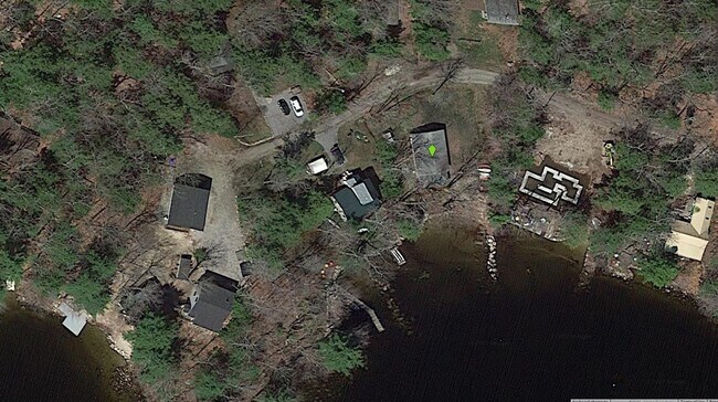
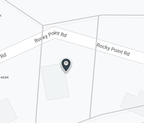
109 Rocky Point Rd, Harrison, ME 04040

Property Detail
109 Rocky Point Rd
HRRS-000022-000000-000038
CUMBERLAND
Commercialnec
Maine
STANDA
38
B and X Area of moderate flood hazard, usually the area between the limits of the 100-year and 500-year floods.
0.15 AC
2025
NE Cumberland County
2025
Portland/South Portland
015000
Portland-South Portland, ME
384 SF
NEARBY LISTINGS FOR SALE OR LEASE
DEMOGRAPHICS near 109 Rocky Point Rd
1 mile
3 mile
5 mile
2025 Total Population
415
4,321
8,131
2030 Population
451
4,588
8,633
Pop Growth 2025-2030
+ 8.67%
+ 6.18%
+ 6.17%
Average Age
48
47
47
2025 Total Households
191
1,954
3,605
HH Growth 2025-2030
+ 8.38%
+ 6.40%
+ 6.35%
Median Household Inc
$63,300
$72,310
$79,018
Avg Household Size
2.20
2.20
2.20
2025 Avg HH Vehicles
2.00
2.00
2.00
Median Home Value
$433,333
$381,817
$359,834
Median Year Built
1980
1978
1982
Nearby Places
Map Layers
Map Styles
 Street
 Aerial
Layers
 Traffic
 Biking
Places
Listings with unknown addresses are not visible on the map
- Restaurants
- Banks
- Shops
- Fitness
- Groceries
PUBLIC TRANSPORTATION
AIRPORT
Portland International Jetport
Drive
Walk
Distance
Portland International Jetport
68 min
39.4 mi
Freight Ports
Portland, ME
Drive
Walk
Distance
Portland, ME
64 min
39.4 mi
Nearby Properties
Address
Land Use
TOTAL SIZE
Lot Size
Zoning
Address
Land Use
TOTAL SIZE
Lot Size
Zoning
32.30 AC
Address
Land Use
TOTAL SIZE
Lot Size
Zoning
223.61 AC
STANDA
Address
Land Use
TOTAL SIZE
Lot Size
Zoning
Address
Land Use
TOTAL SIZE
Lot Size
Zoning
20.61 AC
Address
Land Use
TOTAL SIZE
Lot Size
Zoning
15.72 AC
Address
Land Use
TOTAL SIZE
Lot Size
Zoning
3,066 SF
146 AC
SHOREL
Address
Land Use
TOTAL SIZE
Lot Size
Zoning
9.27 AC
Address
Land Use
TOTAL SIZE
Lot Size
Zoning
7.98 AC
STANDA
Address
Land Use
TOTAL SIZE
Lot Size
Zoning
41.22 AC
Address
Land Use
TOTAL SIZE
Lot Size
Zoning
29,214 SF
11 AC
STANDA
Address
Land Use
TOTAL SIZE
Lot Size
Zoning
Address
Land Use
TOTAL SIZE
Lot Size
Zoning
Address
Land Use
TOTAL SIZE
Lot Size
Zoning
Address
Land Use
TOTAL SIZE
Lot Size
Zoning
3,030 SF
5.14 AC
Address
Land Use
TOTAL SIZE
Lot Size
Zoning
13.75 AC
Address
Land Use
TOTAL SIZE
Lot Size
Zoning
5,420 SF
0.38 AC
Address
Land Use
TOTAL SIZE
Lot Size
Zoning
Address
Land Use
TOTAL SIZE
Lot Size
Zoning
2,390 SF
7.15 AC
Address
Land Use
TOTAL SIZE
Lot Size
Zoning
Address
Land Use
TOTAL SIZE
Lot Size
Zoning
1,962 SF
1.62 AC
Address
Land Use
TOTAL SIZE
Lot Size
Zoning
1,125 SF
7.30 AC
Address
Land Use
TOTAL SIZE
Lot Size
Zoning
7.81 AC
Address
Land Use
TOTAL SIZE
Lot Size
Zoning
4,304 SF
1.05 AC
Address
Land Use
TOTAL SIZE
Lot Size
Zoning
10,080 SF
5 AC
STANDA
Address
Land Use
TOTAL SIZE
Lot Size
Zoning
2.80 AC
Address
Land Use
TOTAL SIZE
Lot Size
Zoning
1,239 SF
1.03 AC
Address
Land Use
TOTAL SIZE
Lot Size
Zoning
5.59 AC
Address
Land Use
TOTAL SIZE
Lot Size
Zoning
7.89 AC
Address
Land Use
TOTAL SIZE
Lot Size
Zoning
460 SF
5.60 AC
SHOREL
Address
Land Use
TOTAL SIZE
Lot Size
Zoning
1,484 SF
1.05 AC
The World's #1 Commercial Real Estate Marketplace
Connect with us
© 2026 CoStar Group
The information above has been obtained from sources believed reliable. While we do not doubt its accuracy we have not verified it and make no guarantee, warranty or representation about it. It is your responsibility to independently confirm its accuracy and completeness. Any projections, opinions, assumptions, or estimates used are for example only and do not represent the current or future performance of the property. The value of this transaction to you depends on tax and other factors which should be evaluated by your tax, financial, and legal advisors. You and your advisors should conduct a careful, independent investigation of the property to determine to your satisfaction the suitability of the property for your needs.