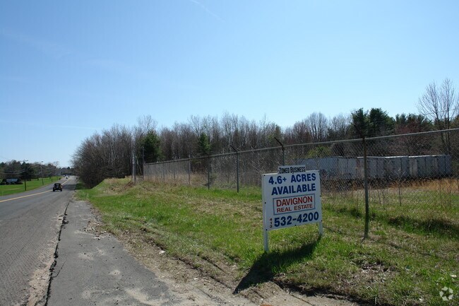
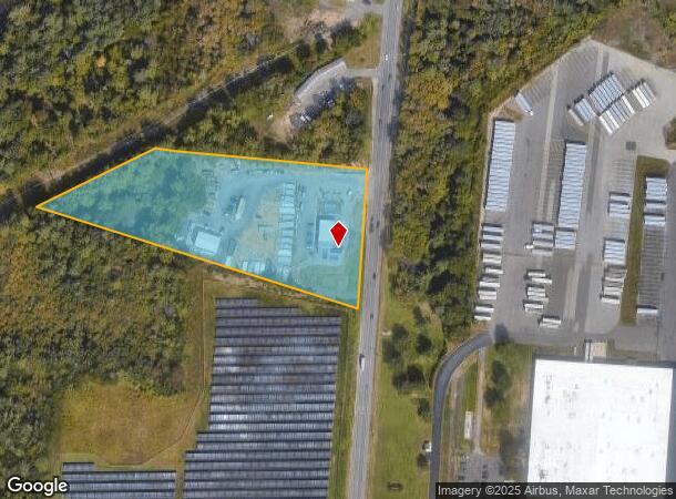
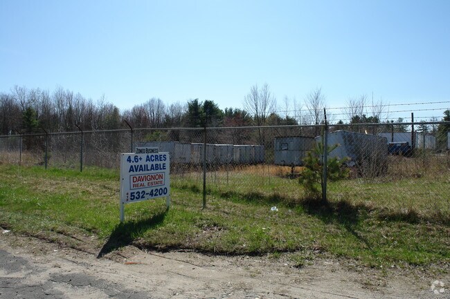
Property Record
1090 Southampton Rd, Westfield, MA 01085
NEARBY LISTINGS FOR SALE OR LEASE
Property Detail
1090 Southampton Rd
WFLD-000070-R000000-000019
Hampden
Commercialnec
Massachusetts
X
19
25013C0190F
4.65 AC
2024
Hampden County
2025
Hartford
812800
Springfield, MA
2,480 SF
DEMOGRAPHICS near 1090 Southampton Rd
1 Mile
3 Mile
5 Mile
2024 Total Population
959
11,233
52,151
2029 Population
949
10,606
49,857
Pop Growth 2024-2029
(1.04%)
(5.58%)
(4.40%)
Average Age
45
44
42
2024 Total Households
376
4,390
20,626
HH Growth 2024-2029
(1.06%)
(5.67%)
(4.58%)
Median Household Inc
$72,338
$81,320
$70,379
Avg Household Size
2.30
2.50
2.30
2024 Avg HH Vehicles
2.00
2.00
2.00
Median Home Value
$272,173
$299,209
$283,250
Median Year Built
1979
1976
1966
Nearby Places
Map Layers
Map Styles
 Street
 Aerial
- Restaurants
- Banks
- Shops
- Fitness
- Groceries
PUBLIC TRANSPORTATION
COMMUTER RAIL
Holyoke Amtrak (Valley Flyer - Amtrak, Vermonter - Amtrak)
DRIVE
WALK
Distance
Holyoke Amtrak (Valley Flyer - Amtrak, Vermonter - Amtrak)
14 min
7.8 mi
AIRPORT
Bradley International
DRIVE
WALK
Distance
Bradley International
47 min
22.5 mi
Freight Ports
Albany, NY Port
DRIVE
WALK
Distance
Albany, NY Port
93 min
76.6 mi
Nearby Properties
Address
Land Use
TOTAL SIZE
Lot Size
Zoning
Address
Land Use
TOTAL SIZE
Lot Size
Zoning
71.67 AC
Address
Land Use
TOTAL SIZE
Lot Size
Zoning
133.29 AC
Address
Land Use
TOTAL SIZE
Lot Size
Zoning
Address
Land Use
TOTAL SIZE
Lot Size
Zoning
3.80 AC
Address
Land Use
TOTAL SIZE
Lot Size
Zoning
Address
Land Use
TOTAL SIZE
Lot Size
Zoning
74.25 AC
Address
Land Use
TOTAL SIZE
Lot Size
Zoning
143,568 SF
14.69 AC
Address
Land Use
TOTAL SIZE
Lot Size
Zoning
264,759 SF
51.70 AC
Address
Land Use
TOTAL SIZE
Lot Size
Zoning
99,230 SF
10.94 AC
Address
Land Use
TOTAL SIZE
Lot Size
Zoning
Address
Land Use
TOTAL SIZE
Lot Size
Zoning
293,814 SF
32.68 AC
Address
Land Use
TOTAL SIZE
Lot Size
Zoning
242,152 SF
18.76 AC
Address
Land Use
TOTAL SIZE
Lot Size
Zoning
105,408 SF
41.06 AC
Address
Land Use
TOTAL SIZE
Lot Size
Zoning
50,911 SF
3.31 AC
Address
Land Use
TOTAL SIZE
Lot Size
Zoning
Address
Land Use
TOTAL SIZE
Lot Size
Zoning
275,103 SF
23.28 AC
Address
Land Use
TOTAL SIZE
Lot Size
Zoning
21,405 SF
0.01 AC
Address
Land Use
TOTAL SIZE
Lot Size
Zoning
6.35 AC
RA
Address
Land Use
TOTAL SIZE
Lot Size
Zoning
6.80 AC
Address
Land Use
TOTAL SIZE
Lot Size
Zoning
86,524 SF
12.40 AC
Address
Land Use
TOTAL SIZE
Lot Size
Zoning
26.09 AC
Address
Land Use
TOTAL SIZE
Lot Size
Zoning
Address
Land Use
TOTAL SIZE
Lot Size
Zoning
126.15 AC
Address
Land Use
TOTAL SIZE
Lot Size
Zoning
Address
Land Use
TOTAL SIZE
Lot Size
Zoning
80,942 SF
3.70 AC
Address
Land Use
TOTAL SIZE
Lot Size
Zoning
34,815 SF
9.29 AC
Address
Land Use
TOTAL SIZE
Lot Size
Zoning
100,000 SF
10.51 AC
Address
Land Use
TOTAL SIZE
Lot Size
Zoning
127,500 SF
20 AC
Address
Land Use
TOTAL SIZE
Lot Size
Zoning
60,186 SF
4.24 AC
Address
Land Use
TOTAL SIZE
Lot Size
Zoning
31,662 SF
6.32 AC
The World's #1 Commercial Real Estate Marketplace
Connect with us
© 2025 CoStar Group
The information above has been obtained from sources believed reliable. While we do not doubt its accuracy we have not verified it and make no guarantee, warranty or representation about it. It is your responsibility to independently confirm its accuracy and completeness. Any projections, opinions, assumptions, or estimates used are for example only and do not represent the current or future performance of the property. The value of this transaction to you depends on tax and other factors which should be evaluated by your tax, financial, and legal advisors. You and your advisors should conduct a careful, independent investigation of the property to determine to your satisfaction the suitability of the property for your needs.