Property Record
10900 Nations Ford Rd, Pineville, NC 28134


NEARBY LISTINGS FOR SALE OR LEASE
Property Detail
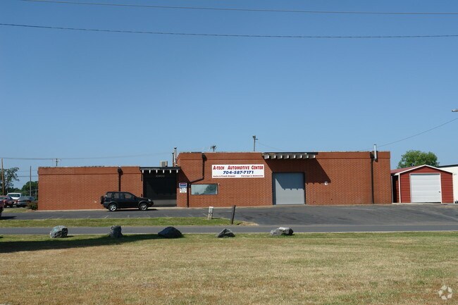
10900 Nations Ford Rd
Charlotte-Concord-Gastonia, NC-SC
Reece F Mcrorie
203-054-06
10900 NATIONS FORD RD
Industrialgeneral
Mecklenburg
X
North Carolina
3710452000K
6
0
0.85 AC
2025
State Line
980200
Charlotte
5,402 SF
DEMOGRAPHICS near 10900 Nations Ford Rd
1 mile
3 mile
5 mile
2024 Total Population
295
56,436
185,764
2029 Population
321
60,432
198,668
Pop Growth 2024-2029
+ 8.81%
+ 7.08%
+ 6.95%
Average Age
38
35
37
2024 Total Households
92
22,994
77,382
HH Growth 2024-2029
+ 8.70%
+ 6.93%
+ 6.88%
Median Household Inc
$62,678
$60,386
$77,535
Avg Household Size
2.70
2.40
2.30
2024 Avg HH Vehicles
2.00
2.00
2.00
Median Home Value
$210,000
$270,589
$332,087
Median Year Built
1979
1994
1995
Nearby Places
Map Layers
Map Styles
 Street
 Aerial
Transit
 Traffic
 Biking
Places
Listings with unknown addresses are not visible on the map
- Restaurants
- Banks
- Shops
- Fitness
- Groceries
PUBLIC TRANSPORTATION
AIRPORT
Charlotte/Douglas International
Drive
Walk
Distance
Charlotte/Douglas International
19 min
9.2 mi
Concord-Padgett Regional
Drive
Walk
Distance
Concord-Padgett Regional
38 min
26.3 mi
Nearby Properties
Address
Land Use
TOTAL SIZE
Lot Size
Zoning
Address
Land Use
TOTAL SIZE
Lot Size
Zoning
605,976 SF
46.31 AC
R17MF
Address
Land Use
TOTAL SIZE
Lot Size
Zoning
646,209 SF
72.24 AC
CC
Address
Land Use
TOTAL SIZE
Lot Size
Zoning
393,779 SF
26.71 AC
R17MF
Address
Land Use
TOTAL SIZE
Lot Size
Zoning
326,013 SF
25.59 AC
RMF
Address
Land Use
TOTAL SIZE
Lot Size
Zoning
395,382 SF
9.84 AC
MUDDO
Address
Land Use
TOTAL SIZE
Lot Size
Zoning
381,729 SF
22.37 AC
R17MF
Address
Land Use
TOTAL SIZE
Lot Size
Zoning
298,298 SF
16.60 AC
R17MFCD
Address
Land Use
TOTAL SIZE
Lot Size
Zoning
1,007,888 SF
55.04 AC
G-I
Address
Land Use
TOTAL SIZE
Lot Size
Zoning
452,964 SF
9.19 AC
OCCD
Address
Land Use
TOTAL SIZE
Lot Size
Zoning
324,998 SF
16.60 AC
OICD
Address
Land Use
TOTAL SIZE
Lot Size
Zoning
604,827 SF
41.01 AC
O1CD
Address
Land Use
TOTAL SIZE
Lot Size
Zoning
289,148 SF
17.12 AC
Address
Land Use
TOTAL SIZE
Lot Size
Zoning
238,604 SF
25.85 AC
R12MF
Address
Land Use
TOTAL SIZE
Lot Size
Zoning
1,396,936 SF
68.78 AC
I2
Address
Land Use
TOTAL SIZE
Lot Size
Zoning
136,576 SF
4.75 AC
Address
Land Use
TOTAL SIZE
Lot Size
Zoning
334,858 SF
40.40 AC
I-2
Address
Land Use
TOTAL SIZE
Lot Size
Zoning
857,532 SF
73.57 AC
I1
Address
Land Use
TOTAL SIZE
Lot Size
Zoning
212,904 SF
58.09 AC
INST
Address
Land Use
TOTAL SIZE
Lot Size
Zoning
273,184 SF
22.51 AC
O1
Address
Land Use
TOTAL SIZE
Lot Size
Zoning
301,671 SF
14.81 AC
Address
Land Use
TOTAL SIZE
Lot Size
Zoning
245,573 SF
23.62 AC
R12MFCD
Address
Land Use
TOTAL SIZE
Lot Size
Zoning
32.80 AC
MUDD-O
Address
Land Use
TOTAL SIZE
Lot Size
Zoning
254,214 SF
15.39 AC
Address
Land Use
TOTAL SIZE
Lot Size
Zoning
395,788 SF
8.73 AC
Address
Land Use
TOTAL SIZE
Lot Size
Zoning
200,765 SF
7.71 AC
Address
Land Use
TOTAL SIZE
Lot Size
Zoning
395,336 SF
12.77 AC
Address
Land Use
TOTAL SIZE
Lot Size
Zoning
213,739 SF
9.79 AC
MUDDO
Address
Land Use
TOTAL SIZE
Lot Size
Zoning
220,232 SF
15.45 AC
R15MFCD
Address
Land Use
TOTAL SIZE
Lot Size
Zoning
873,356 SF
52.31 AC
I2
Address
Land Use
TOTAL SIZE
Lot Size
Zoning
186,233 SF
16.81 AC
O-1(CD)
The World's #1 Commercial Real Estate Marketplace
Connect with us
© 2026 CoStar Group
The information above has been obtained from sources believed reliable. While we do not doubt its accuracy we have not verified it and make no guarantee, warranty or representation about it. It is your responsibility to independently confirm its accuracy and completeness. Any projections, opinions, assumptions, or estimates used are for example only and do not represent the current or future performance of the property. The value of this transaction to you depends on tax and other factors which should be evaluated by your tax, financial, and legal advisors. You and your advisors should conduct a careful, independent investigation of the property to determine to your satisfaction the suitability of the property for your needs.