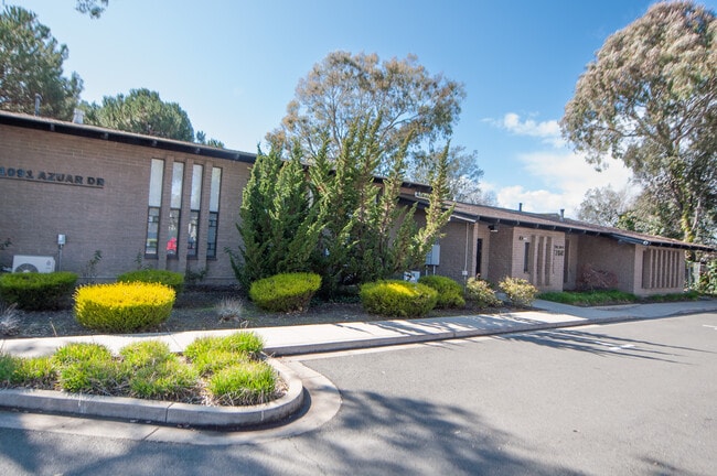
Property Record
1091 Azuar Ave, Vallejo, CA 94592


NEARBY LISTINGS FOR SALE OR LEASE
Property Detail
1091 Azuar Ave
Vallejo, CA
Farragut Village 4
0066-113-010
FARRAGUT VILLAGE 4 SUB LOT 60
Medicalbuilding
Solano
X
California
06095C0607F
60
2024
0.54 AC
2025
Benicia/Vallejo
250801
North Bay/Santa Rosa
3,140 SF
DEMOGRAPHICS near 1091 Azuar Ave
1 Mile
3 Mile
5 Mile
2024 Total Population
3,822
59,330
148,675
2029 Population
3,802
58,793
146,680
Pop Growth 2024-2029
(0.52%)
(0.91%)
(1.34%)
Average Age
41
39
41
2024 Total Households
1,631
21,855
51,097
HH Growth 2024-2029
(0.43%)
(0.87%)
(1.30%)
Median Household Inc
$44,623
$62,639
$79,775
Avg Household Size
2.20
2.60
2.80
2024 Avg HH Vehicles
1.00
2.00
2.00
Median Home Value
$604,430
$460,588
$541,362
Median Year Built
1969
1957
1973
Nearby Places
Map Layers
Map Styles
 Street
 Aerial
- Restaurants
- Banks
- Shops
- Fitness
- Groceries
PUBLIC TRANSPORTATION
AIRPORT
Metro Oakland International
DRIVE
WALK
Distance
Metro Oakland International
53 min
39.0 mi
San Francisco International
DRIVE
WALK
Distance
San Francisco International
66 min
46.6 mi
SALE & LEASE HISTORY
LISTING DATE
SALE/LEASE

Jun 21, 2023
For Lease
Jun 14, 2023
For Lease
Nearby Properties
Address
Land Use
TOTAL SIZE
Lot Size
Zoning
Address
Land Use
TOTAL SIZE
Lot Size
Zoning
432,550 SF
29.70 AC
Address
Land Use
TOTAL SIZE
Lot Size
Zoning
349.61 AC
Address
Land Use
TOTAL SIZE
Lot Size
Zoning
197,656 SF
18.63 AC
Address
Land Use
TOTAL SIZE
Lot Size
Zoning
123,566 SF
7.17 AC
Address
Land Use
TOTAL SIZE
Lot Size
Zoning
176,119 SF
6.80 AC
CHANGE-MUL
Address
Land Use
TOTAL SIZE
Lot Size
Zoning
43.81 AC
Address
Land Use
TOTAL SIZE
Lot Size
Zoning
7.86 AC
Address
Land Use
TOTAL SIZE
Lot Size
Zoning
128,544 SF
5.92 AC
Address
Land Use
TOTAL SIZE
Lot Size
Zoning
151,720 SF
8 AC
HDR
Address
Land Use
TOTAL SIZE
Lot Size
Zoning
240,905 SF
19.12 AC
Address
Land Use
TOTAL SIZE
Lot Size
Zoning
108,316 SF
5.31 AC
MULTI RES
Address
Land Use
TOTAL SIZE
Lot Size
Zoning
73,819 SF
5.64 AC
Address
Land Use
TOTAL SIZE
Lot Size
Zoning
178,265 SF
10.87 AC
Address
Land Use
TOTAL SIZE
Lot Size
Zoning
4.99 AC
Address
Land Use
TOTAL SIZE
Lot Size
Zoning
119,746 SF
0.64 AC
Address
Land Use
TOTAL SIZE
Lot Size
Zoning
83,768 SF
4.08 AC
Address
Land Use
TOTAL SIZE
Lot Size
Zoning
150,719 SF
14.16 AC
Address
Land Use
TOTAL SIZE
Lot Size
Zoning
130,460 SF
11.91 AC
Address
Land Use
TOTAL SIZE
Lot Size
Zoning
78,742 SF
0.67 AC
Address
Land Use
TOTAL SIZE
Lot Size
Zoning
69,011 SF
3.67 AC
PUBLIC-PF
Address
Land Use
TOTAL SIZE
Lot Size
Zoning
60,597 SF
3.21 AC
Address
Land Use
TOTAL SIZE
Lot Size
Zoning
57,267 SF
3.42 AC
Address
Land Use
TOTAL SIZE
Lot Size
Zoning
95,280 SF
3.75 AC
Address
Land Use
TOTAL SIZE
Lot Size
Zoning
49,896 SF
4.40 AC
Address
Land Use
TOTAL SIZE
Lot Size
Zoning
52,350 SF
3.88 AC
Address
Land Use
TOTAL SIZE
Lot Size
Zoning
20,816 SF
3.60 AC
Address
Land Use
TOTAL SIZE
Lot Size
Zoning
29,708 SF
2.08 AC
Address
Land Use
TOTAL SIZE
Lot Size
Zoning
35,576 SF
2.81 AC
Address
Land Use
TOTAL SIZE
Lot Size
Zoning
56,753 SF
2.21 AC
Address
Land Use
TOTAL SIZE
Lot Size
Zoning
96,025 SF
3.91 AC
LITE INDUS
The World's #1 Commercial Real Estate Marketplace
Connect with us
© 2026 CoStar Group
The information above has been obtained from sources believed reliable. While we do not doubt its accuracy we have not verified it and make no guarantee, warranty or representation about it. It is your responsibility to independently confirm its accuracy and completeness. Any projections, opinions, assumptions, or estimates used are for example only and do not represent the current or future performance of the property. The value of this transaction to you depends on tax and other factors which should be evaluated by your tax, financial, and legal advisors. You and your advisors should conduct a careful, independent investigation of the property to determine to your satisfaction the suitability of the property for your needs.