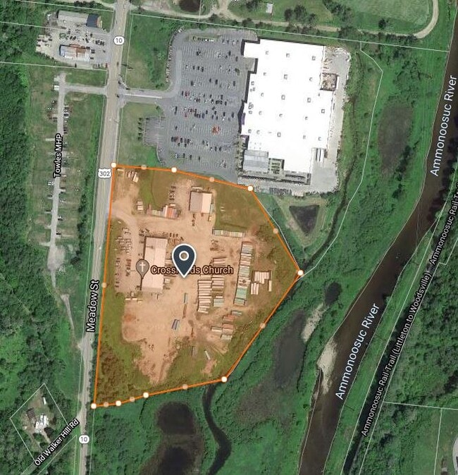
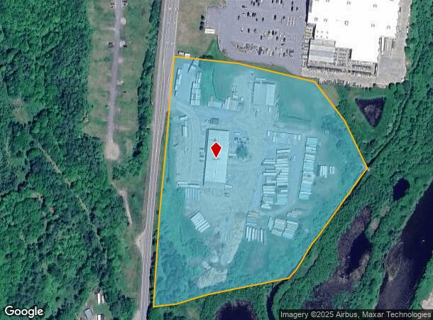
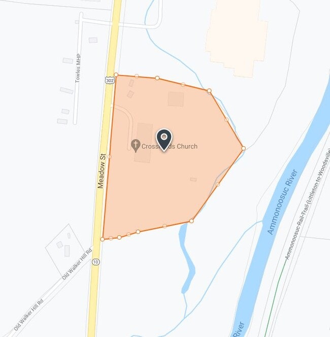
Property Record
1091 Meadow St, Littleton, NH 03561
NEARBY LISTINGS FOR SALE OR LEASE
Property Detail
1091 Meadow St
Commercialbuilding
Grafton
AE
New Hampshire
33009C0116E
13.65 AC
2024
Concord/New Hampshire North Area
2024
Other Market Areas
960102
Claremont-Lebanon, NH-VT
6,400 SF
LTLN-000091-000043
DEMOGRAPHICS near 1091 Meadow St
1 Mile
3 Mile
5 Mile
2024 Total Population
61
5,304
7,610
2029 Population
65
5,595
8,027
Pop Growth 2024-2029
+ 6.56%
+ 5.49%
+ 5.48%
Average Age
47
45
46
2024 Total Households
27
2,507
3,515
HH Growth 2024-2029
+ 7.41%
+ 5.11%
+ 5.12%
Median Household Inc
$98,437
$49,133
$53,370
Avg Household Size
2.20
2.10
2.10
2024 Avg HH Vehicles
2.00
1.00
1.00
Median Home Value
$254,999
$199,326
$207,209
Median Year Built
1995
1961
1964
Nearby Places
Map Layers
Map Styles
 Street
 Aerial
- Restaurants
- Banks
- Shops
- Fitness
- Groceries
Nearby Properties
Address
Land Use
TOTAL SIZE
Lot Size
Zoning
Address
Land Use
TOTAL SIZE
Lot Size
Zoning
181,020 SF
43.36 AC
MU-I
Address
Land Use
TOTAL SIZE
Lot Size
Zoning
141,695 SF
16.60 AC
C-1
Address
Land Use
TOTAL SIZE
Lot Size
Zoning
110,483 SF
3.70 AC
R-1
Address
Land Use
TOTAL SIZE
Lot Size
Zoning
104,134 SF
32.13 AC
C-1
Address
Land Use
TOTAL SIZE
Lot Size
Zoning
96,456 SF
19.30 AC
C-1
Address
Land Use
TOTAL SIZE
Lot Size
Zoning
105,100 SF
7.82 AC
I
Address
Land Use
TOTAL SIZE
Lot Size
Zoning
20,273 SF
18 AC
D-2
Address
Land Use
TOTAL SIZE
Lot Size
Zoning
55,196 SF
9 AC
C-1
Address
Land Use
TOTAL SIZE
Lot Size
Zoning
49,266 SF
21.07 AC
I
Address
Land Use
TOTAL SIZE
Lot Size
Zoning
57,673 SF
4.55 AC
R-1
Address
Land Use
TOTAL SIZE
Lot Size
Zoning
118,756 SF
23.30 AC
I
Address
Land Use
TOTAL SIZE
Lot Size
Zoning
16,080 SF
4.23 AC
I
Address
Land Use
TOTAL SIZE
Lot Size
Zoning
58,967 SF
5.40 AC
C-1
Address
Land Use
TOTAL SIZE
Lot Size
Zoning
77,490 SF
19.10 AC
I
Address
Land Use
TOTAL SIZE
Lot Size
Zoning
62,400 SF
6.30 AC
C-1
Address
Land Use
TOTAL SIZE
Lot Size
Zoning
4,800 SF
29.34 AC
R-1
Address
Land Use
TOTAL SIZE
Lot Size
Zoning
38,764 SF
7.80 AC
C-1
Address
Land Use
TOTAL SIZE
Lot Size
Zoning
23,992 SF
43.30 AC
C-1
Address
Land Use
TOTAL SIZE
Lot Size
Zoning
4.50 AC
R-2
Address
Land Use
TOTAL SIZE
Lot Size
Zoning
29,496 SF
75 AC
R-1
Address
Land Use
TOTAL SIZE
Lot Size
Zoning
34,684 SF
1.90 AC
C-1
Address
Land Use
TOTAL SIZE
Lot Size
Zoning
40,973 SF
4.56 AC
R-1
Address
Land Use
TOTAL SIZE
Lot Size
Zoning
8,450 SF
8.35 AC
C-1
Address
Land Use
TOTAL SIZE
Lot Size
Zoning
23,659 SF
0.84 AC
C-1
Address
Land Use
TOTAL SIZE
Lot Size
Zoning
79,282 SF
16.26 AC
I
Address
Land Use
TOTAL SIZE
Lot Size
Zoning
16,508 SF
17.03 AC
R
Address
Land Use
TOTAL SIZE
Lot Size
Zoning
13,799 SF
1.38 AC
C-4
Address
Land Use
TOTAL SIZE
Lot Size
Zoning
35,574 SF
4.40 AC
I
Address
Land Use
TOTAL SIZE
Lot Size
Zoning
16,741 SF
4.97 AC
C-1
Address
Land Use
TOTAL SIZE
Lot Size
Zoning
4,814 SF
2.30 AC
C-1
The World's #1 Commercial Real Estate Marketplace
Connect with us
© 2025 CoStar Group
The information above has been obtained from sources believed reliable. While we do not doubt its accuracy we have not verified it and make no guarantee, warranty or representation about it. It is your responsibility to independently confirm its accuracy and completeness. Any projections, opinions, assumptions, or estimates used are for example only and do not represent the current or future performance of the property. The value of this transaction to you depends on tax and other factors which should be evaluated by your tax, financial, and legal advisors. You and your advisors should conduct a careful, independent investigation of the property to determine to your satisfaction the suitability of the property for your needs.