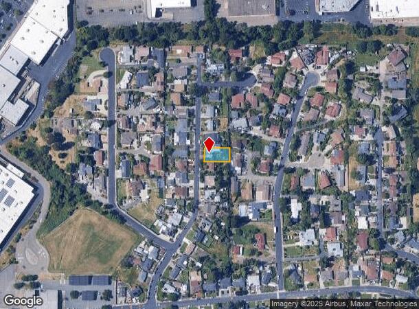
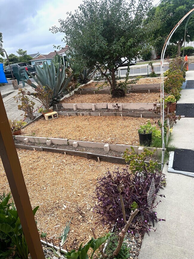
Property Record
1092 Mitchell Way, El Sobrante, CA 94803
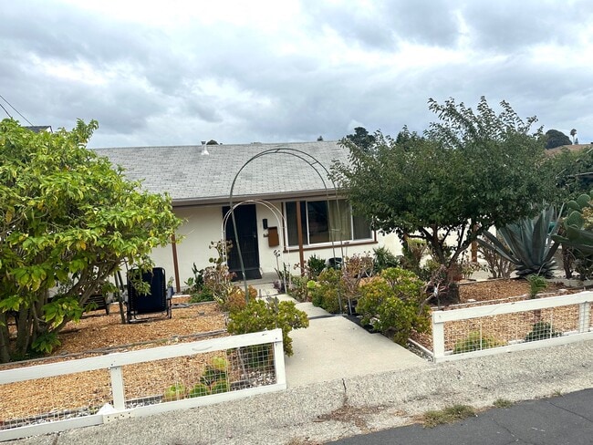
This Property Is For Sale
NEARBY LISTINGS FOR SALE OR LEASE
-
-
View all El Sobrante listings for sale on LoopNet.com
Property Detail
1092 Mitchell Way
Oakland-Fremont-Berkeley, CA
Mitchell Estates
426-051-010-4
Contra Costa
Sfr
California
X
0.16 AC
06013C0231G
Richmond/San Pablo
1,908 SF
East Bay/Oakland
DEMOGRAPHICS near 1092 Mitchell Way
1 Mile
3 Mile
5 Mile
2024 Total Population
15,603
112,145
228,642
2029 Population
15,758
112,846
230,060
Pop Growth 2024-2029
+ 0.99%
+ 0.63%
+ 0.62%
Average Age
42
42
40
2024 Total Households
5,617
38,269
74,739
HH Growth 2024-2029
+ 1.09%
+ 0.60%
+ 0.60%
Median Household Inc
$93,652
$104,309
$99,779
Avg Household Size
2.70
2.80
2.90
2024 Avg HH Vehicles
2.00
2.00
2.00
Median Home Value
$719,122
$713,300
$731,079
Median Year Built
1972
1974
1968
Nearby Places
Map Layers
Map Styles
 Street
 Aerial
- Restaurants
- Banks
- Shops
- Fitness
- Groceries
PUBLIC TRANSPORTATION
COMMUTER RAIL
Richmond (Capitol Corridor - Capitol Corridor Joint Powers Authority)
DRIVE
WALK
Distance
Richmond (Capitol Corridor - Capitol Corridor Joint Powers Authority)
13 min
6.9 mi
AIRPORT
Metro Oakland International
DRIVE
WALK
Distance
Metro Oakland International
36 min
25.4 mi
San Francisco International
DRIVE
WALK
Distance
San Francisco International
49 min
33.0 mi
Freight Ports
Port of Richmond
DRIVE
WALK
Distance
Port of Richmond
21 min
12.0 mi
Nearby Properties
Address
Land Use
TOTAL SIZE
Lot Size
Zoning
Address
Land Use
TOTAL SIZE
Lot Size
Zoning
892,224 SF
46.87 AC
Address
Land Use
TOTAL SIZE
Lot Size
Zoning
707,820 SF
44.29 AC
Address
Land Use
TOTAL SIZE
Lot Size
Zoning
268,936 SF
2.20 AC
Address
Land Use
TOTAL SIZE
Lot Size
Zoning
321,008 SF
47.36 AC
Address
Land Use
TOTAL SIZE
Lot Size
Zoning
252,714 SF
14.68 AC
C
Address
Land Use
TOTAL SIZE
Lot Size
Zoning
459,003 SF
21.30 AC
Address
Land Use
TOTAL SIZE
Lot Size
Zoning
179,961 SF
1.05 AC
Address
Land Use
TOTAL SIZE
Lot Size
Zoning
267,304 SF
1.87 AC
Address
Land Use
TOTAL SIZE
Lot Size
Zoning
247,924 SF
14.36 AC
Address
Land Use
TOTAL SIZE
Lot Size
Zoning
245,680 SF
18.89 AC
Address
Land Use
TOTAL SIZE
Lot Size
Zoning
200,000 SF
14.95 AC
Address
Land Use
TOTAL SIZE
Lot Size
Zoning
70,250 SF
9.55 AC
Address
Land Use
TOTAL SIZE
Lot Size
Zoning
220,864 SF
11.10 AC
Address
Land Use
TOTAL SIZE
Lot Size
Zoning
190,471 SF
11.32 AC
Address
Land Use
TOTAL SIZE
Lot Size
Zoning
171,052 SF
12.06 AC
M3
Address
Land Use
TOTAL SIZE
Lot Size
Zoning
135,904 SF
7.12 AC
Address
Land Use
TOTAL SIZE
Lot Size
Zoning
14,722 SF
5.69 AC
Address
Land Use
TOTAL SIZE
Lot Size
Zoning
41,400 SF
6.32 AC
Address
Land Use
TOTAL SIZE
Lot Size
Zoning
95,850 SF
6.38 AC
Address
Land Use
TOTAL SIZE
Lot Size
Zoning
177,724 SF
63.32 AC
M-2
Address
Land Use
TOTAL SIZE
Lot Size
Zoning
118,658 SF
8.57 AC
Address
Land Use
TOTAL SIZE
Lot Size
Zoning
178,277 SF
58.72 AC
Address
Land Use
TOTAL SIZE
Lot Size
Zoning
96,750 SF
6.54 AC
Address
Land Use
TOTAL SIZE
Lot Size
Zoning
131,693 SF
7.47 AC
Address
Land Use
TOTAL SIZE
Lot Size
Zoning
144,000 SF
7.64 AC
Address
Land Use
TOTAL SIZE
Lot Size
Zoning
61,875 SF
3.62 AC
Address
Land Use
TOTAL SIZE
Lot Size
Zoning
110,765 SF
2.67 AC
Address
Land Use
TOTAL SIZE
Lot Size
Zoning
60,196 SF
13.44 AC
Address
Land Use
TOTAL SIZE
Lot Size
Zoning
85,225 SF
8.34 AC
Address
Land Use
TOTAL SIZE
Lot Size
Zoning
61,403 SF
8.38 AC
The World's #1 Commercial Real Estate Marketplace
Connect with us
© 2026 CoStar Group
The information above has been obtained from sources believed reliable. While we do not doubt its accuracy we have not verified it and make no guarantee, warranty or representation about it. It is your responsibility to independently confirm its accuracy and completeness. Any projections, opinions, assumptions, or estimates used are for example only and do not represent the current or future performance of the property. The value of this transaction to you depends on tax and other factors which should be evaluated by your tax, financial, and legal advisors. You and your advisors should conduct a careful, independent investigation of the property to determine to your satisfaction the suitability of the property for your needs.