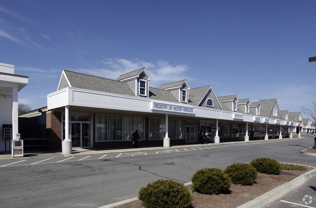
Property Record
1090 Route 28, South Yarmouth, MA 02664
NEARBY LISTINGS FOR SALE OR LEASE
Property Detail
1090 Route 28
Regionalshoppingcenterormallwithanchorstore
Barnstable
X
Massachusetts
25001C0587J
1.46 AC
2025
Cape Cod
2025
Other Market Areas
012002
Barnstable Town, MA
15,306 SF
YARM-000050-000104
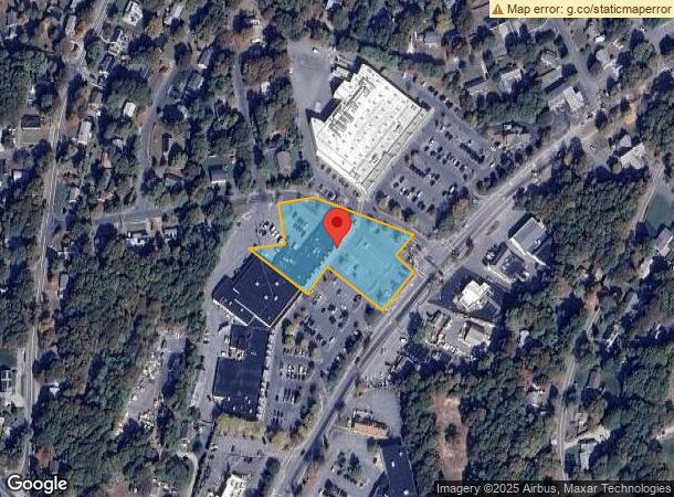
DEMOGRAPHICS near 1090 Route 28
1 Mile
3 Mile
5 Mile
2024 Total Population
5,988
25,854
51,016
2029 Population
6,263
27,257
53,011
Pop Growth 2024-2029
+ 4.59%
+ 5.43%
+ 3.91%
Average Age
47
49
49
2024 Total Households
2,792
12,024
23,672
HH Growth 2024-2029
+ 4.51%
+ 5.50%
+ 3.90%
Median Household Inc
$74,070
$70,143
$70,035
Avg Household Size
2.10
2.10
2.10
2024 Avg HH Vehicles
2.00
2.00
2.00
Median Home Value
$448,823
$443,730
$444,476
Median Year Built
1967
1970
1971
Nearby Places
- Restaurants
- Banks
- Shops
- Fitness
- Groceries
PUBLIC TRANSPORTATION
COMMUTER RAIL
DRIVE
WALK
Distance
9 min
4.4 mi
AIRPORT
Nantucket Memorial
DRIVE
WALK
Distance
Nantucket Memorial
158 min
37.8 mi
Martha's Vineyard
DRIVE
WALK
Distance
Martha's Vineyard
114 min
43.2 mi
Freight Ports
Port of New Bedford Harbor
DRIVE
WALK
Distance
Port of New Bedford Harbor
77 min
54.2 mi
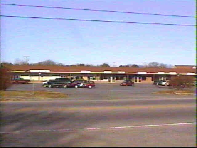
SALE & LEASE HISTORY
LISTING DATE
SALE/LEASE

Sep 25, 2016
For Lease
Aug 18, 2020
For Lease
Nearby Properties
Address
Land Use
TOTAL SIZE
Lot Size
Zoning
Address
Land Use
TOTAL SIZE
Lot Size
Zoning
221,710 SF
67.02 AC
Address
Land Use
TOTAL SIZE
Lot Size
Zoning
11,698 SF
34.50 AC
Address
Land Use
TOTAL SIZE
Lot Size
Zoning
110,415 SF
70 AC
Address
Land Use
TOTAL SIZE
Lot Size
Zoning
177,385 SF
39.53 AC
Address
Land Use
TOTAL SIZE
Lot Size
Zoning
72.55 AC
R60
Address
Land Use
TOTAL SIZE
Lot Size
Zoning
2,264 SF
26.60 AC
Address
Land Use
TOTAL SIZE
Lot Size
Zoning
4,800 SF
414.61 AC
Address
Land Use
TOTAL SIZE
Lot Size
Zoning
Address
Land Use
TOTAL SIZE
Lot Size
Zoning
180,973 SF
11.78 AC
Address
Land Use
TOTAL SIZE
Lot Size
Zoning
35,244 SF
7.70 AC
Address
Land Use
TOTAL SIZE
Lot Size
Zoning
11,017 SF
5.52 AC
Address
Land Use
TOTAL SIZE
Lot Size
Zoning
1,793 SF
1.32 AC
Address
Land Use
TOTAL SIZE
Lot Size
Zoning
7,134 SF
1.45 AC
Address
Land Use
TOTAL SIZE
Lot Size
Zoning
2,560 SF
100.38 AC
Address
Land Use
TOTAL SIZE
Lot Size
Zoning
7,172 SF
1.33 AC
Address
Land Use
TOTAL SIZE
Lot Size
Zoning
2,942 SF
130.52 AC
Address
Land Use
TOTAL SIZE
Lot Size
Zoning
4,556 SF
1.10 AC
Address
Land Use
TOTAL SIZE
Lot Size
Zoning
18,164 SF
5 AC
Address
Land Use
TOTAL SIZE
Lot Size
Zoning
108,651 SF
13.85 AC
Address
Land Use
TOTAL SIZE
Lot Size
Zoning
59,756 SF
9.56 AC
Address
Land Use
TOTAL SIZE
Lot Size
Zoning
62,423 SF
13.98 AC
Address
Land Use
TOTAL SIZE
Lot Size
Zoning
44,504 SF
5.33 AC
Address
Land Use
TOTAL SIZE
Lot Size
Zoning
Address
Land Use
TOTAL SIZE
Lot Size
Zoning
20,536 SF
4.37 AC
Address
Land Use
TOTAL SIZE
Lot Size
Zoning
Address
Land Use
TOTAL SIZE
Lot Size
Zoning
2.15 AC
Address
Land Use
TOTAL SIZE
Lot Size
Zoning
4,770 SF
3.63 AC
Address
Land Use
TOTAL SIZE
Lot Size
Zoning
54,070 SF
5.51 AC
Address
Land Use
TOTAL SIZE
Lot Size
Zoning
54,080 SF
3.60 AC
Address
Land Use
TOTAL SIZE
Lot Size
Zoning
21,758 SF
6.75 AC
The World's #1 Commercial Real Estate Marketplace
Connect with us
© 2025 CoStar Group
The information above has been obtained from sources believed reliable. While we do not doubt its accuracy we have not verified it and make no guarantee, warranty or representation about it. It is your responsibility to independently confirm its accuracy and completeness. Any projections, opinions, assumptions, or estimates used are for example only and do not represent the current or future performance of the property. The value of this transaction to you depends on tax and other factors which should be evaluated by your tax, financial, and legal advisors. You and your advisors should conduct a careful, independent investigation of the property to determine to your satisfaction the suitability of the property for your needs.