Property Record
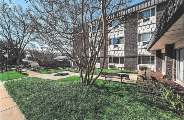
10920 Connecticut Ave, Kensington, MD 20895


NEARBY LISTINGS FOR SALE OR LEASE
Property Detail
10920 Connecticut Ave
13-01131733
Kensington
Apartment
PAR A NORTH KENSINGT ON
X
Montgomery
24031C0365D
Maryland
2024
2.34 AC
2025
North Kensington
703502
Washington, DC
48,121 SF
Washington-Arlington-Alexandria, DC-VA-MD-WV
DEMOGRAPHICS near 10920 Connecticut Ave
1 Mile
3 Mile
5 Mile
2024 Total Population
17,740
174,769
442,924
2029 Population
17,611
172,771
437,193
Pop Growth 2024-2029
(0.73%)
(1.14%)
(1.29%)
Average Age
40
40
41
2024 Total Households
6,274
63,504
169,509
HH Growth 2024-2029
(0.84%)
(1.23%)
(1.31%)
Median Household Inc
$124,067
$114,404
$114,753
Avg Household Size
2.70
2.60
2.50
2024 Avg HH Vehicles
2.00
2.00
2.00
Median Home Value
$597,250
$531,244
$625,916
Median Year Built
1956
1965
1967
Nearby Places
Map Layers
Map Styles
 Street
 Aerial
- Restaurants
- Banks
- Shops
- Fitness
- Groceries
PUBLIC TRANSPORTATION
TRANSIT/SUBWAY
Kensington (Brunswick Line - Maryland Area Regional Commuter Trains (The MARC))
DRIVE
WALK
Distance
Kensington (Brunswick Line - Maryland Area Regional Commuter Trains (The MARC))
3 min
14 min
0.7 mi
COMMUTER RAIL
Kensington (Brunswick Line - Maryland Area Regional Commuter Trains (The MARC))
DRIVE
WALK
Distance
Kensington (Brunswick Line - Maryland Area Regional Commuter Trains (The MARC))
3 min
14 min
0.7 mi
Garrett Park (Brunswick Line - Maryland Area Regional Commuter Trains (The MARC))
DRIVE
WALK
Distance
Garrett Park (Brunswick Line - Maryland Area Regional Commuter Trains (The MARC))
6 min
2.0 mi
AIRPORT
Ronald Reagan Washington Ntl
DRIVE
WALK
Distance
Ronald Reagan Washington Ntl
32 min
16.4 mi
Washington Dulles International
DRIVE
WALK
Distance
Washington Dulles International
45 min
28.1 mi
Baltimore/Washington International Thurgood Marshall
DRIVE
WALK
Distance
Baltimore/Washington International Thurgood Marshall
46 min
33.2 mi
Freight Ports
Port of Baltimore
DRIVE
WALK
Distance
Port of Baltimore
50 min
35.9 mi
SALE & LEASE HISTORY
LISTING DATE
SALE/LEASE

Sep 25, 2016
For Lease
Sep 09, 2020
For Lease
Jul 20, 2017
For Lease
Apr 17, 2025
For Lease
Nearby Properties
Address
Land Use
TOTAL SIZE
Lot Size
Zoning
Address
Land Use
TOTAL SIZE
Lot Size
Zoning
4,400,000 SF
7.92 AC
R60
Address
Land Use
TOTAL SIZE
Lot Size
Zoning
1,332,482 SF
3.79 AC
CR2.0
Address
Land Use
TOTAL SIZE
Lot Size
Zoning
775,490 SF
14.21 AC
R60
Address
Land Use
TOTAL SIZE
Lot Size
Zoning
1,775,186 SF
75.19 AC
GR1.5
Address
Land Use
TOTAL SIZE
Lot Size
Zoning
1,119,608 SF
90.30 AC
R90
Address
Land Use
TOTAL SIZE
Lot Size
Zoning
178,124 SF
11 AC
R60
Address
Land Use
TOTAL SIZE
Lot Size
Zoning
515,000 SF
5.23 AC
CR1.5
Address
Land Use
TOTAL SIZE
Lot Size
Zoning
432,000 SF
1.77 AC
CR4.0
Address
Land Use
TOTAL SIZE
Lot Size
Zoning
379,100 SF
11.80 AC
CR4.0
Address
Land Use
TOTAL SIZE
Lot Size
Zoning
575,000 SF
110.35 AC
R60
Address
Land Use
TOTAL SIZE
Lot Size
Zoning
626,132 SF
7.28 AC
CR0.5
Address
Land Use
TOTAL SIZE
Lot Size
Zoning
380,452 SF
2.38 AC
CR3.0
Address
Land Use
TOTAL SIZE
Lot Size
Zoning
431,630 SF
25.77 AC
R60
Address
Land Use
TOTAL SIZE
Lot Size
Zoning
364,000 SF
CR6.0
Address
Land Use
TOTAL SIZE
Lot Size
Zoning
412,122 SF
10.44 AC
CR1.5
Address
Land Use
TOTAL SIZE
Lot Size
Zoning
379,878 SF
2.13 AC
CR
Address
Land Use
TOTAL SIZE
Lot Size
Zoning
815,414 SF
3.27 AC
CR4.0
Address
Land Use
TOTAL SIZE
Lot Size
Zoning
674,400 SF
3.21 AC
CR3.0
Address
Land Use
TOTAL SIZE
Lot Size
Zoning
223,520 SF
2.77 AC
CR2.0
Address
Land Use
TOTAL SIZE
Lot Size
Zoning
362,353 SF
27.72 AC
R90
Address
Land Use
TOTAL SIZE
Lot Size
Zoning
291,194 SF
0.72 AC
CR4.0
Address
Land Use
TOTAL SIZE
Lot Size
Zoning
80,359 SF
11.61 AC
CRT1.
Address
Land Use
TOTAL SIZE
Lot Size
Zoning
330,650 SF
2.89 AC
MXTD
Address
Land Use
TOTAL SIZE
Lot Size
Zoning
454,275 SF
1.12 AC
CR7.2
Address
Land Use
TOTAL SIZE
Lot Size
Zoning
465,983 SF
1.38 AC
CR3.0
Address
Land Use
TOTAL SIZE
Lot Size
Zoning
429,137 SF
1.80 AC
CR4.0
Address
Land Use
TOTAL SIZE
Lot Size
Zoning
51.89 AC
R60
Address
Land Use
TOTAL SIZE
Lot Size
Zoning
460,492 SF
3.56 AC
CR4.0
Address
Land Use
TOTAL SIZE
Lot Size
Zoning
152,330 SF
CR
Address
Land Use
TOTAL SIZE
Lot Size
Zoning
291,945 SF
10.49 AC
R10
The World's #1 Commercial Real Estate Marketplace
Connect with us
© 2026 CoStar Group
The information above has been obtained from sources believed reliable. While we do not doubt its accuracy we have not verified it and make no guarantee, warranty or representation about it. It is your responsibility to independently confirm its accuracy and completeness. Any projections, opinions, assumptions, or estimates used are for example only and do not represent the current or future performance of the property. The value of this transaction to you depends on tax and other factors which should be evaluated by your tax, financial, and legal advisors. You and your advisors should conduct a careful, independent investigation of the property to determine to your satisfaction the suitability of the property for your needs.