Property Record
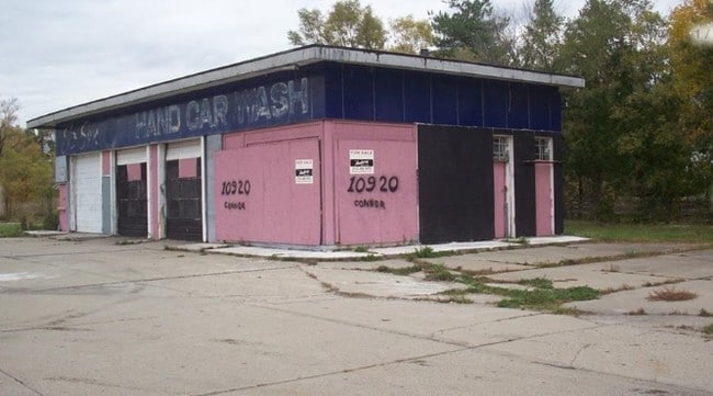
10920 Conner St, Detroit, MI 48213


NEARBY LISTINGS FOR SALE OR LEASE
Property Detail
10920 Conner St
21-04628-390
David Trombley Estate
Servicestation
E CONNER N 10.23 FT 8 7 THRU 1 DAVID TROMBLEY ESTATES SUB L38 P18 PLATS, W C R 21/460 156.41 X 105.54
X
Wayne
26163C0140F
Michigan
2025
0.36 AC
2025
Detroit E of Woodward
505200
Detroit
1,654 SF
Detroit-Warren-Dearborn, MI
DEMOGRAPHICS near 10920 Conner St
1 Mile
3 Mile
5 Mile
2024 Total Population
11,884
135,871
369,966
2029 Population
12,247
138,097
368,341
Pop Growth 2024-2029
+ 3.05%
+ 1.64%
(0.44%)
Average Age
38
37
38
2024 Total Households
4,276
48,423
143,825
HH Growth 2024-2029
+ 2.99%
+ 1.89%
(0.50%)
Median Household Inc
$34,824
$34,671
$40,504
Avg Household Size
2.60
2.70
2.50
2024 Avg HH Vehicles
1.00
1.00
1.00
Median Home Value
$62,004
$68,226
$89,453
Median Year Built
1949
1949
1950
Nearby Places
Map Layers
Map Styles
 Street
 Aerial
- Restaurants
- Banks
- Shops
- Fitness
- Groceries
PUBLIC TRANSPORTATION
AIRPORT
Detroit City
DRIVE
WALK
Distance
Detroit City
8 min
2.4 mi
Detroit Metro Wayne County
DRIVE
WALK
Distance
Detroit Metro Wayne County
35 min
28.7 mi
Freight Ports
Port of Baltimore
DRIVE
WALK
Distance
Port of Baltimore
1 min
398.8 mi
SALE & LEASE HISTORY
LISTING DATE
SALE/LEASE

Aug 08, 2017
For Sale
Nearby Properties
Address
Land Use
TOTAL SIZE
Lot Size
Zoning
Address
Land Use
TOTAL SIZE
Lot Size
Zoning
3,793,609 SF
265.70 AC
M4
Address
Land Use
TOTAL SIZE
Lot Size
Zoning
2,958,207 SF
277.38 AC
M4
Address
Land Use
TOTAL SIZE
Lot Size
Zoning
2,005,073 SF
108.66 AC
M4
Address
Land Use
TOTAL SIZE
Lot Size
Zoning
996,200 SF
2.14 AC
Address
Land Use
TOTAL SIZE
Lot Size
Zoning
482,649 SF
M4
Address
Land Use
TOTAL SIZE
Lot Size
Zoning
506,404 SF
198 AC
M4
Address
Land Use
TOTAL SIZE
Lot Size
Zoning
182,866 SF
5.08 AC
PD
Address
Land Use
TOTAL SIZE
Lot Size
Zoning
892,351 SF
92.45 AC
I
Address
Land Use
TOTAL SIZE
Lot Size
Zoning
197,670 SF
42.84 AC
M4
Address
Land Use
TOTAL SIZE
Lot Size
Zoning
144,578 SF
7.10 AC
PD
Address
Land Use
TOTAL SIZE
Lot Size
Zoning
300,000 SF
0.29 AC
M4
Address
Land Use
TOTAL SIZE
Lot Size
Zoning
405,004 SF
28.13 AC
M4
Address
Land Use
TOTAL SIZE
Lot Size
Zoning
358,327 SF
M4
Address
Land Use
TOTAL SIZE
Lot Size
Zoning
455,634 SF
0.58 AC
Address
Land Use
TOTAL SIZE
Lot Size
Zoning
302,305 SF
M4
Address
Land Use
TOTAL SIZE
Lot Size
Zoning
410,359 SF
27.52 AC
M4
Address
Land Use
TOTAL SIZE
Lot Size
Zoning
286,023 SF
M4
Address
Land Use
TOTAL SIZE
Lot Size
Zoning
224,148 SF
8.59 AC
M4
Address
Land Use
TOTAL SIZE
Lot Size
Zoning
307,262 SF
M4
Address
Land Use
TOTAL SIZE
Lot Size
Zoning
72,940 SF
83.37 AC
M4
Address
Land Use
TOTAL SIZE
Lot Size
Zoning
88,695 SF
6.53 AC
PD
Address
Land Use
TOTAL SIZE
Lot Size
Zoning
115,839 SF
8.54 AC
M4
Address
Land Use
TOTAL SIZE
Lot Size
Zoning
36,417 SF
0.68 AC
B4
Address
Land Use
TOTAL SIZE
Lot Size
Zoning
192,452 SF
10.89 AC
M4
Address
Land Use
TOTAL SIZE
Lot Size
Zoning
218,188 SF
33.22 AC
M4
Address
Land Use
TOTAL SIZE
Lot Size
Zoning
70,152 SF
3.43 AC
M2
Address
Land Use
TOTAL SIZE
Lot Size
Zoning
233,876 SF
8.20 AC
Address
Land Use
TOTAL SIZE
Lot Size
Zoning
4,344 SF
44.72 AC
M4
Address
Land Use
TOTAL SIZE
Lot Size
Zoning
49,807 SF
0.84 AC
PD
Address
Land Use
TOTAL SIZE
Lot Size
Zoning
221,832 SF
6.57 AC
I
The World's #1 Commercial Real Estate Marketplace
Connect with us
© 2026 CoStar Group
The information above has been obtained from sources believed reliable. While we do not doubt its accuracy we have not verified it and make no guarantee, warranty or representation about it. It is your responsibility to independently confirm its accuracy and completeness. Any projections, opinions, assumptions, or estimates used are for example only and do not represent the current or future performance of the property. The value of this transaction to you depends on tax and other factors which should be evaluated by your tax, financial, and legal advisors. You and your advisors should conduct a careful, independent investigation of the property to determine to your satisfaction the suitability of the property for your needs.