Property Record
10927 Bellefontaine Estates Ct, Saint Louis, MO 63137
NEARBY LISTINGS FOR SALE OR LEASE
Property Detail
10927 Bellefontaine Estates Ct
St. Louis, MO-IL
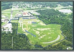
Bellefontaine Estates Plat One
10D-13-0465
BELLEFONTAINE ESTATES PLAT ONE LOT 2
Vacantlandnec
St. Louis
X
Missouri
29183C0350G
2
2024
0.14 AC
2025
North County
210200
St. Louis
DEMOGRAPHICS near 10927 Bellefontaine Estates Ct
1 Mile
3 Mile
5 Mile
2024 Total Population
9,694
51,502
131,658
2029 Population
9,882
51,552
131,264
Pop Growth 2024-2029
+ 1.94%
+ 0.10%
(0.30%)
Average Age
33
38
39
2024 Total Households
3,595
20,096
52,964
HH Growth 2024-2029
+ 1.86%
+ 0.01%
(0.37%)
Median Household Inc
$36,944
$41,297
$41,072
Avg Household Size
2.60
2.50
2.40
2024 Avg HH Vehicles
1.00
1.00
1.00
Median Home Value
$64,270
$85,456
$92,000
Median Year Built
1959
1961
1961
Nearby Places
- Restaurants
- Banks
- Shops
- Fitness
- Groceries
PUBLIC TRANSPORTATION
COMMUTER RAIL
Um St. Louis North (Lambert Airport Shiloh-Scott - St. Louis MetroLink (MetroLink))
DRIVE
WALK
Distance
Um St. Louis North (Lambert Airport Shiloh-Scott - St. Louis MetroLink (MetroLink))
18 min
9.3 mi
AIRPORT
St Louis Lambert International
DRIVE
WALK
Distance
St Louis Lambert International
16 min
10.6 mi
Scott AFB/Midamerica St Louis
DRIVE
WALK
Distance
Scott AFB/Midamerica St Louis
55 min
35.0 mi
Freight Ports
Port Milwaukee
DRIVE
WALK
Distance
Port Milwaukee
414 min
366.6 mi
Nearby Properties
Address
Land Use
TOTAL SIZE
Lot Size
Zoning
Address
Land Use
TOTAL SIZE
Lot Size
Zoning
1,925 SF
21.27 AC
C-8
Address
Land Use
TOTAL SIZE
Lot Size
Zoning
75.13 AC
R3
Address
Land Use
TOTAL SIZE
Lot Size
Zoning
205,268 SF
36.09 AC
88R-1
Address
Land Use
TOTAL SIZE
Lot Size
Zoning
48.23 AC
R3
Address
Land Use
TOTAL SIZE
Lot Size
Zoning
643,294 SF
32.09 AC
R7
Address
Land Use
TOTAL SIZE
Lot Size
Zoning
39.86 AC
A
Address
Land Use
TOTAL SIZE
Lot Size
Zoning
77,616 SF
10.56 AC
C-8
Address
Land Use
TOTAL SIZE
Lot Size
Zoning
20.62 AC
R3
Address
Land Use
TOTAL SIZE
Lot Size
Zoning
18.86 AC
R3
Address
Land Use
TOTAL SIZE
Lot Size
Zoning
218,822 SF
15.94 AC
R6
Address
Land Use
TOTAL SIZE
Lot Size
Zoning
10,362 SF
19.03 AC
81R-2
Address
Land Use
TOTAL SIZE
Lot Size
Zoning
179,262 SF
9.58 AC
R2
Address
Land Use
TOTAL SIZE
Lot Size
Zoning
92,740 SF
27.63 AC
NU
Address
Land Use
TOTAL SIZE
Lot Size
Zoning
10 AC
R3
Address
Land Use
TOTAL SIZE
Lot Size
Zoning
64,372 SF
4.95 AC
C-8
Address
Land Use
TOTAL SIZE
Lot Size
Zoning
8.66 AC
R3
Address
Land Use
TOTAL SIZE
Lot Size
Zoning
10.24 AC
R-4
Address
Land Use
TOTAL SIZE
Lot Size
Zoning
3,256 SF
38.63 AC
88R-3
Address
Land Use
TOTAL SIZE
Lot Size
Zoning
217,644 SF
12.07 AC
R6
Address
Land Use
TOTAL SIZE
Lot Size
Zoning
30.81 AC
R3
Address
Land Use
TOTAL SIZE
Lot Size
Zoning
31,800 SF
17.34 AC
C-8
Address
Land Use
TOTAL SIZE
Lot Size
Zoning
90,985 SF
7.77 AC
C-8
Address
Land Use
TOTAL SIZE
Lot Size
Zoning
171,193 SF
11.63 AC
R6
Address
Land Use
TOTAL SIZE
Lot Size
Zoning
69.24 AC
A
Address
Land Use
TOTAL SIZE
Lot Size
Zoning
5 AC
R5
Address
Land Use
TOTAL SIZE
Lot Size
Zoning
4.36 AC
NU
Address
Land Use
TOTAL SIZE
Lot Size
Zoning
191,910 SF
6.51 AC
R7
Address
Land Use
TOTAL SIZE
Lot Size
Zoning
138,038 SF
7.03 AC
MI
Address
Land Use
TOTAL SIZE
Lot Size
Zoning
5 AC
88R-3
Address
Land Use
TOTAL SIZE
Lot Size
Zoning
6,915 SF
8.20 AC
88M-2
The World's #1 Commercial Real Estate Marketplace
Connect with us
© 2025 CoStar Group
The information above has been obtained from sources believed reliable. While we do not doubt its accuracy we have not verified it and make no guarantee, warranty or representation about it. It is your responsibility to independently confirm its accuracy and completeness. Any projections, opinions, assumptions, or estimates used are for example only and do not represent the current or future performance of the property. The value of this transaction to you depends on tax and other factors which should be evaluated by your tax, financial, and legal advisors. You and your advisors should conduct a careful, independent investigation of the property to determine to your satisfaction the suitability of the property for your needs.