Property Record
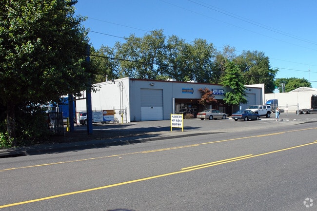
10931 N Vancouver Way, Portland, OR 97217


NEARBY LISTINGS FOR SALE OR LEASE
Property Detail
10931 N Vancouver Way
R314461
SECTION 03 1N 1E, TL 800 0.66 ACRES
Industrialgeneral
Multnomah
ARE
Oregon
41067C0400E
0.66 AC
2025
Airport Way
2025
Portland
007202
Portland-Vancouver-Hillsboro, OR-WA
10,000 SF
DEMOGRAPHICS near 10931 N Vancouver Way
1 Mile
3 Mile
5 Mile
2024 Total Population
4,407
84,733
247,327
2029 Population
4,401
85,658
251,163
Pop Growth 2024-2029
(0.14%)
+ 1.09%
+ 1.55%
Average Age
48
40
40
2024 Total Households
2,291
36,451
107,416
HH Growth 2024-2029
(0.17%)
+ 1.71%
+ 1.56%
Median Household Inc
$85,084
$78,021
$81,866
Avg Household Size
1.80
2.20
2.20
2024 Avg HH Vehicles
2.00
2.00
2.00
Median Home Value
$423,313
$486,047
$516,791
Median Year Built
1991
1960
1967
Nearby Places
Map Layers
Map Styles
 Street
 Aerial
- Restaurants
- Banks
- Shops
- Fitness
- Groceries
PUBLIC TRANSPORTATION
COMMUTER RAIL
DRIVE
WALK
Distance
9 min
3.7 mi
DRIVE
WALK
Distance
11 min
6.4 mi
AIRPORT
Portland International
DRIVE
WALK
Distance
Portland International
19 min
8.3 mi
Freight Ports
Port of Vancouver
DRIVE
WALK
Distance
Port of Vancouver
12 min
5.2 mi
Nearby Properties
Address
Land Use
TOTAL SIZE
Lot Size
Zoning
Address
Land Use
TOTAL SIZE
Lot Size
Zoning
200,109 SF
70.44 AC
IH
Address
Land Use
TOTAL SIZE
Lot Size
Zoning
15,473 SF
192.67 AC
IG2
Address
Land Use
TOTAL SIZE
Lot Size
Zoning
590,457 SF
53.12 AC
CPX
Address
Land Use
TOTAL SIZE
Lot Size
Zoning
522,778 SF
193.16 AC
CPX
Address
Land Use
TOTAL SIZE
Lot Size
Zoning
437,419 SF
37.90 AC
IG2
Address
Land Use
TOTAL SIZE
Lot Size
Zoning
465,188 SF
1.29 AC
CX
Address
Land Use
TOTAL SIZE
Lot Size
Zoning
Address
Land Use
TOTAL SIZE
Lot Size
Zoning
769,347 SF
8.52 AC
CX
Address
Land Use
TOTAL SIZE
Lot Size
Zoning
319,958 SF
53.08 AC
CPX
Address
Land Use
TOTAL SIZE
Lot Size
Zoning
490,802 SF
56.17 AC
CGX
Address
Land Use
TOTAL SIZE
Lot Size
Zoning
1,660,710 SF
110.33 AC
IG2
Address
Land Use
TOTAL SIZE
Lot Size
Zoning
463,000 SF
67.68 AC
CPX
Address
Land Use
TOTAL SIZE
Lot Size
Zoning
589,596 SF
9.63 AC
R-22
Address
Land Use
TOTAL SIZE
Lot Size
Zoning
85,000 SF
1.65 AC
CI2
Address
Land Use
TOTAL SIZE
Lot Size
Zoning
278,788 SF
0.92 AC
CX
Address
Land Use
TOTAL SIZE
Lot Size
Zoning
307,468 SF
8.27 AC
CPX
Address
Land Use
TOTAL SIZE
Lot Size
Zoning
97,000 SF
NULL
Address
Land Use
TOTAL SIZE
Lot Size
Zoning
107,958 SF
2.48 AC
IG2
Address
Land Use
TOTAL SIZE
Lot Size
Zoning
294,114 SF
2.03 AC
CX
Address
Land Use
TOTAL SIZE
Lot Size
Zoning
222,177 SF
4.96 AC
CX
Address
Land Use
TOTAL SIZE
Lot Size
Zoning
18,135 SF
0.45 AC
CX
Address
Land Use
TOTAL SIZE
Lot Size
Zoning
294,955 SF
14.10 AC
IL
Address
Land Use
TOTAL SIZE
Lot Size
Zoning
133.11 AC
IG2
Address
Land Use
TOTAL SIZE
Lot Size
Zoning
5.19 AC
IH
Address
Land Use
TOTAL SIZE
Lot Size
Zoning
253,011 SF
0.98 AC
CX
Address
Land Use
TOTAL SIZE
Lot Size
Zoning
516,079 SF
19.29 AC
R-30
Address
Land Use
TOTAL SIZE
Lot Size
Zoning
112,578 SF
2.94 AC
CI2
Address
Land Use
TOTAL SIZE
Lot Size
Zoning
127,050 SF
1.23 AC
CX
Address
Land Use
TOTAL SIZE
Lot Size
Zoning
118,469 SF
47.45 AC
IG2
Address
Land Use
TOTAL SIZE
Lot Size
Zoning
141,560 SF
8.12 AC
R5
The World's #1 Commercial Real Estate Marketplace
Connect with us
© 2025 CoStar Group
The information above has been obtained from sources believed reliable. While we do not doubt its accuracy we have not verified it and make no guarantee, warranty or representation about it. It is your responsibility to independently confirm its accuracy and completeness. Any projections, opinions, assumptions, or estimates used are for example only and do not represent the current or future performance of the property. The value of this transaction to you depends on tax and other factors which should be evaluated by your tax, financial, and legal advisors. You and your advisors should conduct a careful, independent investigation of the property to determine to your satisfaction the suitability of the property for your needs.