Property Record
1095 N Farnsworth Ave, Aurora, IL 60505

NEARBY LISTINGS FOR SALE OR LEASE
Property Detail
1095 N Farnsworth Ave
Chicago-Naperville-Elgin, IL-IN-WI
Tollview Av&Becker Ln
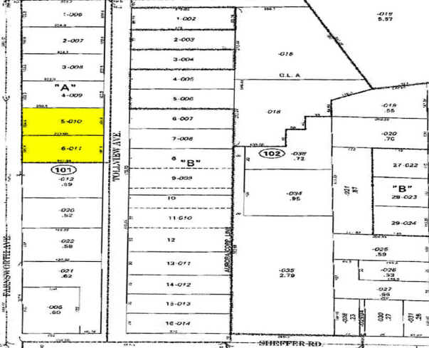
15-13-101-011
CHALET ACRES LOT 6 LOT DIMENSIONS: 104.40 X 200.86 APPROX LOT SQ FT 20970 SUBDIVISION: TOLLVIEW AV&BECKER LN RANGE CODE: 001
Commercialnec
Kane
X
Illinois
17043C0119J
6
2024
0.48 AC
2024
Western East/West Corr
852903
Chicago
6,840 SF
DEMOGRAPHICS near 1095 N Farnsworth Ave
1 Mile
3 Mile
5 Mile
2024 Total Population
10,707
102,402
243,415
2029 Population
10,687
101,588
242,911
Pop Growth 2024-2029
(0.19%)
(0.79%)
(0.21%)
Average Age
40
37
37
2024 Total Households
4,032
33,945
84,346
HH Growth 2024-2029
(0.12%)
(0.76%)
(0.19%)
Median Household Inc
$83,097
$77,908
$85,985
Avg Household Size
2.60
2.90
2.80
2024 Avg HH Vehicles
2.00
2.00
2.00
Median Home Value
$227,645
$226,771
$248,211
Median Year Built
1979
1979
1986
Nearby Places
Map Layers
Map Styles
 Street
 Aerial
- Restaurants
- Banks
- Shops
- Fitness
- Groceries
PUBLIC TRANSPORTATION
COMMUTER RAIL
Aurora Station (Burlington Northern-Santa Fe Railway Line - Northeast Illinois Regional Commuter Railroad (Metra))
DRIVE
WALK
Distance
Aurora Station (Burlington Northern-Santa Fe Railway Line - Northeast Illinois Regional Commuter Railroad (Metra))
7 min
2.8 mi
Route 59 Station (Burlington Northern-Santa Fe Railway Line - Northeast Illinois Regional Commuter Railroad (Metra))
DRIVE
WALK
Distance
Route 59 Station (Burlington Northern-Santa Fe Railway Line - Northeast Illinois Regional Commuter Railroad (Metra))
10 min
4.2 mi
AIRPORT
Chicago Midway International
DRIVE
WALK
Distance
Chicago Midway International
49 min
33.5 mi
Chicago O'Hare International
DRIVE
WALK
Distance
Chicago O'Hare International
48 min
34.4 mi
Freight Ports
Port Milwaukee
DRIVE
WALK
Distance
Port Milwaukee
130 min
106.1 mi
Nearby Properties
Address
Land Use
TOTAL SIZE
Lot Size
Zoning
Address
Land Use
TOTAL SIZE
Lot Size
Zoning
41.29 AC
Address
Land Use
TOTAL SIZE
Lot Size
Zoning
28.52 AC
R
Address
Land Use
TOTAL SIZE
Lot Size
Zoning
27.18 AC
Address
Land Use
TOTAL SIZE
Lot Size
Zoning
41.42 AC
Address
Land Use
TOTAL SIZE
Lot Size
Zoning
19.94 AC
R
Address
Land Use
TOTAL SIZE
Lot Size
Zoning
10.62 AC
Address
Land Use
TOTAL SIZE
Lot Size
Zoning
684,925 SF
25.63 AC
Address
Land Use
TOTAL SIZE
Lot Size
Zoning
283,844 SF
16.06 AC
M
Address
Land Use
TOTAL SIZE
Lot Size
Zoning
692,020 SF
33.90 AC
Address
Land Use
TOTAL SIZE
Lot Size
Zoning
397,771 SF
22.12 AC
Address
Land Use
TOTAL SIZE
Lot Size
Zoning
Address
Land Use
TOTAL SIZE
Lot Size
Zoning
581,960 SF
17.63 AC
Address
Land Use
TOTAL SIZE
Lot Size
Zoning
120,059 SF
13.29 AC
Address
Land Use
TOTAL SIZE
Lot Size
Zoning
12.80 AC
Address
Land Use
TOTAL SIZE
Lot Size
Zoning
622,072 SF
6.04 AC
Address
Land Use
TOTAL SIZE
Lot Size
Zoning
521,922 SF
19.87 AC
Address
Land Use
TOTAL SIZE
Lot Size
Zoning
363,500 SF
19.89 AC
Address
Land Use
TOTAL SIZE
Lot Size
Zoning
Address
Land Use
TOTAL SIZE
Lot Size
Zoning
607,706 SF
16.55 AC
Address
Land Use
TOTAL SIZE
Lot Size
Zoning
25.07 AC
Address
Land Use
TOTAL SIZE
Lot Size
Zoning
11.79 AC
Address
Land Use
TOTAL SIZE
Lot Size
Zoning
46,828 SF
5.97 AC
Address
Land Use
TOTAL SIZE
Lot Size
Zoning
320,874 SF
1.49 AC
Address
Land Use
TOTAL SIZE
Lot Size
Zoning
383,948 SF
17.92 AC
Address
Land Use
TOTAL SIZE
Lot Size
Zoning
17.42 AC
Address
Land Use
TOTAL SIZE
Lot Size
Zoning
116,621 SF
8.50 AC
O
Address
Land Use
TOTAL SIZE
Lot Size
Zoning
224,624 SF
8.35 AC
Address
Land Use
TOTAL SIZE
Lot Size
Zoning
317,815 SF
21.29 AC
Address
Land Use
TOTAL SIZE
Lot Size
Zoning
307,544 SF
22.99 AC
I
Address
Land Use
TOTAL SIZE
Lot Size
Zoning
173,240 SF
0.90 AC
The World's #1 Commercial Real Estate Marketplace
Connect with us
© 2025 CoStar Group
The information above has been obtained from sources believed reliable. While we do not doubt its accuracy we have not verified it and make no guarantee, warranty or representation about it. It is your responsibility to independently confirm its accuracy and completeness. Any projections, opinions, assumptions, or estimates used are for example only and do not represent the current or future performance of the property. The value of this transaction to you depends on tax and other factors which should be evaluated by your tax, financial, and legal advisors. You and your advisors should conduct a careful, independent investigation of the property to determine to your satisfaction the suitability of the property for your needs.