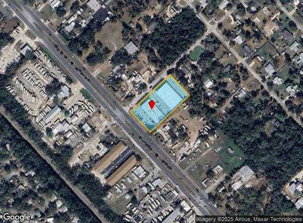
Property Record
1095 N Us Highway 1, Ormond Beach, FL 32174


Current Lease Availabilities
NEARBY LISTINGS FOR SALE OR LEASE
-
-
View all Ormond Beach listings for lease on LoopNet.com
Property Detail
1095 N Us Highway 1
Deltona-Daytona Beach-Ormond Beach, FL
Tomoka Estate
4238-02-06-0140
LOTS 14 & 15 EXC PART IN HWY BLK 6 TOMOKA ESTATES PER OR 3967 PGS 1581-1585 INC
Regionalshoppingcenterormallwithanchorstore
Volusia
X
Florida
12127C0203K
14,15
2025
1.68 AC
2026
Ormond Beach
080101
Deltona/Daytona Beach
28,640 SF
DEMOGRAPHICS near 1095 N Us Highway 1
1 Mile
3 Mile
5 Mile
2024 Total Population
3,124
26,873
68,033
2029 Population
3,464
30,023
76,040
Pop Growth 2024-2029
+ 10.88%
+ 11.72%
+ 11.77%
Average Age
49
49
48
2024 Total Households
1,351
12,300
30,874
HH Growth 2024-2029
+ 11.10%
+ 12.07%
+ 12.05%
Median Household Inc
$63,703
$58,670
$59,189
Avg Household Size
2.30
2.10
2.10
2024 Avg HH Vehicles
2.00
2.00
2.00
Median Home Value
$283,783
$274,570
$273,463
Median Year Built
1996
1979
1983
Nearby Places
Map Layers
Map Styles
 Street
 Aerial
- Restaurants
- Banks
- Shops
- Fitness
- Groceries
PUBLIC TRANSPORTATION
AIRPORT
Daytona Beach International
DRIVE
WALK
Distance
Daytona Beach International
24 min
14.2 mi
Nearby Properties
Address
Land Use
TOTAL SIZE
Lot Size
Zoning
Address
Land Use
TOTAL SIZE
Lot Size
Zoning
13,846 SF
126.83 AC
13T1
Address
Land Use
TOTAL SIZE
Lot Size
Zoning
137,934 SF
48.30 AC
Address
Land Use
TOTAL SIZE
Lot Size
Zoning
168,456 SF
15.74 AC
Address
Land Use
TOTAL SIZE
Lot Size
Zoning
144,576 SF
11.19 AC
13R6
Address
Land Use
TOTAL SIZE
Lot Size
Zoning
162,450 SF
1.42 AC
13B9
Address
Land Use
TOTAL SIZE
Lot Size
Zoning
5,350 SF
36.42 AC
13T1
Address
Land Use
TOTAL SIZE
Lot Size
Zoning
179,868 SF
0.33 AC
Address
Land Use
TOTAL SIZE
Lot Size
Zoning
161,123 SF
13.56 AC
I1
Address
Land Use
TOTAL SIZE
Lot Size
Zoning
196,932 SF
12.44 AC
BPUD
Address
Land Use
TOTAL SIZE
Lot Size
Zoning
96,309 SF
29.04 AC
Address
Land Use
TOTAL SIZE
Lot Size
Zoning
87,633 SF
568.97 AC
RR
Address
Land Use
TOTAL SIZE
Lot Size
Zoning
173,757 SF
11.64 AC
Address
Land Use
TOTAL SIZE
Lot Size
Zoning
125,088 SF
10.66 AC
B3
Address
Land Use
TOTAL SIZE
Lot Size
Zoning
102,345 SF
2.74 AC
Address
Land Use
TOTAL SIZE
Lot Size
Zoning
117,116 SF
18 AC
Address
Land Use
TOTAL SIZE
Lot Size
Zoning
180,677 SF
12.31 AC
13I1
Address
Land Use
TOTAL SIZE
Lot Size
Zoning
98,646 SF
6.88 AC
13B4
Address
Land Use
TOTAL SIZE
Lot Size
Zoning
85,950 SF
8.24 AC
Address
Land Use
TOTAL SIZE
Lot Size
Zoning
89,633 SF
9.66 AC
13R6
Address
Land Use
TOTAL SIZE
Lot Size
Zoning
194,615 SF
22.98 AC
13B9
Address
Land Use
TOTAL SIZE
Lot Size
Zoning
181,481 SF
8.76 AC
13I1
Address
Land Use
TOTAL SIZE
Lot Size
Zoning
13,724 SF
219.03 AC
RPUD
Address
Land Use
TOTAL SIZE
Lot Size
Zoning
2,763 SF
6.70 AC
Address
Land Use
TOTAL SIZE
Lot Size
Zoning
37,371 SF
7.86 AC
Address
Land Use
TOTAL SIZE
Lot Size
Zoning
50,626 SF
6.77 AC
13B1
Address
Land Use
TOTAL SIZE
Lot Size
Zoning
16,887 SF
9.09 AC
01I1
Address
Land Use
TOTAL SIZE
Lot Size
Zoning
20,986 SF
796 AC
RC
Address
Land Use
TOTAL SIZE
Lot Size
Zoning
35,322 SF
2.34 AC
13B1
Address
Land Use
TOTAL SIZE
Lot Size
Zoning
31,277 SF
5.45 AC
BPUD
Address
Land Use
TOTAL SIZE
Lot Size
Zoning
102,465 SF
12.50 AC
13I1
The World's #1 Commercial Real Estate Marketplace
Connect with us
© 2026 CoStar Group
The information above has been obtained from sources believed reliable. While we do not doubt its accuracy we have not verified it and make no guarantee, warranty or representation about it. It is your responsibility to independently confirm its accuracy and completeness. Any projections, opinions, assumptions, or estimates used are for example only and do not represent the current or future performance of the property. The value of this transaction to you depends on tax and other factors which should be evaluated by your tax, financial, and legal advisors. You and your advisors should conduct a careful, independent investigation of the property to determine to your satisfaction the suitability of the property for your needs.