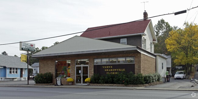
Property Record
10956 Reading Rd, Cincinnati, OH 45241


NEARBY LISTINGS FOR SALE OR LEASE
Property Detail
10956 Reading Rd
608-0007-0009
ES READING RD 0.2737 AC R1 T4 S29
Retailwithmorethanonenonretailuse
Hamilton
X
Ohio
39061C0093E
0.27 AC
2025
Blue Ash
2025
Cincinnati/Dayton
023002
Cincinnati, OH-KY-IN
3,188 SF
DEMOGRAPHICS near 10956 Reading Rd
1 Mile
3 Mile
5 Mile
2024 Total Population
4,176
37,931
145,931
2029 Population
4,119
37,798
145,309
Pop Growth 2024-2029
(1.36%)
(0.35%)
(0.43%)
Average Age
43
42
41
2024 Total Households
1,818
15,543
59,178
HH Growth 2024-2029
(1.54%)
(0.48%)
(0.60%)
Median Household Inc
$88,238
$85,092
$83,387
Avg Household Size
2.20
2.40
2.40
2024 Avg HH Vehicles
2.00
2.00
2.00
Median Home Value
$187,391
$258,427
$244,846
Median Year Built
1966
1976
1971
Nearby Places
Map Layers
Map Styles
 Street
 Aerial
- Restaurants
- Banks
- Shops
- Fitness
- Groceries
PUBLIC TRANSPORTATION
AIRPORT
Cincinnati/Northern Kentucky International
DRIVE
WALK
Distance
Cincinnati/Northern Kentucky International
44 min
27.5 mi
Nearby Properties
Address
Land Use
TOTAL SIZE
Lot Size
Zoning
Address
Land Use
TOTAL SIZE
Lot Size
Zoning
47.52 AC
Address
Land Use
TOTAL SIZE
Lot Size
Zoning
6.03 AC
Address
Land Use
TOTAL SIZE
Lot Size
Zoning
119.08 AC
R1
Address
Land Use
TOTAL SIZE
Lot Size
Zoning
15.33 AC
Address
Land Use
TOTAL SIZE
Lot Size
Zoning
29.79 AC
M1
Address
Land Use
TOTAL SIZE
Lot Size
Zoning
4,620 SF
85.80 AC
Address
Land Use
TOTAL SIZE
Lot Size
Zoning
Address
Land Use
TOTAL SIZE
Lot Size
Zoning
124.81 AC
Address
Land Use
TOTAL SIZE
Lot Size
Zoning
68.49 AC
Address
Land Use
TOTAL SIZE
Lot Size
Zoning
29.95 AC
Address
Land Use
TOTAL SIZE
Lot Size
Zoning
Address
Land Use
TOTAL SIZE
Lot Size
Zoning
Address
Land Use
TOTAL SIZE
Lot Size
Zoning
Address
Land Use
TOTAL SIZE
Lot Size
Zoning
Address
Land Use
TOTAL SIZE
Lot Size
Zoning
4,599 SF
29.03 AC
R4
Address
Land Use
TOTAL SIZE
Lot Size
Zoning
8,964 SF
11.61 AC
Address
Land Use
TOTAL SIZE
Lot Size
Zoning
555 SF
7.20 AC
M1
Address
Land Use
TOTAL SIZE
Lot Size
Zoning
8.06 AC
Address
Land Use
TOTAL SIZE
Lot Size
Zoning
Address
Land Use
TOTAL SIZE
Lot Size
Zoning
Address
Land Use
TOTAL SIZE
Lot Size
Zoning
54.92 AC
Address
Land Use
TOTAL SIZE
Lot Size
Zoning
9,744 SF
8.15 AC
Address
Land Use
TOTAL SIZE
Lot Size
Zoning
8.77 AC
O
Address
Land Use
TOTAL SIZE
Lot Size
Zoning
Address
Land Use
TOTAL SIZE
Lot Size
Zoning
113,400 SF
53.19 AC
Address
Land Use
TOTAL SIZE
Lot Size
Zoning
3,608 SF
8.05 AC
M1
Address
Land Use
TOTAL SIZE
Lot Size
Zoning
1,788 SF
9.55 AC
M1
Address
Land Use
TOTAL SIZE
Lot Size
Zoning
5.33 AC
Address
Land Use
TOTAL SIZE
Lot Size
Zoning
3,202 SF
3.34 AC
Address
Land Use
TOTAL SIZE
Lot Size
Zoning
17.10 AC
The World's #1 Commercial Real Estate Marketplace
Connect with us
© 2026 CoStar Group
The information above has been obtained from sources believed reliable. While we do not doubt its accuracy we have not verified it and make no guarantee, warranty or representation about it. It is your responsibility to independently confirm its accuracy and completeness. Any projections, opinions, assumptions, or estimates used are for example only and do not represent the current or future performance of the property. The value of this transaction to you depends on tax and other factors which should be evaluated by your tax, financial, and legal advisors. You and your advisors should conduct a careful, independent investigation of the property to determine to your satisfaction the suitability of the property for your needs.