Property Record
10980 N Oracle Rd, Tucson, AZ 85737
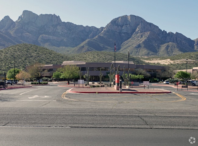


Property Detail
10980 N Oracle Rd
220-11-074A
TRI PTN E2 NE4 LYG SE & ADJ HWY SEC 7 & PTN NW4 LYG SE & ADJ HWY SEC 8 58.86 AC T12S R14E
Warehouse
PIMA
CPI
Arizona
B and X Area of moderate flood hazard, usually the area between the limits of the 100-year and 500-year floods.
47
2025
58.86 AC
2026
North Tucson/Oro Valley
004635
Tucson
368,956 SF
Tucson, AZ
NEARBY LISTINGS FOR SALE OR LEASE
DEMOGRAPHICS near 10980 N Oracle Rd
1 mile
3 mile
5 mile
2025 Total Population
3,902
22,120
60,459
2030 Population
4,144
22,965
62,678
Pop Growth 2025-2030
+ 6.20%
+ 3.82%
+ 3.67%
Average Age
48
49
50
2025 Total Households
2,023
10,131
26,604
HH Growth 2025-2030
+ 5.83%
+ 3.97%
+ 3.85%
Median Household Inc
$95,809
$106,189
$109,847
Avg Household Size
1.90
2.20
2.20
2025 Avg HH Vehicles
2.00
2.00
2.00
Median Home Value
$463,590
$456,120
$474,929
Median Year Built
1997
1996
1995
Nearby Places
Map Layers
Map Styles
 Street
 Aerial
Layers
 Traffic
 Biking
Places
Listings with unknown addresses are not visible on the map
- Restaurants
- Banks
- Shops
- Fitness
- Groceries
PUBLIC TRANSPORTATION
AIRPORT
Tucson International
Drive
Walk
Distance
Tucson International
42 min
22.7 mi
SALE & LEASE HISTORY
LISTING DATE
SALE/LEASE

Dec 06, 2022
For Lease
Nearby Properties
Address
Land Use
TOTAL SIZE
Lot Size
Zoning
Address
Land Use
TOTAL SIZE
Lot Size
Zoning
26,560 SF
9.02 AC
PAD
Address
Land Use
TOTAL SIZE
Lot Size
Zoning
231,366 SF
34.15 AC
PAD
Address
Land Use
TOTAL SIZE
Lot Size
Zoning
362,401 SF
19.55 AC
PAD
Address
Land Use
TOTAL SIZE
Lot Size
Zoning
Address
Land Use
TOTAL SIZE
Lot Size
Zoning
320,757 SF
15.73 AC
Address
Land Use
TOTAL SIZE
Lot Size
Zoning
272,429 SF
36.97 AC
R1144
Address
Land Use
TOTAL SIZE
Lot Size
Zoning
187,045 SF
16.70 AC
PAD
Address
Land Use
TOTAL SIZE
Lot Size
Zoning
352,158 SF
15.89 AC
Address
Land Use
TOTAL SIZE
Lot Size
Zoning
214,008 SF
9.20 AC
Address
Land Use
TOTAL SIZE
Lot Size
Zoning
89,041 SF
35.51 AC
Address
Land Use
TOTAL SIZE
Lot Size
Zoning
194,629 SF
17.47 AC
PAD
Address
Land Use
TOTAL SIZE
Lot Size
Zoning
206,109 SF
7.12 AC
PAD
Address
Land Use
TOTAL SIZE
Lot Size
Zoning
9,240 SF
17.07 AC
PAD
Address
Land Use
TOTAL SIZE
Lot Size
Zoning
287,745 SF
13.03 AC
Address
Land Use
TOTAL SIZE
Lot Size
Zoning
4,977 SF
1.75 AC
Address
Land Use
TOTAL SIZE
Lot Size
Zoning
5.40 AC
PAD
Address
Land Use
TOTAL SIZE
Lot Size
Zoning
330,372 SF
8.78 AC
Address
Land Use
TOTAL SIZE
Lot Size
Zoning
136,060 SF
13.36 AC
R1144
Address
Land Use
TOTAL SIZE
Lot Size
Zoning
69,865 SF
0.84 AC
PAD
Address
Land Use
TOTAL SIZE
Lot Size
Zoning
97,858 SF
11.54 AC
PAD
Address
Land Use
TOTAL SIZE
Lot Size
Zoning
343,624 SF
27.10 AC
Address
Land Use
TOTAL SIZE
Lot Size
Zoning
1.47 AC
PAD
Address
Land Use
TOTAL SIZE
Lot Size
Zoning
103,699 SF
4.34 AC
R4
Address
Land Use
TOTAL SIZE
Lot Size
Zoning
27,464 SF
4.63 AC
PAD
Address
Land Use
TOTAL SIZE
Lot Size
Zoning
3,598 SF
1.87 AC
PAD
Address
Land Use
TOTAL SIZE
Lot Size
Zoning
59,868 SF
8.91 AC
PSC
Address
Land Use
TOTAL SIZE
Lot Size
Zoning
1.34 AC
PAD
Address
Land Use
TOTAL SIZE
Lot Size
Zoning
130,481 SF
10.69 AC
PAD
Address
Land Use
TOTAL SIZE
Lot Size
Zoning
62,040 SF
9.47 AC
PAD
The World's #1 Commercial Real Estate Marketplace
Connect with us
© 2026 CoStar Group
The information above has been obtained from sources believed reliable. While we do not doubt its accuracy we have not verified it and make no guarantee, warranty or representation about it. It is your responsibility to independently confirm its accuracy and completeness. Any projections, opinions, assumptions, or estimates used are for example only and do not represent the current or future performance of the property. The value of this transaction to you depends on tax and other factors which should be evaluated by your tax, financial, and legal advisors. You and your advisors should conduct a careful, independent investigation of the property to determine to your satisfaction the suitability of the property for your needs.