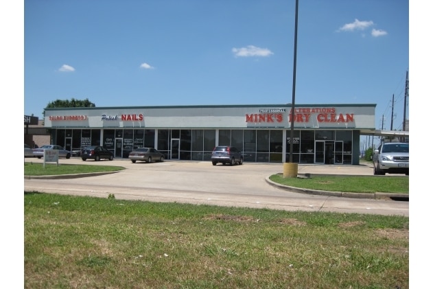
Property Record
10980 West Rd, Houston, TX 77064


Property Detail
10980 West Rd
0321050001049
TR 11A-2A SATSUMA ACREAGE
Storebuilding
HARRIS
B and X Area of moderate flood hazard, usually the area between the limits of the 100-year and 500-year floods.
Texas
2025
0.37 AC
2025
Jersey Village
551705
Houston
4,950 SF
Houston-Pasadena-The Woodlands, TX
NEARBY LISTINGS FOR SALE OR LEASE
DEMOGRAPHICS near 10980 West Rd
1 mile
3 mile
5 mile
2025 Total Population
20,559
102,299
262,091
2030 Population
21,754
107,814
276,809
Pop Growth 2025-2030
+ 5.81%
+ 5.39%
+ 5.62%
Average Age
38
38
38
2025 Total Households
8,484
38,222
93,462
HH Growth 2025-2030
+ 5.91%
+ 5.54%
+ 5.81%
Median Household Inc
$78,975
$79,125
$80,279
Avg Household Size
2.40
2.60
2.70
2025 Avg HH Vehicles
2.00
2.00
2.00
Median Home Value
$262,834
$272,888
$274,810
Median Year Built
1991
1992
1992
Nearby Places
Map Layers
Map Styles
 Street
 Aerial
Layers
 Traffic
 Biking
Places
Listings with unknown addresses are not visible on the map
- Restaurants
- Banks
- Shops
- Fitness
- Groceries
PUBLIC TRANSPORTATION
AIRPORT
George Bush Intcntl/Houston
Drive
Walk
Distance
George Bush Intcntl/Houston
27 min
19.7 mi
William P Hobby
Drive
Walk
Distance
William P Hobby
49 min
32.7 mi
Freight Ports
Port of Houston
Drive
Walk
Distance
Port of Houston
41 min
28.4 mi
SALE & LEASE HISTORY
LISTING DATE
SALE/LEASE

Apr 26, 2023
For Lease
Nearby Properties
Address
Land Use
TOTAL SIZE
Lot Size
Zoning
Address
Land Use
TOTAL SIZE
Lot Size
Zoning
660,000 SF
104.88 AC
Address
Land Use
TOTAL SIZE
Lot Size
Zoning
682,700 SF
37 AC
Address
Land Use
TOTAL SIZE
Lot Size
Zoning
625,701 SF
52.20 AC
Address
Land Use
TOTAL SIZE
Lot Size
Zoning
664,361 SF
39.18 AC
Address
Land Use
TOTAL SIZE
Lot Size
Zoning
380,959 SF
21.43 AC
Address
Land Use
TOTAL SIZE
Lot Size
Zoning
466,299 SF
23.82 AC
Address
Land Use
TOTAL SIZE
Lot Size
Zoning
373,516 SF
18.63 AC
Address
Land Use
TOTAL SIZE
Lot Size
Zoning
266,802 SF
3.14 AC
Address
Land Use
TOTAL SIZE
Lot Size
Zoning
408,710 SF
4.49 AC
Address
Land Use
TOTAL SIZE
Lot Size
Zoning
365,380 SF
19.17 AC
Address
Land Use
TOTAL SIZE
Lot Size
Zoning
471,800 SF
27.03 AC
Address
Land Use
TOTAL SIZE
Lot Size
Zoning
307,698 SF
13.12 AC
Address
Land Use
TOTAL SIZE
Lot Size
Zoning
449,032 SF
23.46 AC
Address
Land Use
TOTAL SIZE
Lot Size
Zoning
387,245 SF
18.18 AC
Address
Land Use
TOTAL SIZE
Lot Size
Zoning
402,712 SF
25.64 AC
Address
Land Use
TOTAL SIZE
Lot Size
Zoning
375,251 SF
14.85 AC
Address
Land Use
TOTAL SIZE
Lot Size
Zoning
463,932 SF
26.62 AC
Address
Land Use
TOTAL SIZE
Lot Size
Zoning
347,694 SF
17.61 AC
Address
Land Use
TOTAL SIZE
Lot Size
Zoning
384,280 SF
27.19 AC
Address
Land Use
TOTAL SIZE
Lot Size
Zoning
461,430 SF
22.46 AC
Address
Land Use
TOTAL SIZE
Lot Size
Zoning
275,561 SF
19.78 AC
Address
Land Use
TOTAL SIZE
Lot Size
Zoning
363,896 SF
21.69 AC
Address
Land Use
TOTAL SIZE
Lot Size
Zoning
371,729 SF
18.73 AC
Address
Land Use
TOTAL SIZE
Lot Size
Zoning
412,250 SF
45.79 AC
Address
Land Use
TOTAL SIZE
Lot Size
Zoning
364,057 SF
22.03 AC
Address
Land Use
TOTAL SIZE
Lot Size
Zoning
320,985 SF
14.88 AC
Address
Land Use
TOTAL SIZE
Lot Size
Zoning
297,351 SF
13.47 AC
Address
Land Use
TOTAL SIZE
Lot Size
Zoning
373,783 SF
23.12 AC
Address
Land Use
TOTAL SIZE
Lot Size
Zoning
403,200 SF
20.53 AC
Address
Land Use
TOTAL SIZE
Lot Size
Zoning
299,280 SF
15.71 AC
The World's #1 Commercial Real Estate Marketplace
Connect with us
© 2026 CoStar Group
The information above has been obtained from sources believed reliable. While we do not doubt its accuracy we have not verified it and make no guarantee, warranty or representation about it. It is your responsibility to independently confirm its accuracy and completeness. Any projections, opinions, assumptions, or estimates used are for example only and do not represent the current or future performance of the property. The value of this transaction to you depends on tax and other factors which should be evaluated by your tax, financial, and legal advisors. You and your advisors should conduct a careful, independent investigation of the property to determine to your satisfaction the suitability of the property for your needs.