Property Record
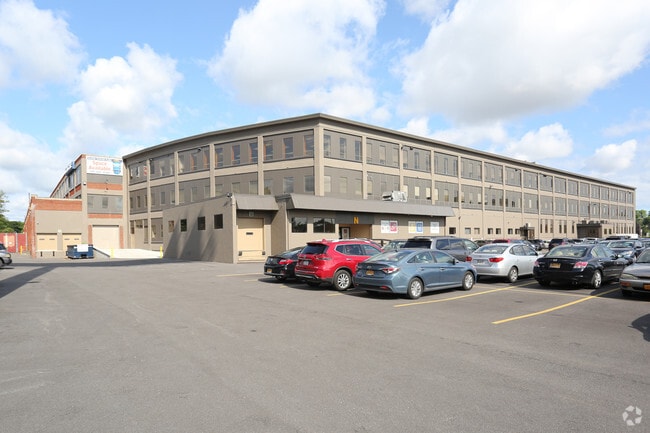
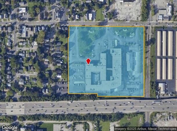
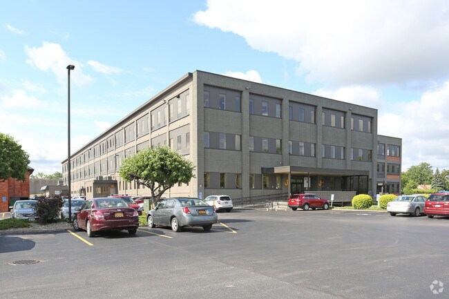
1099 Jay St, Rochester, NY 14611
NEARBY LISTINGS FOR SALE OR LEASE
Property Detail
1099 Jay St
261400-105-800-0001-082-000-0000
0087.01 210 24 00222 4315833677902164
Manufacturinglight
Monroe
X
New York
36055C0192G
82.000
2025
11.66 AC
2024
Greater Rochester
009605
Rochester
281,951 SF
Rochester, NY
DEMOGRAPHICS near 1099 Jay St
1 Mile
3 Mile
5 Mile
2024 Total Population
18,210
130,033
296,466
2029 Population
17,766
128,098
291,660
Pop Growth 2024-2029
(2.44%)
(1.49%)
(1.62%)
Average Age
36
37
39
2024 Total Households
6,957
55,555
129,395
HH Growth 2024-2029
(2.56%)
(1.43%)
(1.65%)
Median Household Inc
$34,300
$41,484
$50,710
Avg Household Size
2.50
2.20
2.20
2024 Avg HH Vehicles
1.00
1.00
1.00
Median Home Value
$60,542
$93,786
$133,818
Median Year Built
1947
1948
1951
Nearby Places
Map Layers
Map Styles
 Street
 Aerial
- Restaurants
- Banks
- Shops
- Fitness
- Groceries
PUBLIC TRANSPORTATION
COMMUTER RAIL
Rochester (Empire Service - VIA Rail, Lake Shore Limited - VIA Rail, Maple Leaf - VIA Rail, Toronto - New York - VIA Rail)
DRIVE
WALK
Distance
Rochester (Empire Service - VIA Rail, Lake Shore Limited - VIA Rail, Maple Leaf - VIA Rail, Toronto - New York - VIA Rail)
7 min
2.9 mi
AIRPORT
Frederick Douglass/Greater Rochester International
DRIVE
WALK
Distance
Frederick Douglass/Greater Rochester International
10 min
4.9 mi
Freight Ports
Albany, NY Port
DRIVE
WALK
Distance
Albany, NY Port
271 min
228.9 mi
Nearby Properties
Address
Land Use
TOTAL SIZE
Lot Size
Zoning
Address
Land Use
TOTAL SIZE
Lot Size
Zoning
0.47 AC
Address
Land Use
TOTAL SIZE
Lot Size
Zoning
173,649 SF
85.98 AC
Address
Land Use
TOTAL SIZE
Lot Size
Zoning
1,216,095 SF
22.89 AC
Address
Land Use
TOTAL SIZE
Lot Size
Zoning
60,120 SF
12.90 AC
Address
Land Use
TOTAL SIZE
Lot Size
Zoning
200,000 SF
764.91 AC
Address
Land Use
TOTAL SIZE
Lot Size
Zoning
1,878,160 SF
4.05 AC
Address
Land Use
TOTAL SIZE
Lot Size
Zoning
0.13 AC
Address
Land Use
TOTAL SIZE
Lot Size
Zoning
181,500 SF
57.85 AC
Address
Land Use
TOTAL SIZE
Lot Size
Zoning
614,053 SF
9.30 AC
Address
Land Use
TOTAL SIZE
Lot Size
Zoning
64,041 SF
42.66 AC
Address
Land Use
TOTAL SIZE
Lot Size
Zoning
41,376 SF
59.90 AC
06 - INDUS
Address
Land Use
TOTAL SIZE
Lot Size
Zoning
11,408 SF
98.28 AC
02 - SINGL
Address
Land Use
TOTAL SIZE
Lot Size
Zoning
128,539 SF
15.01 AC
Address
Land Use
TOTAL SIZE
Lot Size
Zoning
13.10 AC
Address
Land Use
TOTAL SIZE
Lot Size
Zoning
373,200 SF
5.42 AC
Address
Land Use
TOTAL SIZE
Lot Size
Zoning
178,321 SF
3.10 AC
Address
Land Use
TOTAL SIZE
Lot Size
Zoning
0.01 AC
Address
Land Use
TOTAL SIZE
Lot Size
Zoning
302,484 SF
2.53 AC
Address
Land Use
TOTAL SIZE
Lot Size
Zoning
473,876 SF
1.49 AC
Address
Land Use
TOTAL SIZE
Lot Size
Zoning
342,266 SF
1.44 AC
Address
Land Use
TOTAL SIZE
Lot Size
Zoning
7,200 SF
12.35 AC
Address
Land Use
TOTAL SIZE
Lot Size
Zoning
416,083 SF
0.94 AC
Address
Land Use
TOTAL SIZE
Lot Size
Zoning
0.01 AC
Address
Land Use
TOTAL SIZE
Lot Size
Zoning
0.65 AC
Address
Land Use
TOTAL SIZE
Lot Size
Zoning
273,900 SF
0.74 AC
Address
Land Use
TOTAL SIZE
Lot Size
Zoning
336,447 SF
1.38 AC
Address
Land Use
TOTAL SIZE
Lot Size
Zoning
335,918 SF
10.19 AC
Address
Land Use
TOTAL SIZE
Lot Size
Zoning
151,590 SF
1.14 AC
Address
Land Use
TOTAL SIZE
Lot Size
Zoning
233,579 SF
1.13 AC
Address
Land Use
TOTAL SIZE
Lot Size
Zoning
410,400 SF
2.88 AC
The World's #1 Commercial Real Estate Marketplace
Connect with us
© 2025 CoStar Group
The information above has been obtained from sources believed reliable. While we do not doubt its accuracy we have not verified it and make no guarantee, warranty or representation about it. It is your responsibility to independently confirm its accuracy and completeness. Any projections, opinions, assumptions, or estimates used are for example only and do not represent the current or future performance of the property. The value of this transaction to you depends on tax and other factors which should be evaluated by your tax, financial, and legal advisors. You and your advisors should conduct a careful, independent investigation of the property to determine to your satisfaction the suitability of the property for your needs.