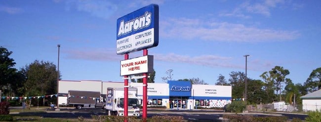
Property Record
1099 Nw 21St St, Stuart, FL 34994


NEARBY LISTINGS FOR SALE OR LEASE
Property Detail
1099 Nw 21St St
Port St. Lucie, FL
St Lucie Gardens
29-37-41-004-002-00080-0
Martin
Storemultistory
Florida
X
1.91 AC
12085C0132H
Port St Lucie
19,374 SF
Port St Lucie/Fort Pierce
DEMOGRAPHICS near 1099 Nw 21St St
1 mile
3 mile
5 mile
2024 Total Population
5,978
36,693
118,338
2029 Population
6,386
40,117
133,820
Pop Growth 2024-2029
+ 6.83%
+ 9.33%
+ 13.08%
Average Age
47
48
48
2024 Total Households
2,631
16,386
52,339
HH Growth 2024-2029
+ 6.77%
+ 8.95%
+ 12.81%
Median Household Inc
$67,415
$65,522
$64,951
Avg Household Size
2.20
2.20
2.20
2024 Avg HH Vehicles
2.00
2.00
2.00
Median Home Value
$340,459
$333,523
$301,706
Median Year Built
1987
1986
1987
Nearby Places
Map Layers
Map Styles
 Street
 Aerial
Transit
 Traffic
 Biking
Places
Listings with unknown addresses are not visible on the map
- Restaurants
- Banks
- Shops
- Fitness
- Groceries
SALE & LEASE HISTORY
LISTING DATE
SALE/LEASE

Sep 16, 2021
For Sale
Mar 03, 2020
For Sale
Aug 22, 2019
For Sale
Nearby Properties
Address
Land Use
TOTAL SIZE
Lot Size
Zoning
Address
Land Use
TOTAL SIZE
Lot Size
Zoning
609,195 SF
13.77 AC
H
Address
Land Use
TOTAL SIZE
Lot Size
Zoning
481,508 SF
59.41 AC
PUDC
Address
Land Use
TOTAL SIZE
Lot Size
Zoning
11.34 AC
Address
Land Use
TOTAL SIZE
Lot Size
Zoning
292,279 SF
65.79 AC
R2
Address
Land Use
TOTAL SIZE
Lot Size
Zoning
309,031 SF
76.74 AC
RPUD
Address
Land Use
TOTAL SIZE
Lot Size
Zoning
187,420 SF
96.46 AC
Address
Land Use
TOTAL SIZE
Lot Size
Zoning
378,814 SF
34.25 AC
PUDR
Address
Land Use
TOTAL SIZE
Lot Size
Zoning
14.86 AC
M1
Address
Land Use
TOTAL SIZE
Lot Size
Zoning
23.08 AC
RM8
Address
Land Use
TOTAL SIZE
Lot Size
Zoning
9.45 AC
RS6
Address
Land Use
TOTAL SIZE
Lot Size
Zoning
160,211 SF
17.44 AC
CPUD
Address
Land Use
TOTAL SIZE
Lot Size
Zoning
127,238 SF
3.62 AC
P
Address
Land Use
TOTAL SIZE
Lot Size
Zoning
106,357 SF
22.96 AC
Address
Land Use
TOTAL SIZE
Lot Size
Zoning
19,435 SF
44.50 AC
Address
Land Use
TOTAL SIZE
Lot Size
Zoning
196,180 SF
18.71 AC
B1
Address
Land Use
TOTAL SIZE
Lot Size
Zoning
175,170 SF
19.53 AC
B1
Address
Land Use
TOTAL SIZE
Lot Size
Zoning
1,050 SF
5.33 AC
R3
Address
Land Use
TOTAL SIZE
Lot Size
Zoning
10,520 SF
88.85 AC
TP
Address
Land Use
TOTAL SIZE
Lot Size
Zoning
2,221 SF
18.12 AC
R3A
Address
Land Use
TOTAL SIZE
Lot Size
Zoning
2,400 SF
7.31 AC
INDUST
Address
Land Use
TOTAL SIZE
Lot Size
Zoning
212,656 SF
29.91 AC
CG - CO
Address
Land Use
TOTAL SIZE
Lot Size
Zoning
204,538 SF
22.65 AC
P
Address
Land Use
TOTAL SIZE
Lot Size
Zoning
152,826 SF
15 AC
B2
Address
Land Use
TOTAL SIZE
Lot Size
Zoning
198,758 SF
39.92 AC
RM5
Address
Land Use
TOTAL SIZE
Lot Size
Zoning
111,534 SF
11.59 AC
PUDC
Address
Land Use
TOTAL SIZE
Lot Size
Zoning
96,999 SF
11.72 AC
MH
Address
Land Use
TOTAL SIZE
Lot Size
Zoning
52,554 SF
130.53 AC
PUD
Address
Land Use
TOTAL SIZE
Lot Size
Zoning
106,931 SF
14.36 AC
PUDWJ
Address
Land Use
TOTAL SIZE
Lot Size
Zoning
136,311 SF
19.29 AC
PUDWJ
Address
Land Use
TOTAL SIZE
Lot Size
Zoning
39,850 SF
2.98 AC
CC
The World's #1 Commercial Real Estate Marketplace
Connect with us
© 2026 CoStar Group
The information above has been obtained from sources believed reliable. While we do not doubt its accuracy we have not verified it and make no guarantee, warranty or representation about it. It is your responsibility to independently confirm its accuracy and completeness. Any projections, opinions, assumptions, or estimates used are for example only and do not represent the current or future performance of the property. The value of this transaction to you depends on tax and other factors which should be evaluated by your tax, financial, and legal advisors. You and your advisors should conduct a careful, independent investigation of the property to determine to your satisfaction the suitability of the property for your needs.