Property Record
10990 E 450 Rd, Claremore, OK 74017

Property Detail
10990 E 450 Rd
Tulsa, OK
LOT 1 BLOCK 1 CLAREMORE 88 CENTER
0099846
Rogers
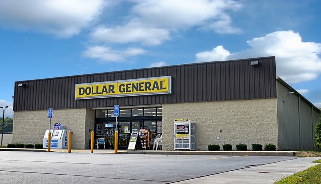
Wholesaleoutletdiscountstore
Oklahoma
B and X Area of moderate flood hazard, usually the area between the limits of the 100-year and 500-year floods.
1
2025
1.70 AC
2025
Rogers County
050304
Tulsa
9,004 SF
NEARBY LISTINGS FOR SALE OR LEASE
-
-
View all Claremore listings for sale on LoopNet.com
DEMOGRAPHICS near 10990 E 450 Rd
1 mile
3 mile
5 mile
2025 Total Population
480
6,274
26,831
2030 Population
508
6,613
28,330
Pop Growth 2025-2030
+ 5.83%
+ 5.40%
+ 5.59%
Average Age
44
42
41
2025 Total Households
186
2,426
10,415
HH Growth 2025-2030
+ 5.91%
+ 5.56%
+ 5.70%
Median Household Inc
$86,250
$73,212
$59,782
Avg Household Size
2.50
2.50
2.40
2025 Avg HH Vehicles
3.00
2.00
2.00
Median Home Value
$281,249
$237,294
$213,235
Median Year Built
1993
1992
1984
Nearby Places
Map Layers
Map Styles
 Street
 Aerial
Transit
 Traffic
 Biking
Places
Listings with unknown addresses are not visible on the map
- Restaurants
- Banks
- Shops
- Fitness
- Groceries
PUBLIC TRANSPORTATION
AIRPORT
Tulsa International
Drive
Walk
Distance
Tulsa International
37 min
24.2 mi
Freight Ports
Tulsa Port Of Catoosa
Drive
Walk
Distance
Tulsa Port Of Catoosa
26 min
16.3 mi
SALE & LEASE HISTORY
LISTING DATE
SALE/LEASE

Aug 03, 2017
For Sale
Nearby Properties
Address
Land Use
TOTAL SIZE
Lot Size
Zoning
Address
Land Use
TOTAL SIZE
Lot Size
Zoning
24,886 SF
2.05 AC
Address
Land Use
TOTAL SIZE
Lot Size
Zoning
30,872 SF
29.26 AC
Address
Land Use
TOTAL SIZE
Lot Size
Zoning
2,000 SF
13.81 AC
Address
Land Use
TOTAL SIZE
Lot Size
Zoning
35,022 SF
3.94 AC
Address
Land Use
TOTAL SIZE
Lot Size
Zoning
32,000 SF
Address
Land Use
TOTAL SIZE
Lot Size
Zoning
15,680 SF
10.72 AC
Address
Land Use
TOTAL SIZE
Lot Size
Zoning
5,096 SF
7.27 AC
Address
Land Use
TOTAL SIZE
Lot Size
Zoning
60,266 SF
7.91 AC
Address
Land Use
TOTAL SIZE
Lot Size
Zoning
14,724 SF
5.80 AC
Address
Land Use
TOTAL SIZE
Lot Size
Zoning
450 SF
16.43 AC
Address
Land Use
TOTAL SIZE
Lot Size
Zoning
35,700 SF
Address
Land Use
TOTAL SIZE
Lot Size
Zoning
3,705 SF
8.50 AC
Address
Land Use
TOTAL SIZE
Lot Size
Zoning
45,568 SF
5.20 AC
Address
Land Use
TOTAL SIZE
Lot Size
Zoning
75,840 SF
11.10 AC
Address
Land Use
TOTAL SIZE
Lot Size
Zoning
168,245 SF
16.74 AC
Address
Land Use
TOTAL SIZE
Lot Size
Zoning
18,000 SF
Address
Land Use
TOTAL SIZE
Lot Size
Zoning
103,996 SF
20.33 AC
Address
Land Use
TOTAL SIZE
Lot Size
Zoning
6,792 SF
27.51 AC
Address
Land Use
TOTAL SIZE
Lot Size
Zoning
48,316 SF
3.95 AC
Address
Land Use
TOTAL SIZE
Lot Size
Zoning
16,278 SF
2.17 AC
Address
Land Use
TOTAL SIZE
Lot Size
Zoning
55,560 SF
10 AC
Address
Land Use
TOTAL SIZE
Lot Size
Zoning
8,660 SF
6.11 AC
Address
Land Use
TOTAL SIZE
Lot Size
Zoning
2,250 SF
Address
Land Use
TOTAL SIZE
Lot Size
Zoning
17,600 SF
3 AC
Address
Land Use
TOTAL SIZE
Lot Size
Zoning
5,000 SF
1.70 AC
Address
Land Use
TOTAL SIZE
Lot Size
Zoning
100,112 SF
5.32 AC
Address
Land Use
TOTAL SIZE
Lot Size
Zoning
3,600 SF
17.34 AC
Address
Land Use
TOTAL SIZE
Lot Size
Zoning
12,480 SF
1.80 AC
The World's #1 Commercial Real Estate Marketplace
Connect with us
© 2026 CoStar Group
The information above has been obtained from sources believed reliable. While we do not doubt its accuracy we have not verified it and make no guarantee, warranty or representation about it. It is your responsibility to independently confirm its accuracy and completeness. Any projections, opinions, assumptions, or estimates used are for example only and do not represent the current or future performance of the property. The value of this transaction to you depends on tax and other factors which should be evaluated by your tax, financial, and legal advisors. You and your advisors should conduct a careful, independent investigation of the property to determine to your satisfaction the suitability of the property for your needs.