Property Record
10990 W I 20, Forney, TX 75126
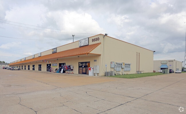

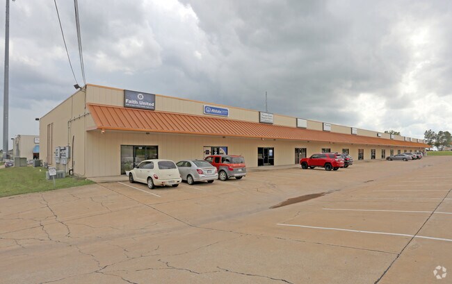
Property Detail
10990 W I 20
16147
STEPHEN WHITE, TRACT 255.01; 21.7983 ACRES
Commercialnec
KAUFMAN
B and X Area of moderate flood hazard, usually the area between the limits of the 100-year and 500-year floods.
Texas
2024
21.80 AC
2025
Forney/Terrll/Kauf Cy
050214
Dallas/Ft Worth
72,000 SF
Dallas-Fort Worth-Arlington, TX
NEARBY LISTINGS FOR SALE OR LEASE
-
-
View all Forney listings for lease on LoopNet.com
DEMOGRAPHICS near 10990 W I 20
1 mile
3 mile
5 mile
2025 Total Population
1,733
36,932
79,725
2030 Population
2,219
47,805
103,242
Pop Growth 2025-2030
+ 28.04%
+ 29.44%
+ 29.50%
Average Age
36
34
33
2025 Total Households
511
10,817
24,155
HH Growth 2025-2030
+ 25.64%
+ 27.10%
+ 27.17%
Median Household Inc
$125,179
$128,199
$111,641
Avg Household Size
3.20
3.30
3.10
2025 Avg HH Vehicles
3.00
2.00
2.00
Median Home Value
$433,333
$404,582
$376,457
Median Year Built
2008
2010
2010
Nearby Places
Map Layers
Map Styles
 Street
 Aerial
Transit
 Traffic
 Biking
Places
Listings with unknown addresses are not visible on the map
- Restaurants
- Banks
- Shops
- Fitness
- Groceries
PUBLIC TRANSPORTATION
AIRPORT
Dallas Love Field
Drive
Walk
Distance
Dallas Love Field
42 min
30.2 mi
SALE & LEASE HISTORY
LISTING DATE
SALE/LEASE

Sep 25, 2016
For Lease
Mar 31, 2020
For Lease
Nearby Properties
Address
Land Use
TOTAL SIZE
Lot Size
Zoning
Address
Land Use
TOTAL SIZE
Lot Size
Zoning
108.89 AC
Address
Land Use
TOTAL SIZE
Lot Size
Zoning
1,214,840 SF
102.04 AC
Address
Land Use
TOTAL SIZE
Lot Size
Zoning
1,120,000 SF
79.53 AC
Address
Land Use
TOTAL SIZE
Lot Size
Zoning
2,495 SF
46.30 AC
Address
Land Use
TOTAL SIZE
Lot Size
Zoning
90.42 AC
Address
Land Use
TOTAL SIZE
Lot Size
Zoning
44.92 AC
Address
Land Use
TOTAL SIZE
Lot Size
Zoning
201,088 SF
69.99 AC
Address
Land Use
TOTAL SIZE
Lot Size
Zoning
27.49 AC
Address
Land Use
TOTAL SIZE
Lot Size
Zoning
155,195 SF
27.30 AC
Address
Land Use
TOTAL SIZE
Lot Size
Zoning
17.34 AC
Address
Land Use
TOTAL SIZE
Lot Size
Zoning
Address
Land Use
TOTAL SIZE
Lot Size
Zoning
Address
Land Use
TOTAL SIZE
Lot Size
Zoning
8.60 AC
Address
Land Use
TOTAL SIZE
Lot Size
Zoning
19.57 AC
Address
Land Use
TOTAL SIZE
Lot Size
Zoning
201,375 SF
48.29 AC
Address
Land Use
TOTAL SIZE
Lot Size
Zoning
76,550 SF
10.97 AC
Address
Land Use
TOTAL SIZE
Lot Size
Zoning
75,076 SF
13.20 AC
Address
Land Use
TOTAL SIZE
Lot Size
Zoning
16.45 AC
Address
Land Use
TOTAL SIZE
Lot Size
Zoning
34,466 SF
11.16 AC
Address
Land Use
TOTAL SIZE
Lot Size
Zoning
10,000 SF
17.98 AC
Address
Land Use
TOTAL SIZE
Lot Size
Zoning
78,600 SF
14.79 AC
Address
Land Use
TOTAL SIZE
Lot Size
Zoning
6.27 AC
Address
Land Use
TOTAL SIZE
Lot Size
Zoning
9,801 SF
39.75 AC
Address
Land Use
TOTAL SIZE
Lot Size
Zoning
12,000 SF
16.61 AC
Address
Land Use
TOTAL SIZE
Lot Size
Zoning
34,468 SF
20 AC
Address
Land Use
TOTAL SIZE
Lot Size
Zoning
195,900 SF
12.33 AC
Address
Land Use
TOTAL SIZE
Lot Size
Zoning
46,959 SF
6.34 AC
Address
Land Use
TOTAL SIZE
Lot Size
Zoning
94.07 AC
Address
Land Use
TOTAL SIZE
Lot Size
Zoning
1,536 SF
6 AC
Address
Land Use
TOTAL SIZE
Lot Size
Zoning
24.88 AC
The World's #1 Commercial Real Estate Marketplace
Connect with us
© 2026 CoStar Group
The information above has been obtained from sources believed reliable. While we do not doubt its accuracy we have not verified it and make no guarantee, warranty or representation about it. It is your responsibility to independently confirm its accuracy and completeness. Any projections, opinions, assumptions, or estimates used are for example only and do not represent the current or future performance of the property. The value of this transaction to you depends on tax and other factors which should be evaluated by your tax, financial, and legal advisors. You and your advisors should conduct a careful, independent investigation of the property to determine to your satisfaction the suitability of the property for your needs.