Property Record
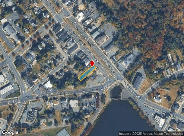
10B W Railroad Ave, Jamesburg, NJ 08831


NEARBY LISTINGS FOR SALE OR LEASE
Property Detail
10B W Railroad Ave
New York-Jersey City-White Plains, NY-NJ
40X200
08-00043-0000-00013
Middlesex
Storemultistory
New Jersey
AE
13
34023C0256F
0.18 AC
2024
Brunswick
2025
Northern New Jersey
008300
DEMOGRAPHICS near 10B W Railroad Ave
1 Mile
3 Mile
5 Mile
2024 Total Population
7,127
36,021
91,978
2029 Population
7,004
35,679
91,734
Pop Growth 2024-2029
(1.73%)
(0.95%)
(0.27%)
Average Age
40
50
46
2024 Total Households
2,490
15,149
35,322
HH Growth 2024-2029
(1.97%)
(1.59%)
(0.66%)
Median Household Inc
$112,619
$93,326
$114,883
Avg Household Size
2.80
2.30
2.60
2024 Avg HH Vehicles
2.00
2.00
2.00
Median Home Value
$351,858
$381,967
$459,950
Median Year Built
1975
1985
1987
Nearby Places
Map Layers
Map Styles
 Street
 Aerial
- Restaurants
- Banks
- Shops
- Fitness
- Groceries
PUBLIC TRANSPORTATION
AIRPORT
Trenton Mercer
DRIVE
WALK
Distance
Trenton Mercer
40 min
26.3 mi
Newark Liberty International
DRIVE
WALK
Distance
Newark Liberty International
49 min
37.4 mi
Freight Ports
New York Container Terminal
DRIVE
WALK
Distance
New York Container Terminal
42 min
32.5 mi
SALE & LEASE HISTORY
LISTING DATE
SALE/LEASE

Jul 24, 2020
For Sale
Nearby Properties
Address
Land Use
TOTAL SIZE
Lot Size
Zoning
Address
Land Use
TOTAL SIZE
Lot Size
Zoning
161,447 SF
67.62 AC
R30
Address
Land Use
TOTAL SIZE
Lot Size
Zoning
1,154,372 SF
167.04 AC
LI
Address
Land Use
TOTAL SIZE
Lot Size
Zoning
1,145,608 SF
73.19 AC
LI
Address
Land Use
TOTAL SIZE
Lot Size
Zoning
983,940 SF
62.53 AC
LI
Address
Land Use
TOTAL SIZE
Lot Size
Zoning
58.21 AC
LI
Address
Land Use
TOTAL SIZE
Lot Size
Zoning
382,699 SF
29.60 AC
R30
Address
Land Use
TOTAL SIZE
Lot Size
Zoning
29,951 SF
55.65 AC
R20
Address
Land Use
TOTAL SIZE
Lot Size
Zoning
74.64 AC
LI
Address
Land Use
TOTAL SIZE
Lot Size
Zoning
51.28 AC
LI
Address
Land Use
TOTAL SIZE
Lot Size
Zoning
87.65 AC
LI-4
Address
Land Use
TOTAL SIZE
Lot Size
Zoning
528,314 SF
31.98 AC
LI
Address
Land Use
TOTAL SIZE
Lot Size
Zoning
14,552 SF
484.47 AC
R20
Address
Land Use
TOTAL SIZE
Lot Size
Zoning
29.74 AC
R30
Address
Land Use
TOTAL SIZE
Lot Size
Zoning
79.67 AC
I-3
Address
Land Use
TOTAL SIZE
Lot Size
Zoning
50.73 AC
I-3
Address
Land Use
TOTAL SIZE
Lot Size
Zoning
414,975 SF
37.45 AC
LI
Address
Land Use
TOTAL SIZE
Lot Size
Zoning
68,539 SF
14.40 AC
PRC
Address
Land Use
TOTAL SIZE
Lot Size
Zoning
5.10 AC
Address
Land Use
TOTAL SIZE
Lot Size
Zoning
18.93 AC
R30
Address
Land Use
TOTAL SIZE
Lot Size
Zoning
251,698 SF
0.01 AC
LI
Address
Land Use
TOTAL SIZE
Lot Size
Zoning
44.80 AC
LI-4
Address
Land Use
TOTAL SIZE
Lot Size
Zoning
49.12 AC
LI-4
Address
Land Use
TOTAL SIZE
Lot Size
Zoning
56 AC
LI-4
Address
Land Use
TOTAL SIZE
Lot Size
Zoning
168,226 SF
49.66 AC
R30
Address
Land Use
TOTAL SIZE
Lot Size
Zoning
324,567 SF
17.29 AC
LI
Address
Land Use
TOTAL SIZE
Lot Size
Zoning
299,532 SF
22.35 AC
LI
Address
Land Use
TOTAL SIZE
Lot Size
Zoning
5,660 SF
112.88 AC
HD
Address
Land Use
TOTAL SIZE
Lot Size
Zoning
43.90 AC
I-3
Address
Land Use
TOTAL SIZE
Lot Size
Zoning
227,175 SF
16.43 AC
LI
Address
Land Use
TOTAL SIZE
Lot Size
Zoning
34.73 AC
LI-4
The World's #1 Commercial Real Estate Marketplace
Connect with us
© 2025 CoStar Group
The information above has been obtained from sources believed reliable. While we do not doubt its accuracy we have not verified it and make no guarantee, warranty or representation about it. It is your responsibility to independently confirm its accuracy and completeness. Any projections, opinions, assumptions, or estimates used are for example only and do not represent the current or future performance of the property. The value of this transaction to you depends on tax and other factors which should be evaluated by your tax, financial, and legal advisors. You and your advisors should conduct a careful, independent investigation of the property to determine to your satisfaction the suitability of the property for your needs.