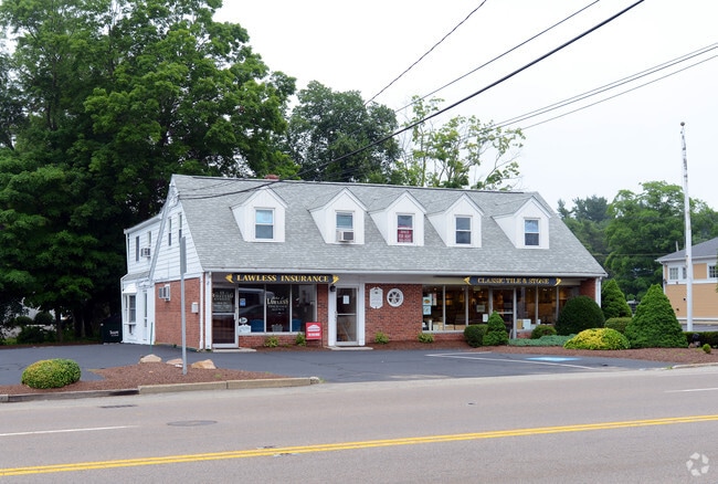
Property Record
11 Whiting St, Plymouth, MA 02360

NEARBY LISTINGS FOR SALE OR LEASE
Property Detail
11 Whiting St
Boston-Cambridge-Newton, MA-NH
Plymouth
PLYM-000022-000000-000092
Massachusetts
Sfr
0.20 AC
X
Route 3 Corridor
25023C0358L
Boston
2,594 SF
DEMOGRAPHICS near 11 Whiting St
1 Mile
3 Mile
5 Mile
2024 Total Population
3,141
30,905
109,907
2029 Population
3,173
31,005
110,020
Pop Growth 2024-2029
+ 1.02%
+ 0.32%
+ 0.10%
Average Age
42
43
42
2024 Total Households
1,040
11,792
43,428
HH Growth 2024-2029
+ 0.96%
+ 0.29%
+ 0.04%
Median Household Inc
$158,152
$123,968
$112,812
Avg Household Size
2.90
2.60
2.50
2024 Avg HH Vehicles
2.00
2.00
2.00
Median Home Value
$644,872
$604,499
$555,998
Median Year Built
1966
1970
1967
Nearby Places
Map Layers
Map Styles
 Street
 Aerial
- Restaurants
- Banks
- Shops
- Fitness
- Groceries
PUBLIC TRANSPORTATION
COMMUTER RAIL
Kingston/Route 3 (Kingston/Plymouth Line - Massachusetts Bay Transportation Authority Commuter Rail (Purple Line))
DRIVE
WALK
Distance
Kingston/Route 3 (Kingston/Plymouth Line - Massachusetts Bay Transportation Authority Commuter Rail (Purple Line))
12 min
5.3 mi
Freight Ports
Port of New Bedford Harbor
DRIVE
WALK
Distance
Port of New Bedford Harbor
49 min
32.3 mi
SALE & LEASE HISTORY
LISTING DATE
SALE/LEASE

Aug 15, 2025
For Lease
Nearby Properties
Address
Land Use
TOTAL SIZE
Lot Size
Zoning
Address
Land Use
TOTAL SIZE
Lot Size
Zoning
24.64 AC
HC
Address
Land Use
TOTAL SIZE
Lot Size
Zoning
42.21 AC
R25
Address
Land Use
TOTAL SIZE
Lot Size
Zoning
56.81 AC
LI
Address
Land Use
TOTAL SIZE
Lot Size
Zoning
12.26 AC
R25
Address
Land Use
TOTAL SIZE
Lot Size
Zoning
205,540 SF
8.16 AC
LI
Address
Land Use
TOTAL SIZE
Lot Size
Zoning
4.67 AC
LI
Address
Land Use
TOTAL SIZE
Lot Size
Zoning
18.38 AC
AC
Address
Land Use
TOTAL SIZE
Lot Size
Zoning
197,178 SF
47.10 AC
RR
Address
Land Use
TOTAL SIZE
Lot Size
Zoning
98,501 SF
4.74 AC
R20M
Address
Land Use
TOTAL SIZE
Lot Size
Zoning
122,558 SF
17.44 AC
GC
Address
Land Use
TOTAL SIZE
Lot Size
Zoning
134,760 SF
13.18 AC
HC
Address
Land Use
TOTAL SIZE
Lot Size
Zoning
18.33 AC
LI
Address
Land Use
TOTAL SIZE
Lot Size
Zoning
233,971 SF
14.93 AC
R20M
Address
Land Use
TOTAL SIZE
Lot Size
Zoning
62,502 SF
0.92 AC
R20S
Address
Land Use
TOTAL SIZE
Lot Size
Zoning
12.71 AC
LI
Address
Land Use
TOTAL SIZE
Lot Size
Zoning
4.58 AC
R20M
Address
Land Use
TOTAL SIZE
Lot Size
Zoning
95.79 AC
LI
Address
Land Use
TOTAL SIZE
Lot Size
Zoning
17.26 AC
HC
Address
Land Use
TOTAL SIZE
Lot Size
Zoning
5.50 AC
HC
Address
Land Use
TOTAL SIZE
Lot Size
Zoning
120,654 SF
14.14 AC
R25
Address
Land Use
TOTAL SIZE
Lot Size
Zoning
166,865 SF
22.21 AC
HC
Address
Land Use
TOTAL SIZE
Lot Size
Zoning
16.30 AC
GC
Address
Land Use
TOTAL SIZE
Lot Size
Zoning
97,390 SF
16.25 AC
LI
Address
Land Use
TOTAL SIZE
Lot Size
Zoning
13.88 AC
LI
Address
Land Use
TOTAL SIZE
Lot Size
Zoning
3.13 AC
R20M
Address
Land Use
TOTAL SIZE
Lot Size
Zoning
96,598 SF
8.47 AC
R20M
Address
Land Use
TOTAL SIZE
Lot Size
Zoning
138,240 SF
16.70 AC
Address
Land Use
TOTAL SIZE
Lot Size
Zoning
89,568 SF
3.52 AC
R20S
Address
Land Use
TOTAL SIZE
Lot Size
Zoning
95,228 SF
7.65 AC
HC
Address
Land Use
TOTAL SIZE
Lot Size
Zoning
118,602 SF
10.49 AC
AC
The World's #1 Commercial Real Estate Marketplace
Connect with us
© 2026 CoStar Group
The information above has been obtained from sources believed reliable. While we do not doubt its accuracy we have not verified it and make no guarantee, warranty or representation about it. It is your responsibility to independently confirm its accuracy and completeness. Any projections, opinions, assumptions, or estimates used are for example only and do not represent the current or future performance of the property. The value of this transaction to you depends on tax and other factors which should be evaluated by your tax, financial, and legal advisors. You and your advisors should conduct a careful, independent investigation of the property to determine to your satisfaction the suitability of the property for your needs.