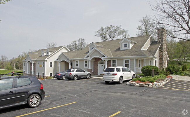
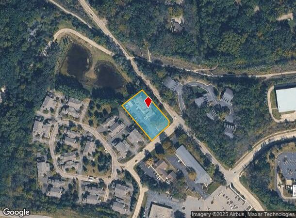
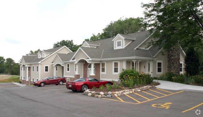
Property Record
15 Crossroads Ct, Delafield, WI 53018
NEARBY LISTINGS FOR SALE OR LEASE
Property Detail
15 Crossroads Ct
Milwaukee-Waukesha, WI
Delafield
DELC-0803-011
LOT 11 CROSS ROADS DELAFIELD PT NW1/4 & SW1/4 SEC 21 T7N R18E :: DOC# 4192172
Commercialnec
Waukesha
X
Wisconsin
55133C0167H
11
2024
0.92 AC
2024
NE/Delafield
203704
Milwaukee/Madison
DEMOGRAPHICS near 15 Crossroads Ct
1 mile
3 mile
5 mile
2024 Total Population
2,598
14,729
42,385
2029 Population
2,641
14,984
43,410
Pop Growth 2024-2029
+ 1.66%
+ 1.73%
+ 2.42%
Average Age
46
44
44
2024 Total Households
1,127
5,801
16,828
HH Growth 2024-2029
+ 1.77%
+ 1.91%
+ 2.50%
Median Household Inc
$113,855
$121,890
$109,978
Avg Household Size
2.30
2.50
2.50
2024 Avg HH Vehicles
2.00
2.00
2.00
Median Home Value
$415,508
$464,344
$424,697
Median Year Built
1979
1987
1985
Nearby Places
Map Layers
Map Styles
 Street
 Aerial
Transit
 Traffic
 Biking
Places
Listings with unknown addresses are not visible on the map
- Restaurants
- Banks
- Shops
- Fitness
- Groceries
PUBLIC TRANSPORTATION
AIRPORT
General Mitchell International
Drive
Walk
Distance
General Mitchell International
43 min
30.4 mi
Freight Ports
Port Milwaukee
Drive
Walk
Distance
Port Milwaukee
36 min
27.0 mi
SALE & LEASE HISTORY
LISTING DATE
SALE/LEASE

Oct 18, 2023
For Lease
Nearby Properties
Address
Land Use
TOTAL SIZE
Lot Size
Zoning
Address
Land Use
TOTAL SIZE
Lot Size
Zoning
Address
Land Use
TOTAL SIZE
Lot Size
Zoning
7.45 AC
Address
Land Use
TOTAL SIZE
Lot Size
Zoning
1.05 AC
Address
Land Use
TOTAL SIZE
Lot Size
Zoning
14.91 AC
Address
Land Use
TOTAL SIZE
Lot Size
Zoning
16.23 AC
Address
Land Use
TOTAL SIZE
Lot Size
Zoning
8.48 AC
Address
Land Use
TOTAL SIZE
Lot Size
Zoning
6.66 AC
Address
Land Use
TOTAL SIZE
Lot Size
Zoning
6.33 AC
Address
Land Use
TOTAL SIZE
Lot Size
Zoning
7.04 AC
Address
Land Use
TOTAL SIZE
Lot Size
Zoning
Address
Land Use
TOTAL SIZE
Lot Size
Zoning
Address
Land Use
TOTAL SIZE
Lot Size
Zoning
1.71 AC
Address
Land Use
TOTAL SIZE
Lot Size
Zoning
Address
Land Use
TOTAL SIZE
Lot Size
Zoning
28.53 AC
Address
Land Use
TOTAL SIZE
Lot Size
Zoning
10.89 AC
Address
Land Use
TOTAL SIZE
Lot Size
Zoning
12.11 AC
Address
Land Use
TOTAL SIZE
Lot Size
Zoning
2.83 AC
Address
Land Use
TOTAL SIZE
Lot Size
Zoning
18.15 AC
Address
Land Use
TOTAL SIZE
Lot Size
Zoning
3.74 AC
Address
Land Use
TOTAL SIZE
Lot Size
Zoning
2.86 AC
Address
Land Use
TOTAL SIZE
Lot Size
Zoning
11.21 AC
Address
Land Use
TOTAL SIZE
Lot Size
Zoning
Address
Land Use
TOTAL SIZE
Lot Size
Zoning
Address
Land Use
TOTAL SIZE
Lot Size
Zoning
12.98 AC
Address
Land Use
TOTAL SIZE
Lot Size
Zoning
5.31 AC
B-6
Address
Land Use
TOTAL SIZE
Lot Size
Zoning
Address
Land Use
TOTAL SIZE
Lot Size
Zoning
Address
Land Use
TOTAL SIZE
Lot Size
Zoning
Address
Land Use
TOTAL SIZE
Lot Size
Zoning
Address
Land Use
TOTAL SIZE
Lot Size
Zoning
6.83 AC
The World's #1 Commercial Real Estate Marketplace
Connect with us
© 2026 CoStar Group
The information above has been obtained from sources believed reliable. While we do not doubt its accuracy we have not verified it and make no guarantee, warranty or representation about it. It is your responsibility to independently confirm its accuracy and completeness. Any projections, opinions, assumptions, or estimates used are for example only and do not represent the current or future performance of the property. The value of this transaction to you depends on tax and other factors which should be evaluated by your tax, financial, and legal advisors. You and your advisors should conduct a careful, independent investigation of the property to determine to your satisfaction the suitability of the property for your needs.