Property Record
11 Campanelli Dr, Assonet, MA 02702
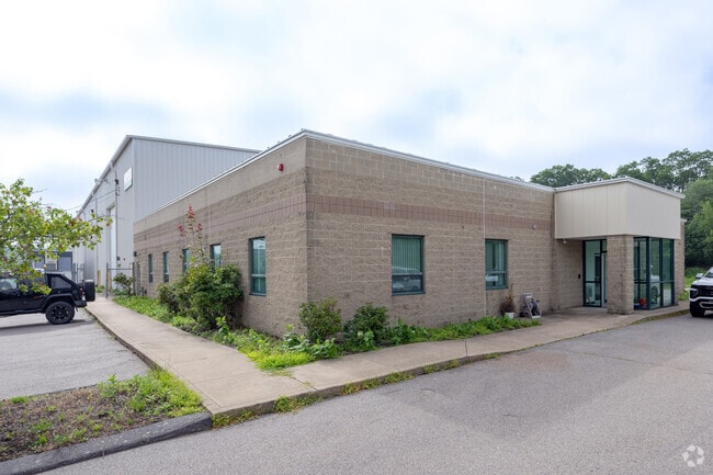


Property Detail
11 Campanelli Dr
Stateproperty
BRISTOL
I2
Massachusetts
B and X Area of moderate flood hazard, usually the area between the limits of the 100-year and 500-year floods.
24.31 AC
2024
Attleboro/New Bedford
2025
Boston
617101
Providence-Warwick, RI-MA
65,800 SF
FREE-000215-000000-000041
NEARBY LISTINGS FOR SALE OR LEASE
DEMOGRAPHICS near 11 Campanelli Dr
1 mile
3 mile
5 mile
2025 Total Population
657
10,728
40,151
2030 Population
664
10,942
40,980
Pop Growth 2025-2030
+ 1.07%
+ 1.99%
+ 2.06%
Average Age
42
42
43
2025 Total Households
232
4,302
15,363
HH Growth 2025-2030
+ 0.86%
+ 2.14%
+ 2.21%
Median Household Inc
$153,461
$94,065
$106,284
Avg Household Size
2.70
2.50
2.50
2025 Avg HH Vehicles
2.00
2.00
2.00
Median Home Value
$594,538
$495,248
$471,595
Median Year Built
1977
1978
1974
Nearby Places
Map Layers
Map Styles
 Street
 Aerial
Layers
 Traffic
 Biking
Places
Listings with unknown addresses are not visible on the map
- Restaurants
- Banks
- Shops
- Fitness
- Groceries
PUBLIC TRANSPORTATION
AIRPORT
Rhode Island Tf Green International
Drive
Walk
Distance
Rhode Island Tf Green International
48 min
29.6 mi
Freight Ports
Port of New Bedford Harbor
Drive
Walk
Distance
Port of New Bedford Harbor
29 min
21.1 mi
Nearby Properties
Address
Land Use
TOTAL SIZE
Lot Size
Zoning
Address
Land Use
TOTAL SIZE
Lot Size
Zoning
174.51 AC
I
Address
Land Use
TOTAL SIZE
Lot Size
Zoning
0.06 AC
A-2
Address
Land Use
TOTAL SIZE
Lot Size
Zoning
599,760 SF
33.60 AC
INPK
Address
Land Use
TOTAL SIZE
Lot Size
Zoning
387.83 AC
I
Address
Land Use
TOTAL SIZE
Lot Size
Zoning
17.18 AC
IND
Address
Land Use
TOTAL SIZE
Lot Size
Zoning
53.87 AC
N/A
Address
Land Use
TOTAL SIZE
Lot Size
Zoning
18.65 AC
A-2
Address
Land Use
TOTAL SIZE
Lot Size
Zoning
65.74 AC
B
Address
Land Use
TOTAL SIZE
Lot Size
Zoning
497,656 SF
30.47 AC
INPK
Address
Land Use
TOTAL SIZE
Lot Size
Zoning
26.51 AC
G
Address
Land Use
TOTAL SIZE
Lot Size
Zoning
161,640 SF
5.59 AC
INPK
Address
Land Use
TOTAL SIZE
Lot Size
Zoning
1,930 AC
INPK
Address
Land Use
TOTAL SIZE
Lot Size
Zoning
9.65 AC
B-L
Address
Land Use
TOTAL SIZE
Lot Size
Zoning
4.33 AC
B
Address
Land Use
TOTAL SIZE
Lot Size
Zoning
10,400 SF
54 AC
G
Address
Land Use
TOTAL SIZE
Lot Size
Zoning
297,041 SF
30.89 AC
INPK
Address
Land Use
TOTAL SIZE
Lot Size
Zoning
39,944 SF
47.07 AC
I2
Address
Land Use
TOTAL SIZE
Lot Size
Zoning
34.88 AC
G
Address
Land Use
TOTAL SIZE
Lot Size
Zoning
2,295.68 AC
OSR
Address
Land Use
TOTAL SIZE
Lot Size
Zoning
83,628 SF
5.51 AC
R1
Address
Land Use
TOTAL SIZE
Lot Size
Zoning
87,806 SF
4 AC
B
Address
Land Use
TOTAL SIZE
Lot Size
Zoning
79,119 SF
10.91 AC
A-2
Address
Land Use
TOTAL SIZE
Lot Size
Zoning
1,780 SF
0.43 AC
A-2
Address
Land Use
TOTAL SIZE
Lot Size
Zoning
113,500 SF
9.56 AC
INPK
Address
Land Use
TOTAL SIZE
Lot Size
Zoning
158,487 SF
15.55 AC
INPK
Address
Land Use
TOTAL SIZE
Lot Size
Zoning
36,216 SF
18.22 AC
N/A
Address
Land Use
TOTAL SIZE
Lot Size
Zoning
87,809 SF
11.12 AC
INPK
Address
Land Use
TOTAL SIZE
Lot Size
Zoning
64,890 SF
6.54 AC
INPK
Address
Land Use
TOTAL SIZE
Lot Size
Zoning
649 AC
OSR
The World's #1 Commercial Real Estate Marketplace
Connect with us
© 2026 CoStar Group
The information above has been obtained from sources believed reliable. While we do not doubt its accuracy we have not verified it and make no guarantee, warranty or representation about it. It is your responsibility to independently confirm its accuracy and completeness. Any projections, opinions, assumptions, or estimates used are for example only and do not represent the current or future performance of the property. The value of this transaction to you depends on tax and other factors which should be evaluated by your tax, financial, and legal advisors. You and your advisors should conduct a careful, independent investigation of the property to determine to your satisfaction the suitability of the property for your needs.