Property Record
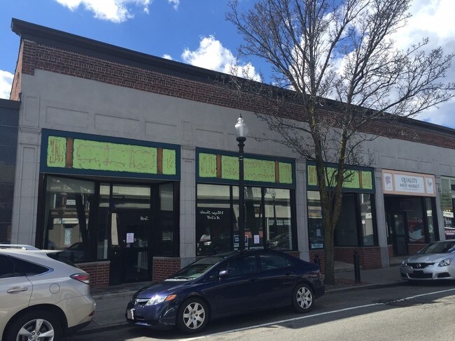
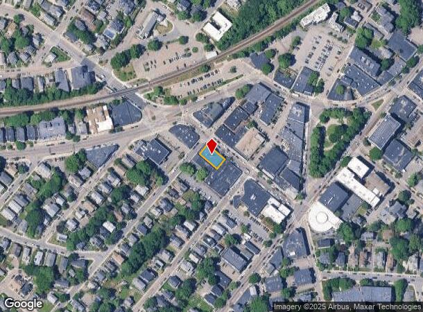
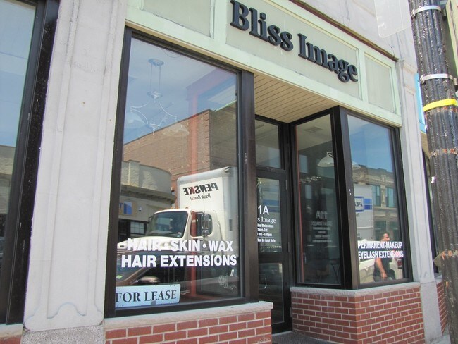
11 Corinth St, Roslindale, MA 02131
NEARBY LISTINGS FOR SALE OR LEASE
Property Detail
11 Corinth St
Regionalshoppingcenterormallwithanchorstore
Suffolk
X
Massachusetts
25021C0042E
0.14 AC
2025
South Suffolk County
2025
Boston
110502
Boston-Cambridge-Newton, MA-NH
5,500 SF
ROSL-000000-000020-000136
DEMOGRAPHICS near 11 Corinth St
1 Mile
3 Mile
5 Mile
2024 Total Population
30,497
211,070
625,075
2029 Population
28,587
200,536
600,013
Pop Growth 2024-2029
(6.26%)
(4.99%)
(4.01%)
Average Age
42
40
38
2024 Total Households
11,871
80,089
242,394
HH Growth 2024-2029
(6.99%)
(5.60%)
(4.43%)
Median Household Inc
$97,949
$87,442
$84,261
Avg Household Size
2.40
2.50
2.30
2024 Avg HH Vehicles
1.00
1.00
1.00
Median Home Value
$654,408
$666,796
$759,180
Median Year Built
1947
1949
1949
Nearby Places
Map Layers
Map Styles
 Street
 Aerial
- Restaurants
- Banks
- Shops
- Fitness
- Groceries
PUBLIC TRANSPORTATION
COMMUTER RAIL
Roslindale Village (Needham Line - Massachusetts Bay Transportation Authority Commuter Rail (Purple Line))
DRIVE
WALK
Distance
Roslindale Village (Needham Line - Massachusetts Bay Transportation Authority Commuter Rail (Purple Line))
1 min
2 min
0.1 mi
Bellevue (Needham Line - Massachusetts Bay Transportation Authority Commuter Rail (Purple Line))
DRIVE
WALK
Distance
Bellevue (Needham Line - Massachusetts Bay Transportation Authority Commuter Rail (Purple Line))
3 min
16 min
0.9 mi
AIRPORT
General Edward Lawrence Logan International
DRIVE
WALK
Distance
General Edward Lawrence Logan International
21 min
9.7 mi
Freight Ports
Port of Boston
DRIVE
WALK
Distance
Port of Boston
19 min
8.0 mi
SALE & LEASE HISTORY
LISTING DATE
SALE/LEASE

Jul 01, 2019
For Lease
Nearby Properties
Address
Land Use
TOTAL SIZE
Lot Size
Zoning
Address
Land Use
TOTAL SIZE
Lot Size
Zoning
262,120 SF
0.62 AC
C
Address
Land Use
TOTAL SIZE
Lot Size
Zoning
317,049 SF
11.22 AC
M05
Address
Land Use
TOTAL SIZE
Lot Size
Zoning
14.59 AC
S40
Address
Land Use
TOTAL SIZE
Lot Size
Zoning
203,252 SF
236.88 AC
S40
Address
Land Use
TOTAL SIZE
Lot Size
Zoning
45,000 SF
14.30 AC
E
Address
Land Use
TOTAL SIZE
Lot Size
Zoning
355,941 SF
4.60 AC
A
Address
Land Use
TOTAL SIZE
Lot Size
Zoning
163,364 SF
3.08 AC
O10
Address
Land Use
TOTAL SIZE
Lot Size
Zoning
351,680 SF
4.01 AC
RC
Address
Land Use
TOTAL SIZE
Lot Size
Zoning
25,744 SF
35.80 AC
S40
Address
Land Use
TOTAL SIZE
Lot Size
Zoning
179.13 AC
E
Address
Land Use
TOTAL SIZE
Lot Size
Zoning
5,119 SF
119.98 AC
S15
Address
Land Use
TOTAL SIZE
Lot Size
Zoning
1,940 SF
58.17 AC
E
Address
Land Use
TOTAL SIZE
Lot Size
Zoning
240.18 AC
E
Address
Land Use
TOTAL SIZE
Lot Size
Zoning
228,215 SF
2.44 AC
RC
Address
Land Use
TOTAL SIZE
Lot Size
Zoning
18,070 SF
119.45 AC
E
Address
Land Use
TOTAL SIZE
Lot Size
Zoning
526,040 SF
27.79 AC
E
Address
Land Use
TOTAL SIZE
Lot Size
Zoning
34.93 AC
LM
Address
Land Use
TOTAL SIZE
Lot Size
Zoning
21,830 SF
158.48 AC
E
Address
Land Use
TOTAL SIZE
Lot Size
Zoning
137,800 SF
5.67 AC
E
Address
Land Use
TOTAL SIZE
Lot Size
Zoning
2,781 SF
60.98 AC
S40
Address
Land Use
TOTAL SIZE
Lot Size
Zoning
53.23 AC
E
Address
Land Use
TOTAL SIZE
Lot Size
Zoning
377,249 SF
2.81 AC
RC
Address
Land Use
TOTAL SIZE
Lot Size
Zoning
3.18 AC
M05
Address
Land Use
TOTAL SIZE
Lot Size
Zoning
24.20 AC
S25
Address
Land Use
TOTAL SIZE
Lot Size
Zoning
14.64 AC
S15
Address
Land Use
TOTAL SIZE
Lot Size
Zoning
26,569 SF
45.93 AC
RC
Address
Land Use
TOTAL SIZE
Lot Size
Zoning
256,875 SF
3.49 AC
A
Address
Land Use
TOTAL SIZE
Lot Size
Zoning
332,100 SF
4.63 AC
M05
Address
Land Use
TOTAL SIZE
Lot Size
Zoning
22.95 AC
E
Address
Land Use
TOTAL SIZE
Lot Size
Zoning
221,500 SF
4.99 AC
E
The World's #1 Commercial Real Estate Marketplace
Connect with us
© 2025 CoStar Group
The information above has been obtained from sources believed reliable. While we do not doubt its accuracy we have not verified it and make no guarantee, warranty or representation about it. It is your responsibility to independently confirm its accuracy and completeness. Any projections, opinions, assumptions, or estimates used are for example only and do not represent the current or future performance of the property. The value of this transaction to you depends on tax and other factors which should be evaluated by your tax, financial, and legal advisors. You and your advisors should conduct a careful, independent investigation of the property to determine to your satisfaction the suitability of the property for your needs.