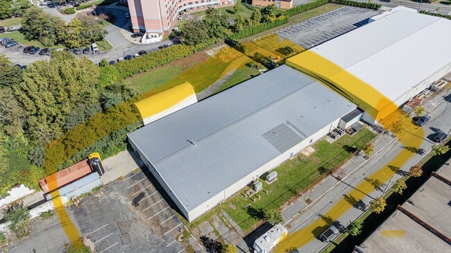
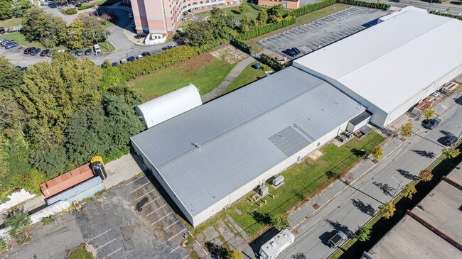
Property Record
11 David St, New Bedford, MA 02744

Current Lease Availabilities
Property Detail
11 David St
NEWB-000014-000000-000218
BRISTOL
Manufacturinglight
Massachusetts
IB
218
2025
1.92 AC
2025
Attleboro/New Bedford
652700
Boston
51,500 SF
Providence-Warwick, RI-MA
NEARBY LISTINGS FOR SALE OR LEASE
-
-
View all New Bedford listings for lease on LoopNet.com
DEMOGRAPHICS near 11 David St
1 mile
3 mile
5 mile
2025 Total Population
12,880
71,840
122,763
2030 Population
12,821
71,715
123,116
Pop Growth 2025-2030
(0.46%)
(0.17%)
+ 0.29%
Average Age
37
42
41
2025 Total Households
5,019
30,340
51,027
HH Growth 2025-2030
(0.38%)
(0.05%)
+ 0.37%
Median Household Inc
$52,606
$61,087
$63,315
Avg Household Size
2.50
2.30
2.30
2025 Avg HH Vehicles
1.00
1.00
2.00
Median Home Value
$357,264
$395,199
$407,639
Median Year Built
1947
1947
1948
Nearby Places
Map Layers
Map Styles
 Street
 Aerial
Layers
 Traffic
 Biking
Places
Listings with unknown addresses are not visible on the map
- Restaurants
- Banks
- Shops
- Fitness
- Groceries
PUBLIC TRANSPORTATION
AIRPORT
Rhode Island Tf Green International
Drive
Walk
Distance
Rhode Island Tf Green International
58 min
40.2 mi
Freight Ports
Port of New Bedford Harbor
Drive
Walk
Distance
Port of New Bedford Harbor
5 min
2.1 mi
Nearby Properties
Address
Land Use
TOTAL SIZE
Lot Size
Zoning
Address
Land Use
TOTAL SIZE
Lot Size
Zoning
10.29 AC
RA
Address
Land Use
TOTAL SIZE
Lot Size
Zoning
23.71 AC
RA
Address
Land Use
TOTAL SIZE
Lot Size
Zoning
252,482 SF
11.56 AC
RA
Address
Land Use
TOTAL SIZE
Lot Size
Zoning
228,726 SF
5.51 AC
MUB
Address
Land Use
TOTAL SIZE
Lot Size
Zoning
61.86 AC
I
Address
Land Use
TOTAL SIZE
Lot Size
Zoning
269,020 SF
2.26 AC
MUB
Address
Land Use
TOTAL SIZE
Lot Size
Zoning
74.70 AC
SRA
Address
Land Use
TOTAL SIZE
Lot Size
Zoning
231,634 SF
2.45 AC
IB
Address
Land Use
TOTAL SIZE
Lot Size
Zoning
160,391 SF
2.86 AC
MUB
Address
Land Use
TOTAL SIZE
Lot Size
Zoning
27.48 AC
B
Address
Land Use
TOTAL SIZE
Lot Size
Zoning
127,514 SF
4.23 AC
MUB
Address
Land Use
TOTAL SIZE
Lot Size
Zoning
188,739 SF
2.57 AC
IB
Address
Land Use
TOTAL SIZE
Lot Size
Zoning
5,716 SF
35.18 AC
GR
Address
Land Use
TOTAL SIZE
Lot Size
Zoning
5.59 AC
RC
Address
Land Use
TOTAL SIZE
Lot Size
Zoning
183,450 SF
2.51 AC
RA
Address
Land Use
TOTAL SIZE
Lot Size
Zoning
146,081 SF
2.15 AC
MUB
Address
Land Use
TOTAL SIZE
Lot Size
Zoning
111,337 SF
11.30 AC
RB
Address
Land Use
TOTAL SIZE
Lot Size
Zoning
147,850 SF
2.50 AC
RC
Address
Land Use
TOTAL SIZE
Lot Size
Zoning
119,865 SF
3.22 AC
IA
Address
Land Use
TOTAL SIZE
Lot Size
Zoning
212,875 SF
7.24 AC
WI
Address
Land Use
TOTAL SIZE
Lot Size
Zoning
11.11 AC
B
Address
Land Use
TOTAL SIZE
Lot Size
Zoning
2,190 SF
9.73 AC
IA
Address
Land Use
TOTAL SIZE
Lot Size
Zoning
8.69 AC
RA
Address
Land Use
TOTAL SIZE
Lot Size
Zoning
48.78 AC
RA
Address
Land Use
TOTAL SIZE
Lot Size
Zoning
91,660 SF
1.26 AC
MUB
Address
Land Use
TOTAL SIZE
Lot Size
Zoning
9.51 AC
SRA
Address
Land Use
TOTAL SIZE
Lot Size
Zoning
3.15 AC
RA
Address
Land Use
TOTAL SIZE
Lot Size
Zoning
101,289 SF
1.98 AC
RC
Address
Land Use
TOTAL SIZE
Lot Size
Zoning
128,298 SF
1.99 AC
MUB
Address
Land Use
TOTAL SIZE
Lot Size
Zoning
74,409 SF
9.40 AC
B
The World's #1 Commercial Real Estate Marketplace
Connect with us
© 2026 CoStar Group
The information above has been obtained from sources believed reliable. While we do not doubt its accuracy we have not verified it and make no guarantee, warranty or representation about it. It is your responsibility to independently confirm its accuracy and completeness. Any projections, opinions, assumptions, or estimates used are for example only and do not represent the current or future performance of the property. The value of this transaction to you depends on tax and other factors which should be evaluated by your tax, financial, and legal advisors. You and your advisors should conduct a careful, independent investigation of the property to determine to your satisfaction the suitability of the property for your needs.