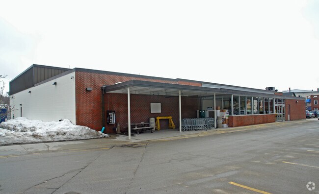
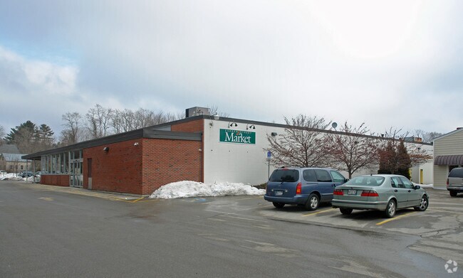
Property Record
11 Gardners Way, Kennebunk, ME 04043
NEARBY LISTINGS FOR SALE OR LEASE
-
-
View all Kennebunk listings for lease on LoopNet.com
Property Detail
11 Gardners Way
KENB-000051-000000-000062
York
Bowlingalley
Maine
X
62
23031C0443G
1.84 AC
2024
York County
2024
Portland/South Portland
028003
Portland-South Portland, ME
15,656 SF
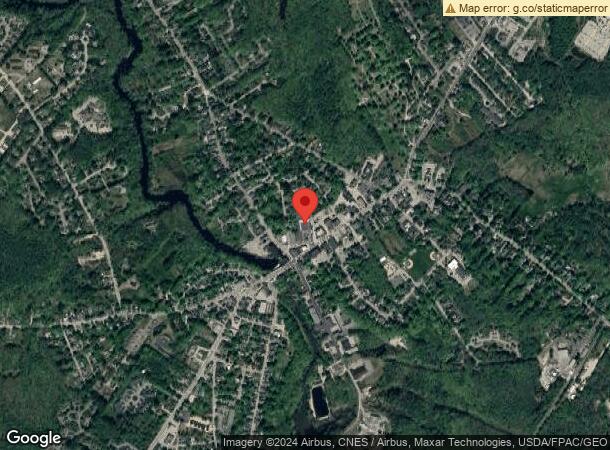
DEMOGRAPHICS near 11 Gardners Way
1 Mile
3 Mile
5 Mile
2024 Total Population
3,414
11,667
21,033
2029 Population
3,635
12,416
22,529
Pop Growth 2024-2029
+ 6.47%
+ 6.42%
+ 7.11%
Average Age
49
49
49
2024 Total Households
1,630
5,231
9,299
HH Growth 2024-2029
+ 6.44%
+ 6.48%
+ 7.21%
Median Household Inc
$79,701
$81,749
$83,974
Avg Household Size
2.00
2.20
2.20
2024 Avg HH Vehicles
2.00
2.00
2.00
Median Home Value
$348,362
$371,314
$399,932
Median Year Built
1980
1985
1984
Nearby Places
Map Layers
Map Styles
 Street
 Aerial
- Restaurants
- Banks
- Shops
- Fitness
- Groceries
PUBLIC TRANSPORTATION
COMMUTER RAIL
DRIVE
WALK
Distance
14 min
8.7 mi
DRIVE
WALK
Distance
17 min
9.5 mi
AIRPORT
Portland International Jetport
DRIVE
WALK
Distance
Portland International Jetport
34 min
23.9 mi
Portsmouth International at Pease
DRIVE
WALK
Distance
Portsmouth International at Pease
41 min
30.8 mi
Freight Ports
Portland, ME
DRIVE
WALK
Distance
Portland, ME
35 min
26.4 mi
SALE & LEASE HISTORY
LISTING DATE
SALE/LEASE

Sep 25, 2016
For Lease
Nearby Properties
Address
Land Use
TOTAL SIZE
Lot Size
Zoning
Address
Land Use
TOTAL SIZE
Lot Size
Zoning
183,767 SF
49 AC
Address
Land Use
TOTAL SIZE
Lot Size
Zoning
12.80 AC
Address
Land Use
TOTAL SIZE
Lot Size
Zoning
Address
Land Use
TOTAL SIZE
Lot Size
Zoning
102,400 SF
26.69 AC
Address
Land Use
TOTAL SIZE
Lot Size
Zoning
119,350 SF
22.60 AC
Address
Land Use
TOTAL SIZE
Lot Size
Zoning
212,312 SF
19 AC
Address
Land Use
TOTAL SIZE
Lot Size
Zoning
4.46 AC
Address
Land Use
TOTAL SIZE
Lot Size
Zoning
88,178 SF
41.10 AC
Address
Land Use
TOTAL SIZE
Lot Size
Zoning
60,925 SF
5.20 AC
Address
Land Use
TOTAL SIZE
Lot Size
Zoning
150 AC
EX
Address
Land Use
TOTAL SIZE
Lot Size
Zoning
63,224 SF
37.60 AC
7
Address
Land Use
TOTAL SIZE
Lot Size
Zoning
44,169 SF
0.80 AC
Address
Land Use
TOTAL SIZE
Lot Size
Zoning
0.98 AC
Address
Land Use
TOTAL SIZE
Lot Size
Zoning
14.05 AC
Address
Land Use
TOTAL SIZE
Lot Size
Zoning
34,415 SF
11.22 AC
Address
Land Use
TOTAL SIZE
Lot Size
Zoning
22.22 AC
Address
Land Use
TOTAL SIZE
Lot Size
Zoning
60,513 SF
18.12 AC
Address
Land Use
TOTAL SIZE
Lot Size
Zoning
25.27 AC
Address
Land Use
TOTAL SIZE
Lot Size
Zoning
182.50 AC
Address
Land Use
TOTAL SIZE
Lot Size
Zoning
29,511 SF
4.40 AC
Address
Land Use
TOTAL SIZE
Lot Size
Zoning
15,700 SF
0.62 AC
Address
Land Use
TOTAL SIZE
Lot Size
Zoning
52,010 SF
33.99 AC
Address
Land Use
TOTAL SIZE
Lot Size
Zoning
16,085 SF
1.27 AC
Address
Land Use
TOTAL SIZE
Lot Size
Zoning
17.65 AC
Address
Land Use
TOTAL SIZE
Lot Size
Zoning
20.38 AC
Address
Land Use
TOTAL SIZE
Lot Size
Zoning
3,752 SF
7.66 AC
Address
Land Use
TOTAL SIZE
Lot Size
Zoning
Address
Land Use
TOTAL SIZE
Lot Size
Zoning
15,042 SF
0.55 AC
Address
Land Use
TOTAL SIZE
Lot Size
Zoning
3.01 AC
Address
Land Use
TOTAL SIZE
Lot Size
Zoning
33,764 SF
2.98 AC
The World's #1 Commercial Real Estate Marketplace
Connect with us
© 2026 CoStar Group
The information above has been obtained from sources believed reliable. While we do not doubt its accuracy we have not verified it and make no guarantee, warranty or representation about it. It is your responsibility to independently confirm its accuracy and completeness. Any projections, opinions, assumptions, or estimates used are for example only and do not represent the current or future performance of the property. The value of this transaction to you depends on tax and other factors which should be evaluated by your tax, financial, and legal advisors. You and your advisors should conduct a careful, independent investigation of the property to determine to your satisfaction the suitability of the property for your needs.