Property Record
11 Lakeview Ave, Saint Charles, MO 63303
NEARBY LISTINGS FOR SALE OR LEASE
-
-
View all Saint Charles listings for sale on LoopNet.com
Property Detail
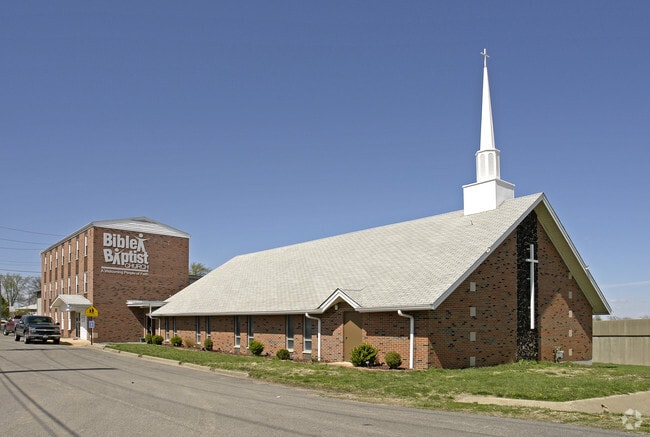
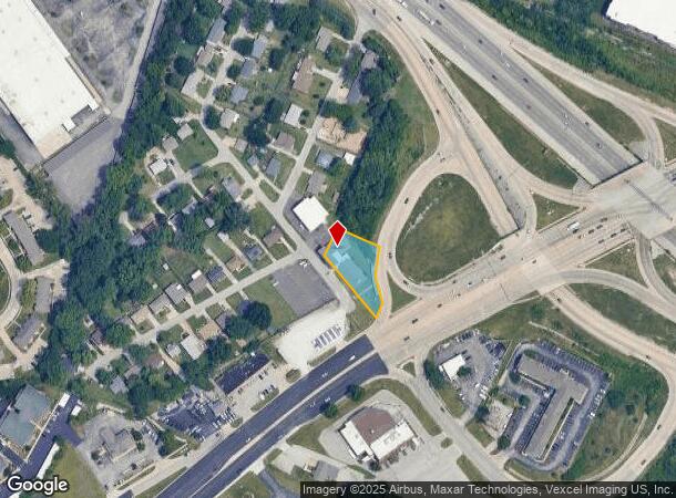
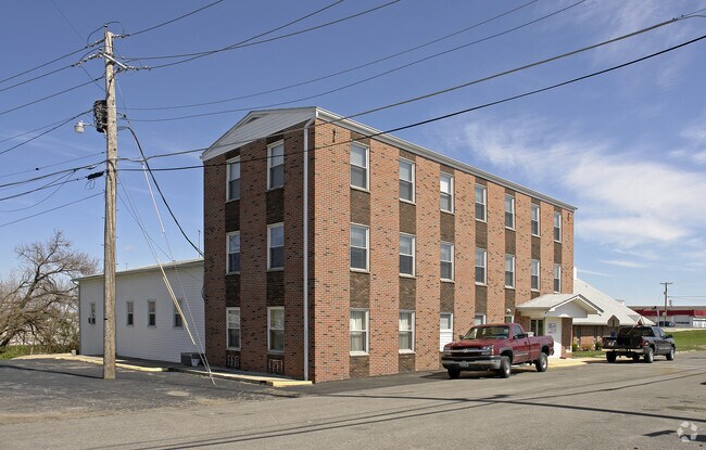
11 Lakeview Ave
St. Louis, MO-IL
Mill Wood 04 Sec 02
3-003A-3280-00-0002.0000000
ST CHAS COMMON PT BLK 6 FRONTS 215ON E SIDE LAKEVIEW SUB
Religious
St. Charles
X
Missouri
29183C0269G
2
0
1.10 AC
2025
St Charles County
311148
St. Louis
DEMOGRAPHICS near 11 Lakeview Ave
1 Mile
3 Mile
5 Mile
2024 Total Population
15,124
78,807
142,469
2029 Population
16,043
83,510
150,216
Pop Growth 2024-2029
+ 6.08%
+ 5.97%
+ 5.44%
Average Age
40
42
42
2024 Total Households
6,975
33,746
59,808
HH Growth 2024-2029
+ 6.15%
+ 6.12%
+ 5.54%
Median Household Inc
$57,403
$75,389
$82,148
Avg Household Size
2.00
2.20
2.30
2024 Avg HH Vehicles
2.00
2.00
2.00
Median Home Value
$191,556
$249,372
$248,161
Median Year Built
1979
1980
1983
Nearby Places
Map Layers
Map Styles
 Street
 Aerial
- Restaurants
- Banks
- Shops
- Fitness
- Groceries
PUBLIC TRANSPORTATION
AIRPORT
St Louis Lambert International
DRIVE
WALK
Distance
St Louis Lambert International
20 min
13.6 mi
Nearby Properties
Address
Land Use
TOTAL SIZE
Lot Size
Zoning
Address
Land Use
TOTAL SIZE
Lot Size
Zoning
2,918,475 SF
30.32 AC
AC1
Address
Land Use
TOTAL SIZE
Lot Size
Zoning
553,382 SF
109.67 AC
FPNU
Address
Land Use
TOTAL SIZE
Lot Size
Zoning
440,000 SF
2.11 AC
Address
Land Use
TOTAL SIZE
Lot Size
Zoning
256,719 SF
27 AC
104PDM
Address
Land Use
TOTAL SIZE
Lot Size
Zoning
581,756 SF
47.18 AC
AC2
Address
Land Use
TOTAL SIZE
Lot Size
Zoning
52,664 SF
13.59 AC
Address
Land Use
TOTAL SIZE
Lot Size
Zoning
564,552 SF
42.07 AC
10M-1
Address
Land Use
TOTAL SIZE
Lot Size
Zoning
488,536 SF
23.53 AC
AF0
Address
Land Use
TOTAL SIZE
Lot Size
Zoning
281,074 SF
8.79 AC
Address
Land Use
TOTAL SIZE
Lot Size
Zoning
312,516 SF
2.18 AC
Address
Land Use
TOTAL SIZE
Lot Size
Zoning
120,050 SF
1.51 AC
Address
Land Use
TOTAL SIZE
Lot Size
Zoning
197,290 SF
29.28 AC
Address
Land Use
TOTAL SIZE
Lot Size
Zoning
87,027 SF
16.04 AC
AC4
Address
Land Use
TOTAL SIZE
Lot Size
Zoning
83.11 AC
AC9
Address
Land Use
TOTAL SIZE
Lot Size
Zoning
273,184 SF
20.05 AC
Address
Land Use
TOTAL SIZE
Lot Size
Zoning
273,398 SF
20.08 AC
AB2
Address
Land Use
TOTAL SIZE
Lot Size
Zoning
15,584 SF
50 AC
AC9
Address
Land Use
TOTAL SIZE
Lot Size
Zoning
316,064 SF
1.84 AC
Address
Land Use
TOTAL SIZE
Lot Size
Zoning
55.46 AC
AF0
Address
Land Use
TOTAL SIZE
Lot Size
Zoning
220,089 SF
25.47 AC
AA7
Address
Land Use
TOTAL SIZE
Lot Size
Zoning
100,633 SF
1.02 AC
Address
Land Use
TOTAL SIZE
Lot Size
Zoning
263,495 SF
20.10 AC
Address
Land Use
TOTAL SIZE
Lot Size
Zoning
320,000 SF
17.30 AC
FPM3
Address
Land Use
TOTAL SIZE
Lot Size
Zoning
199,216 SF
10.26 AC
Address
Land Use
TOTAL SIZE
Lot Size
Zoning
19,493 SF
3.01 AC
Address
Land Use
TOTAL SIZE
Lot Size
Zoning
Address
Land Use
TOTAL SIZE
Lot Size
Zoning
63.61 AC
AC9
Address
Land Use
TOTAL SIZE
Lot Size
Zoning
41,256 SF
4.98 AC
Address
Land Use
TOTAL SIZE
Lot Size
Zoning
130,500 SF
10.68 AC
FPM3
Address
Land Use
TOTAL SIZE
Lot Size
Zoning
32,108 SF
0.90 AC
AF0
The World's #1 Commercial Real Estate Marketplace
Connect with us
© 2026 CoStar Group
The information above has been obtained from sources believed reliable. While we do not doubt its accuracy we have not verified it and make no guarantee, warranty or representation about it. It is your responsibility to independently confirm its accuracy and completeness. Any projections, opinions, assumptions, or estimates used are for example only and do not represent the current or future performance of the property. The value of this transaction to you depends on tax and other factors which should be evaluated by your tax, financial, and legal advisors. You and your advisors should conduct a careful, independent investigation of the property to determine to your satisfaction the suitability of the property for your needs.