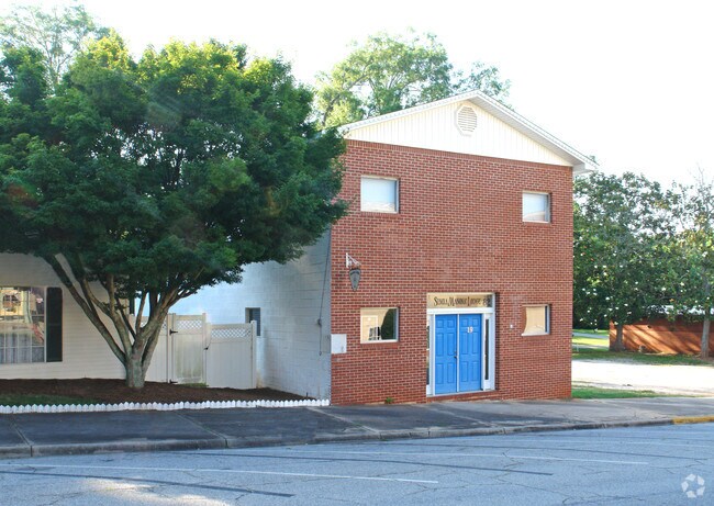
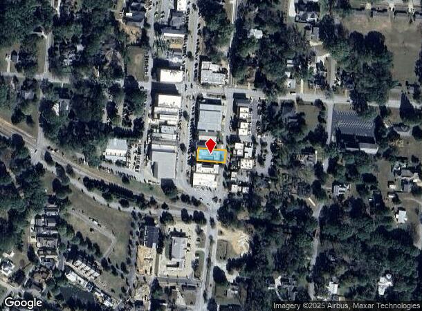
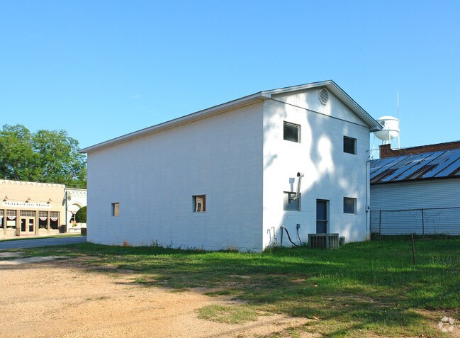
Property Record
11 Main St, Newnan, GA 30263
NEARBY LISTINGS FOR SALE OR LEASE
-
-
View all Newnan listings for sale on LoopNet.com
Property Detail
11 Main St
E02-0030-004
BLDG/LOT/MAIN ST LL 279 LD 1
Apartment
Coweta
X
Georgia
13077C0291D
0.14 AC
2025
Coweta County
2025
Atlanta
170308
Atlanta-Sandy Springs-Roswell, GA
8,608 SF
DEMOGRAPHICS near 11 Main St
1 Mile
3 Mile
5 Mile
2024 Total Population
2,555
10,802
27,739
2029 Population
2,896
12,082
30,462
Pop Growth 2024-2029
+ 13.35%
+ 11.85%
+ 9.82%
Average Age
40
40
40
2024 Total Households
908
3,746
9,691
HH Growth 2024-2029
+ 13.44%
+ 11.96%
+ 9.86%
Median Household Inc
$96,107
$99,054
$94,695
Avg Household Size
2.80
2.80
2.80
2024 Avg HH Vehicles
2.00
2.00
2.00
Median Home Value
$328,940
$347,485
$367,831
Median Year Built
2003
2004
1999
Nearby Places
Map Layers
Map Styles
 Street
 Aerial
- Restaurants
- Banks
- Shops
- Fitness
- Groceries
PUBLIC TRANSPORTATION
AIRPORT
Hartsfield - Jackson Atlanta International
DRIVE
WALK
Distance
Hartsfield - Jackson Atlanta International
46 min
28.1 mi
Freight Ports
Georgia Ports - Savannah
DRIVE
WALK
Distance
Georgia Ports - Savannah
272 min
236.3 mi
Nearby Properties
Address
Land Use
TOTAL SIZE
Lot Size
Zoning
Address
Land Use
TOTAL SIZE
Lot Size
Zoning
115,988 SF
16.67 AC
C LUC
Address
Land Use
TOTAL SIZE
Lot Size
Zoning
93,907 SF
24.25 AC
R1
Address
Land Use
TOTAL SIZE
Lot Size
Zoning
61,637 SF
10.33 AC
R1
Address
Land Use
TOTAL SIZE
Lot Size
Zoning
46,582 SF
4.51 AC
C LUC
Address
Land Use
TOTAL SIZE
Lot Size
Zoning
66,635 SF
10.90 AC
RFA
Address
Land Use
TOTAL SIZE
Lot Size
Zoning
58,800 SF
11.23 AC
R1
Address
Land Use
TOTAL SIZE
Lot Size
Zoning
13,829 SF
52.55 AC
I MI
Address
Land Use
TOTAL SIZE
Lot Size
Zoning
78,300 SF
7.49 AC
R1
Address
Land Use
TOTAL SIZE
Lot Size
Zoning
35,914 SF
64.50 AC
Address
Land Use
TOTAL SIZE
Lot Size
Zoning
234,597 SF
13.41 AC
R1
Address
Land Use
TOTAL SIZE
Lot Size
Zoning
234,597 SF
13.41 AC
R1
Address
Land Use
TOTAL SIZE
Lot Size
Zoning
86.78 AC
Address
Land Use
TOTAL SIZE
Lot Size
Zoning
6,080 SF
167.54 AC
R1
Address
Land Use
TOTAL SIZE
Lot Size
Zoning
90,884 SF
109.14 AC
M-C
Address
Land Use
TOTAL SIZE
Lot Size
Zoning
162,400 SF
10.47 AC
M
Address
Land Use
TOTAL SIZE
Lot Size
Zoning
12,527 SF
8.75 AC
Address
Land Use
TOTAL SIZE
Lot Size
Zoning
55.60 AC
Address
Land Use
TOTAL SIZE
Lot Size
Zoning
4,965 SF
62.66 AC
R1
Address
Land Use
TOTAL SIZE
Lot Size
Zoning
18,000 SF
18.62 AC
001
Address
Land Use
TOTAL SIZE
Lot Size
Zoning
12,530 SF
0.61 AC
R1
Address
Land Use
TOTAL SIZE
Lot Size
Zoning
16,128 SF
4.55 AC
R1
Address
Land Use
TOTAL SIZE
Lot Size
Zoning
7,544 SF
2.88 AC
C
Address
Land Use
TOTAL SIZE
Lot Size
Zoning
9,322 SF
96.17 AC
RFA
Address
Land Use
TOTAL SIZE
Lot Size
Zoning
10,540 SF
9.66 AC
RFA
Address
Land Use
TOTAL SIZE
Lot Size
Zoning
19,800 SF
0.15 AC
C1
Address
Land Use
TOTAL SIZE
Lot Size
Zoning
13,930 SF
2.22 AC
R1
Address
Land Use
TOTAL SIZE
Lot Size
Zoning
7,167 SF
11.19 AC
C
Address
Land Use
TOTAL SIZE
Lot Size
Zoning
4,640 SF
1.51 AC
C GC
Address
Land Use
TOTAL SIZE
Lot Size
Zoning
10,004 SF
1.49 AC
001
Address
Land Use
TOTAL SIZE
Lot Size
Zoning
5,004 SF
1.62 AC
001
The World's #1 Commercial Real Estate Marketplace
Connect with us
© 2026 CoStar Group
The information above has been obtained from sources believed reliable. While we do not doubt its accuracy we have not verified it and make no guarantee, warranty or representation about it. It is your responsibility to independently confirm its accuracy and completeness. Any projections, opinions, assumptions, or estimates used are for example only and do not represent the current or future performance of the property. The value of this transaction to you depends on tax and other factors which should be evaluated by your tax, financial, and legal advisors. You and your advisors should conduct a careful, independent investigation of the property to determine to your satisfaction the suitability of the property for your needs.