Property Record
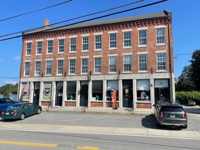
11 N Main St, North Smithfield, RI 02896


Property Detail
11 N Main St
NSMI-000004-000000-000193
PROVIDENCE
Commercialbuilding
Rhode Island
BN
193
B and X Area of moderate flood hazard, usually the area between the limits of the 100-year and 500-year floods.
0.55 AC
2025
Burrillville/Glocester
2025
Providence
012801
Providence-Warwick, RI-MA
5,418 SF
NEARBY LISTINGS FOR SALE OR LEASE
-
-
View all North Smithfield listings for sale on LoopNet.com
DEMOGRAPHICS near 11 N Main St
1 mile
3 mile
5 mile
2025 Total Population
3,844
23,953
75,128
2030 Population
4,017
24,723
77,522
Pop Growth 2025-2030
+ 4.50%
+ 3.21%
+ 3.19%
Average Age
43
42
41
2025 Total Households
1,573
9,487
30,434
HH Growth 2025-2030
+ 4.51%
+ 3.26%
+ 3.21%
Median Household Inc
$106,123
$84,725
$76,816
Avg Household Size
2.40
2.40
2.40
2025 Avg HH Vehicles
2.00
2.00
2.00
Median Home Value
$468,336
$446,436
$411,636
Median Year Built
1972
1961
1957
Nearby Places
Map Layers
Map Styles
 Street
 Aerial
Transit
 Traffic
 Biking
Places
Listings with unknown addresses are not visible on the map
- Restaurants
- Banks
- Shops
- Fitness
- Groceries
PUBLIC TRANSPORTATION
AIRPORT
Rhode Island Tf Green International
Drive
Walk
Distance
Rhode Island Tf Green International
37 min
25.1 mi
Worcester Regional
Drive
Walk
Distance
Worcester Regional
41 min
28.2 mi
SALE & LEASE HISTORY
LISTING DATE
SALE/LEASE

Sep 13, 2017
For Lease
Mar 07, 2024
For Sale
Mar 01, 2023
For Lease
Jun 15, 2017
For Lease
Aug 25, 2017
For Lease
Aug 12, 2018
For Lease
Nearby Properties
Address
Land Use
TOTAL SIZE
Lot Size
Zoning
Address
Land Use
TOTAL SIZE
Lot Size
Zoning
602,336 SF
204.50 AC
B
Address
Land Use
TOTAL SIZE
Lot Size
Zoning
31.45 AC
M
Address
Land Use
TOTAL SIZE
Lot Size
Zoning
8,930 SF
31.56 AC
R4
Address
Land Use
TOTAL SIZE
Lot Size
Zoning
150,385 SF
27.10 AC
Address
Land Use
TOTAL SIZE
Lot Size
Zoning
Address
Land Use
TOTAL SIZE
Lot Size
Zoning
34.30 AC
M
Address
Land Use
TOTAL SIZE
Lot Size
Zoning
23.36 AC
Address
Land Use
TOTAL SIZE
Lot Size
Zoning
115,203 SF
15.52 AC
RA
Address
Land Use
TOTAL SIZE
Lot Size
Zoning
28.39 AC
F5
Address
Land Use
TOTAL SIZE
Lot Size
Zoning
27,720 SF
4.36 AC
I
Address
Land Use
TOTAL SIZE
Lot Size
Zoning
60,999 SF
6.01 AC
R3
Address
Land Use
TOTAL SIZE
Lot Size
Zoning
65,809 SF
17.66 AC
BN
Address
Land Use
TOTAL SIZE
Lot Size
Zoning
18.32 AC
M
Address
Land Use
TOTAL SIZE
Lot Size
Zoning
42,837 SF
6.34 AC
RS
Address
Land Use
TOTAL SIZE
Lot Size
Zoning
68,604 SF
8.62 AC
RA
Address
Land Use
TOTAL SIZE
Lot Size
Zoning
72,024 SF
3.53 AC
I1
Address
Land Use
TOTAL SIZE
Lot Size
Zoning
21,080 SF
34.04 AC
RA
Address
Land Use
TOTAL SIZE
Lot Size
Zoning
42,966 SF
5.08 AC
R2
Address
Land Use
TOTAL SIZE
Lot Size
Zoning
417,592 SF
13.58 AC
MU2
Address
Land Use
TOTAL SIZE
Lot Size
Zoning
10.34 AC
RA
Address
Land Use
TOTAL SIZE
Lot Size
Zoning
57,698 SF
8.36 AC
RS
Address
Land Use
TOTAL SIZE
Lot Size
Zoning
48,309 SF
13.14 AC
RA
Address
Land Use
TOTAL SIZE
Lot Size
Zoning
49,480 SF
4.53 AC
RA
Address
Land Use
TOTAL SIZE
Lot Size
Zoning
52,041 SF
47.80 AC
VRD
Address
Land Use
TOTAL SIZE
Lot Size
Zoning
8,117 SF
0.76 AC
R4
Address
Land Use
TOTAL SIZE
Lot Size
Zoning
48,678 SF
2.11 AC
R3
Address
Land Use
TOTAL SIZE
Lot Size
Zoning
83,475 SF
16.06 AC
Address
Land Use
TOTAL SIZE
Lot Size
Zoning
55,730 SF
8.23 AC
GC
Address
Land Use
TOTAL SIZE
Lot Size
Zoning
31,785 SF
1.01 AC
R4
Address
Land Use
TOTAL SIZE
Lot Size
Zoning
9,464 SF
53.10 AC
AG
The World's #1 Commercial Real Estate Marketplace
Connect with us
© 2026 CoStar Group
The information above has been obtained from sources believed reliable. While we do not doubt its accuracy we have not verified it and make no guarantee, warranty or representation about it. It is your responsibility to independently confirm its accuracy and completeness. Any projections, opinions, assumptions, or estimates used are for example only and do not represent the current or future performance of the property. The value of this transaction to you depends on tax and other factors which should be evaluated by your tax, financial, and legal advisors. You and your advisors should conduct a careful, independent investigation of the property to determine to your satisfaction the suitability of the property for your needs.