Property Record
11 Maple Ave, Southampton, PA 18966
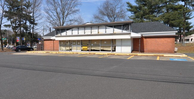


Property Detail
11 Maple Ave
48-003-053
LOT NW COR MAPLE AVE & ST RD 183X134
Storebuilding
Bucks
R3
Pennsylvania
B and X Area of moderate flood hazard, usually the area between the limits of the 100-year and 500-year floods.
0.56 AC
2024
Lower Bucks County
2025
Philadelphia
101506
Philadelphia-Camden-Wilmington, PA-NJ-DE-MD
2,652 SF
NEARBY LISTINGS FOR SALE OR LEASE
DEMOGRAPHICS near 11 Maple Ave
1 mile
3 mile
5 mile
2025 Total Population
13,293
72,200
198,539
2030 Population
13,650
73,318
200,688
Pop Growth 2025-2030
+ 2.69%
+ 1.55%
+ 1.08%
Average Age
47
45
44
2025 Total Households
5,599
28,275
76,252
HH Growth 2025-2030
+ 3.25%
+ 1.70%
+ 1.20%
Median Household Inc
$86,331
$105,160
$103,269
Avg Household Size
2.30
2.50
2.50
2025 Avg HH Vehicles
2.00
2.00
2.00
Median Home Value
$430,722
$450,224
$438,236
Median Year Built
1970
1969
1969
Nearby Places
Map Layers
Map Styles
 Street
 Aerial
Layers
 Traffic
 Biking
Places
Listings with unknown addresses are not visible on the map
- Restaurants
- Banks
- Shops
- Fitness
- Groceries
PUBLIC TRANSPORTATION
COMMUTER RAIL
Warminster (R2 - Southeastern Pennsylvania Transportation Authority Regional Rail (SEPTA Regional Rail))
Drive
Walk
Distance
Warminster (R2 - Southeastern Pennsylvania Transportation Authority Regional Rail (SEPTA Regional Rail))
5 min
2.1 mi
Hatboro (R2 - Southeastern Pennsylvania Transportation Authority Regional Rail (SEPTA Regional Rail))
Drive
Walk
Distance
Hatboro (R2 - Southeastern Pennsylvania Transportation Authority Regional Rail (SEPTA Regional Rail))
7 min
3.5 mi
AIRPORT
Trenton Mercer
Drive
Walk
Distance
Trenton Mercer
32 min
18.5 mi
Philadelphia International
Drive
Walk
Distance
Philadelphia International
54 min
35.0 mi
Lehigh Valley International
Drive
Walk
Distance
Lehigh Valley International
75 min
44.4 mi
Freight Ports
Port of Philadelphia
Drive
Walk
Distance
Port of Philadelphia
33 min
17.5 mi
SALE & LEASE HISTORY
LISTING DATE
SALE/LEASE

Mar 15, 2019
For Lease
Mar 15, 2019
For Sale
Nearby Properties
Address
Land Use
TOTAL SIZE
Lot Size
Zoning
Address
Land Use
TOTAL SIZE
Lot Size
Zoning
377,044 SF
58.73 AC
INST
Address
Land Use
TOTAL SIZE
Lot Size
Zoning
571,213 SF
67.31 AC
M
Address
Land Use
TOTAL SIZE
Lot Size
Zoning
251,655 SF
48.95 AC
SC
Address
Land Use
TOTAL SIZE
Lot Size
Zoning
256,679 SF
14 AC
MI
Address
Land Use
TOTAL SIZE
Lot Size
Zoning
420,736 SF
29.47 AC
LI
Address
Land Use
TOTAL SIZE
Lot Size
Zoning
110,198 SF
12.18 AC
R2
Address
Land Use
TOTAL SIZE
Lot Size
Zoning
273,531 SF
11.11 AC
INST
Address
Land Use
TOTAL SIZE
Lot Size
Zoning
91,814 SF
38.63 AC
RC
Address
Land Use
TOTAL SIZE
Lot Size
Zoning
182,364 SF
21.06 AC
M
Address
Land Use
TOTAL SIZE
Lot Size
Zoning
240,682 SF
4.81 AC
HI
Address
Land Use
TOTAL SIZE
Lot Size
Zoning
220,338 SF
16.76 AC
M
Address
Land Use
TOTAL SIZE
Lot Size
Zoning
60,945 SF
74.12 AC
Address
Land Use
TOTAL SIZE
Lot Size
Zoning
318,625 SF
19.01 AC
I
Address
Land Use
TOTAL SIZE
Lot Size
Zoning
125,387 SF
4.10 AC
RC2
Address
Land Use
TOTAL SIZE
Lot Size
Zoning
84,000 SF
14.17 AC
LI
Address
Land Use
TOTAL SIZE
Lot Size
Zoning
162,363 SF
2.72 AC
HI
Address
Land Use
TOTAL SIZE
Lot Size
Zoning
91,446 SF
2.53 AC
R7
Address
Land Use
TOTAL SIZE
Lot Size
Zoning
257,048 SF
36.13 AC
C
Address
Land Use
TOTAL SIZE
Lot Size
Zoning
69,680 SF
19 AC
LI
Address
Land Use
TOTAL SIZE
Lot Size
Zoning
64,000 SF
11.94 AC
LI
Address
Land Use
TOTAL SIZE
Lot Size
Zoning
74,764 SF
10.17 AC
SC
Address
Land Use
TOTAL SIZE
Lot Size
Zoning
58,318 SF
20.12 AC
R4
Address
Land Use
TOTAL SIZE
Lot Size
Zoning
29,308 SF
15.96 AC
I
Address
Land Use
TOTAL SIZE
Lot Size
Zoning
56,595 SF
3.89 AC
Address
Land Use
TOTAL SIZE
Lot Size
Zoning
44,144 SF
7.30 AC
L
Address
Land Use
TOTAL SIZE
Lot Size
Zoning
87,120 SF
1.51 AC
RC2
Address
Land Use
TOTAL SIZE
Lot Size
Zoning
85,060 SF
8.63 AC
I
Address
Land Use
TOTAL SIZE
Lot Size
Zoning
14,130 SF
83.31 AC
INST
Address
Land Use
TOTAL SIZE
Lot Size
Zoning
56,668 SF
3.68 AC
R4
Address
Land Use
TOTAL SIZE
Lot Size
Zoning
22,386 SF
15.52 AC
INST
The World's #1 Commercial Real Estate Marketplace
Connect with us
© 2026 CoStar Group
The information above has been obtained from sources believed reliable. While we do not doubt its accuracy we have not verified it and make no guarantee, warranty or representation about it. It is your responsibility to independently confirm its accuracy and completeness. Any projections, opinions, assumptions, or estimates used are for example only and do not represent the current or future performance of the property. The value of this transaction to you depends on tax and other factors which should be evaluated by your tax, financial, and legal advisors. You and your advisors should conduct a careful, independent investigation of the property to determine to your satisfaction the suitability of the property for your needs.