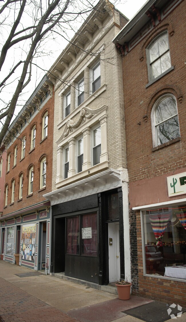
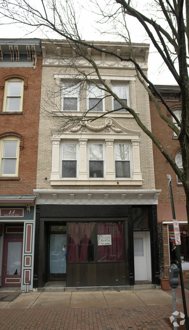
Property Record
11 N Division St, Peekskill, NY 10566

Property Detail
11 N Division St
New York-Jersey City-White Plains, NY-NJ
WESTCHESTER
1200-033-030-00001-000-0007
New York
Restaurantbuilding
7.000
A Areas with a 1% annual chance of flooding and a 26% chance of flooding over the life of a 30-year mortgage.
0.04 AC
2025
Northwest
2025
Westchester/So Connecticut
014300
NEARBY LISTINGS FOR SALE OR LEASE
DEMOGRAPHICS near 11 N Division St
1 mile
3 mile
5 mile
2025 Total Population
19,313
44,313
79,130
2030 Population
19,460
44,593
79,602
Pop Growth 2025-2030
+ 0.76%
+ 0.63%
+ 0.60%
Average Age
40
42
43
2025 Total Households
7,292
16,131
28,761
HH Growth 2025-2030
+ 0.89%
+ 0.60%
+ 0.48%
Median Household Inc
$87,844
$104,755
$112,911
Avg Household Size
2.50
2.60
2.60
2025 Avg HH Vehicles
1.00
2.00
2.00
Median Home Value
$370,833
$455,844
$482,993
Median Year Built
1960
1962
1963
Nearby Places
Map Layers
Map Styles
 Street
 Aerial
Layers
 Traffic
 Biking
Places
Listings with unknown addresses are not visible on the map
- Restaurants
- Banks
- Shops
- Fitness
- Groceries
PUBLIC TRANSPORTATION
TRANSIT/SUBWAY
Peekskill Station (Hudson Line - Metro-North Commuter Railroad Company (Metro-North))
Drive
Walk
Distance
Peekskill Station (Hudson Line - Metro-North Commuter Railroad Company (Metro-North))
2 min
20 min
1.0 mi
COMMUTER RAIL
Peekskill Station (Hudson Line - Metro-North Commuter Railroad Company (Metro-North))
Drive
Walk
Distance
Peekskill Station (Hudson Line - Metro-North Commuter Railroad Company (Metro-North))
3 min
16 min
0.8 mi
Cortlandt Station (Hudson Line - Metro-North Commuter Railroad Company (Metro-North))
Drive
Walk
Distance
Cortlandt Station (Hudson Line - Metro-North Commuter Railroad Company (Metro-North))
10 min
4.2 mi
AIRPORT
New York Stewart International
Drive
Walk
Distance
New York Stewart International
45 min
25.2 mi
Westchester County
Drive
Walk
Distance
Westchester County
44 min
29.5 mi
Freight Ports
NY - Red Hook Container Terminal
Drive
Walk
Distance
NY - Red Hook Container Terminal
85 min
54.2 mi
Nearby Properties
Address
Land Use
TOTAL SIZE
Lot Size
Zoning
Address
Land Use
TOTAL SIZE
Lot Size
Zoning
Address
Land Use
TOTAL SIZE
Lot Size
Zoning
Address
Land Use
TOTAL SIZE
Lot Size
Zoning
Address
Land Use
TOTAL SIZE
Lot Size
Zoning
157 AC
Address
Land Use
TOTAL SIZE
Lot Size
Zoning
Address
Land Use
TOTAL SIZE
Lot Size
Zoning
74.84 AC
Address
Land Use
TOTAL SIZE
Lot Size
Zoning
Address
Land Use
TOTAL SIZE
Lot Size
Zoning
Address
Land Use
TOTAL SIZE
Lot Size
Zoning
Address
Land Use
TOTAL SIZE
Lot Size
Zoning
Address
Land Use
TOTAL SIZE
Lot Size
Zoning
2.70 AC
Address
Land Use
TOTAL SIZE
Lot Size
Zoning
Address
Land Use
TOTAL SIZE
Lot Size
Zoning
Address
Land Use
TOTAL SIZE
Lot Size
Zoning
15.81 AC
R80
Address
Land Use
TOTAL SIZE
Lot Size
Zoning
7,254 SF
17.32 AC
R80
Address
Land Use
TOTAL SIZE
Lot Size
Zoning
22.61 AC
Address
Land Use
TOTAL SIZE
Lot Size
Zoning
8.93 AC
Address
Land Use
TOTAL SIZE
Lot Size
Zoning
2.99 AC
Address
Land Use
TOTAL SIZE
Lot Size
Zoning
Address
Land Use
TOTAL SIZE
Lot Size
Zoning
Address
Land Use
TOTAL SIZE
Lot Size
Zoning
7.50 AC
Address
Land Use
TOTAL SIZE
Lot Size
Zoning
38.05 AC
Address
Land Use
TOTAL SIZE
Lot Size
Zoning
Address
Land Use
TOTAL SIZE
Lot Size
Zoning
Address
Land Use
TOTAL SIZE
Lot Size
Zoning
5,268 SF
33.90 AC
R80
Address
Land Use
TOTAL SIZE
Lot Size
Zoning
9,707 SF
5.51 AC
R80
Address
Land Use
TOTAL SIZE
Lot Size
Zoning
23.27 AC
Address
Land Use
TOTAL SIZE
Lot Size
Zoning
9,498 SF
0.21 AC
R10
Address
Land Use
TOTAL SIZE
Lot Size
Zoning
48.07 AC
Address
Land Use
TOTAL SIZE
Lot Size
Zoning
26.80 AC
The World's #1 Commercial Real Estate Marketplace
Connect with us
© 2026 CoStar Group
The information above has been obtained from sources believed reliable. While we do not doubt its accuracy we have not verified it and make no guarantee, warranty or representation about it. It is your responsibility to independently confirm its accuracy and completeness. Any projections, opinions, assumptions, or estimates used are for example only and do not represent the current or future performance of the property. The value of this transaction to you depends on tax and other factors which should be evaluated by your tax, financial, and legal advisors. You and your advisors should conduct a careful, independent investigation of the property to determine to your satisfaction the suitability of the property for your needs.