Property Record
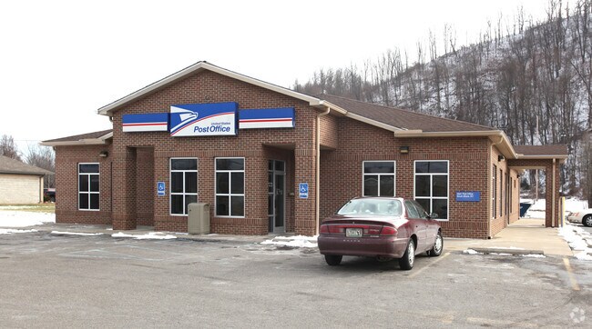
11 Narco Dr, South Shore, KY 41175


NEARBY LISTINGS FOR SALE OR LEASE
Property Detail
11 Narco Dr
067-30-01-033.00
NARCO DR 1.4945 AC POST OFFICE
Institutionalgeneral
Greenup
X
Kentucky
39145C0402F
1.49 AC
2025
Greenup County
2025
Huntington/Ashland
040600
Huntington-Ashland, WV-KY-OH
5,808 SF
DEMOGRAPHICS near 11 Narco Dr
1 Mile
3 Mile
5 Mile
2024 Total Population
1,259
18,667
29,408
2029 Population
1,208
18,224
28,778
Pop Growth 2024-2029
(4.05%)
(2.37%)
(2.14%)
Average Age
41
40
41
2024 Total Households
550
7,833
12,382
HH Growth 2024-2029
(4.00%)
(2.37%)
(2.15%)
Median Household Inc
$29,855
$27,995
$31,116
Avg Household Size
2.20
2.20
2.20
2024 Avg HH Vehicles
2.00
1.00
2.00
Median Home Value
$86,363
$79,143
$82,014
Median Year Built
1970
1952
1956
Nearby Places
Map Layers
Map Styles
 Street
 Aerial
- Restaurants
- Banks
- Shops
- Fitness
- Groceries
PUBLIC TRANSPORTATION
COMMUTER RAIL
DRIVE
WALK
Distance
1 min
17 min
0.6 mi
AIRPORT
Tri-State/Milton J Ferguson Field
DRIVE
WALK
Distance
Tri-State/Milton J Ferguson Field
53 min
41.3 mi
Nearby Properties
Address
Land Use
TOTAL SIZE
Lot Size
Zoning
Address
Land Use
TOTAL SIZE
Lot Size
Zoning
15.67 AC
Address
Land Use
TOTAL SIZE
Lot Size
Zoning
3.57 AC
Address
Land Use
TOTAL SIZE
Lot Size
Zoning
0.26 AC
Address
Land Use
TOTAL SIZE
Lot Size
Zoning
0.30 AC
Address
Land Use
TOTAL SIZE
Lot Size
Zoning
1,680 SF
164.70 AC
Address
Land Use
TOTAL SIZE
Lot Size
Zoning
2.47 AC
Address
Land Use
TOTAL SIZE
Lot Size
Zoning
23.14 AC
Address
Land Use
TOTAL SIZE
Lot Size
Zoning
277.25 AC
Address
Land Use
TOTAL SIZE
Lot Size
Zoning
4.17 AC
Address
Land Use
TOTAL SIZE
Lot Size
Zoning
11.26 AC
Address
Land Use
TOTAL SIZE
Lot Size
Zoning
Address
Land Use
TOTAL SIZE
Lot Size
Zoning
2.71 AC
Address
Land Use
TOTAL SIZE
Lot Size
Zoning
0.91 AC
Address
Land Use
TOTAL SIZE
Lot Size
Zoning
16.98 AC
Address
Land Use
TOTAL SIZE
Lot Size
Zoning
1.18 AC
Address
Land Use
TOTAL SIZE
Lot Size
Zoning
17,946 SF
2.33 AC
Address
Land Use
TOTAL SIZE
Lot Size
Zoning
1.58 AC
Address
Land Use
TOTAL SIZE
Lot Size
Zoning
Address
Land Use
TOTAL SIZE
Lot Size
Zoning
31.88 AC
Address
Land Use
TOTAL SIZE
Lot Size
Zoning
28.24 AC
Address
Land Use
TOTAL SIZE
Lot Size
Zoning
25,200 SF
10 AC
Address
Land Use
TOTAL SIZE
Lot Size
Zoning
0.12 AC
Address
Land Use
TOTAL SIZE
Lot Size
Zoning
1.57 AC
Address
Land Use
TOTAL SIZE
Lot Size
Zoning
0.25 AC
Address
Land Use
TOTAL SIZE
Lot Size
Zoning
16.84 AC
Address
Land Use
TOTAL SIZE
Lot Size
Zoning
3.09 AC
Address
Land Use
TOTAL SIZE
Lot Size
Zoning
40,000 SF
9.93 AC
Address
Land Use
TOTAL SIZE
Lot Size
Zoning
2.80 AC
Address
Land Use
TOTAL SIZE
Lot Size
Zoning
Address
Land Use
TOTAL SIZE
Lot Size
Zoning
8.04 AC
The World's #1 Commercial Real Estate Marketplace
Connect with us
© 2026 CoStar Group
The information above has been obtained from sources believed reliable. While we do not doubt its accuracy we have not verified it and make no guarantee, warranty or representation about it. It is your responsibility to independently confirm its accuracy and completeness. Any projections, opinions, assumptions, or estimates used are for example only and do not represent the current or future performance of the property. The value of this transaction to you depends on tax and other factors which should be evaluated by your tax, financial, and legal advisors. You and your advisors should conduct a careful, independent investigation of the property to determine to your satisfaction the suitability of the property for your needs.