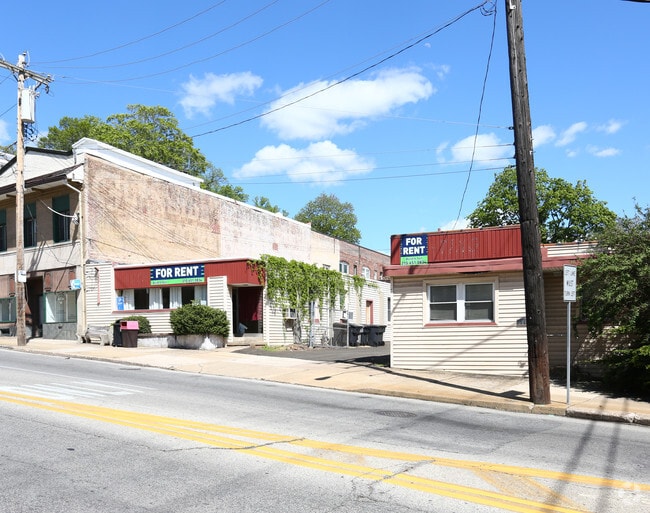
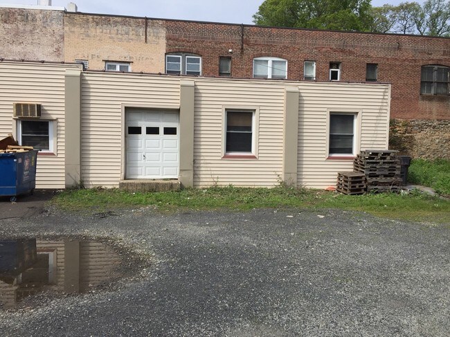
Property Record
11 S Easton Rd, Glenside, PA 19038

NEARBY LISTINGS FOR SALE OR LEASE
Property Detail
11 S Easton Rd
Philadelphia-Camden-Wilmington, PA-NJ-DE-MD
Ira H Kahan
31-00-08596-004
ASSESSOR BLOCK-UNIT NUMBER 129-93
Restaurantbuilding
Montgomery
X
Pennsylvania
42091C0382G
93
2024
0.28 AC
2025
Horsham/Willow Grove
202603
Philadelphia
3,785 SF
DEMOGRAPHICS near 11 S Easton Rd
1 Mile
3 Mile
5 Mile
2024 Total Population
17,249
142,846
392,588
2029 Population
17,559
143,143
387,231
Pop Growth 2024-2029
+ 1.80%
+ 0.21%
(1.36%)
Average Age
41
42
42
2024 Total Households
6,532
56,788
154,956
HH Growth 2024-2029
+ 1.76%
+ 0.17%
(1.55%)
Median Household Inc
$120,572
$84,941
$72,202
Avg Household Size
2.50
2.40
2.40
2024 Avg HH Vehicles
2.00
2.00
1.00
Median Home Value
$356,998
$302,940
$277,858
Median Year Built
1948
1953
1952
Nearby Places
Map Layers
Map Styles
 Street
 Aerial
- Restaurants
- Banks
- Shops
- Fitness
- Groceries
SALE & LEASE HISTORY
LISTING DATE
SALE/LEASE

Sep 23, 2016
For Sale
Nearby Properties
Address
Land Use
TOTAL SIZE
Lot Size
Zoning
Address
Land Use
TOTAL SIZE
Lot Size
Zoning
1,556,628 SF
7.70 AC
AO
Address
Land Use
TOTAL SIZE
Lot Size
Zoning
638,776 SF
20 AC
RM2
Address
Land Use
TOTAL SIZE
Lot Size
Zoning
2,146,150 SF
119.95 AC
M1
Address
Land Use
TOTAL SIZE
Lot Size
Zoning
649,400 SF
55.03 AC
R1
Address
Land Use
TOTAL SIZE
Lot Size
Zoning
678,360 SF
67.10 AC
LIM
Address
Land Use
TOTAL SIZE
Lot Size
Zoning
487,936 SF
58.50 AC
T
Address
Land Use
TOTAL SIZE
Lot Size
Zoning
148,293 SF
7.45 AC
RM2
Address
Land Use
TOTAL SIZE
Lot Size
Zoning
705,687 SF
19.89 AC
C1
Address
Land Use
TOTAL SIZE
Lot Size
Zoning
263,000 SF
5.31 AC
RM2
Address
Land Use
TOTAL SIZE
Lot Size
Zoning
234,934 SF
43.63 AC
AA
Address
Land Use
TOTAL SIZE
Lot Size
Zoning
635,387 SF
10.12 AC
C1
Address
Land Use
TOTAL SIZE
Lot Size
Zoning
131,720 SF
4.33 AC
RM2
Address
Land Use
TOTAL SIZE
Lot Size
Zoning
316,163 SF
45.32 AC
T
Address
Land Use
TOTAL SIZE
Lot Size
Zoning
557,091 SF
21.87 AC
AO
Address
Land Use
TOTAL SIZE
Lot Size
Zoning
222,235 SF
29.23 AC
A
Address
Land Use
TOTAL SIZE
Lot Size
Zoning
582,294 SF
9.07 AC
C1
Address
Land Use
TOTAL SIZE
Lot Size
Zoning
615,217 SF
33.52 AC
C2
Address
Land Use
TOTAL SIZE
Lot Size
Zoning
182,130 SF
6.45 AC
RSA3
Address
Land Use
TOTAL SIZE
Lot Size
Zoning
435,888 SF
16.35 AC
MD
Address
Land Use
TOTAL SIZE
Lot Size
Zoning
336,650 SF
61.74 AC
R3
Address
Land Use
TOTAL SIZE
Lot Size
Zoning
232,190 SF
34.16 AC
R4
Address
Land Use
TOTAL SIZE
Lot Size
Zoning
259,505 SF
42.19 AC
V
Address
Land Use
TOTAL SIZE
Lot Size
Zoning
130,115 SF
10.45 AC
PB
Address
Land Use
TOTAL SIZE
Lot Size
Zoning
139,087 SF
2.76 AC
V
Address
Land Use
TOTAL SIZE
Lot Size
Zoning
232,000 SF
13.71 AC
RSA3
Address
Land Use
TOTAL SIZE
Lot Size
Zoning
103,898 SF
10.23 AC
CA2
Address
Land Use
TOTAL SIZE
Lot Size
Zoning
566,988 SF
29.69 AC
C2
Address
Land Use
TOTAL SIZE
Lot Size
Zoning
574,944 SF
5.45 AC
F2
Address
Land Use
TOTAL SIZE
Lot Size
Zoning
336,463 SF
7.52 AC
Address
Land Use
TOTAL SIZE
Lot Size
Zoning
193,334 SF
32.50 AC
NR
The World's #1 Commercial Real Estate Marketplace
Connect with us
© 2025 CoStar Group
The information above has been obtained from sources believed reliable. While we do not doubt its accuracy we have not verified it and make no guarantee, warranty or representation about it. It is your responsibility to independently confirm its accuracy and completeness. Any projections, opinions, assumptions, or estimates used are for example only and do not represent the current or future performance of the property. The value of this transaction to you depends on tax and other factors which should be evaluated by your tax, financial, and legal advisors. You and your advisors should conduct a careful, independent investigation of the property to determine to your satisfaction the suitability of the property for your needs.