Property Record
11 Wilson Ct, Laconia, NH 03246
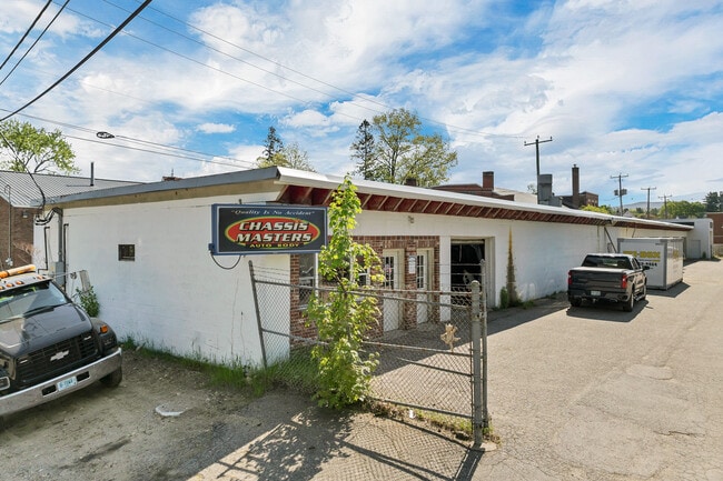
This Property Is For Sale
NEARBY LISTINGS FOR SALE OR LEASE
Property Detail
11 Wilson Ct
Laconia, NH
Belknap
LACO-000411-000049-000012
New Hampshire
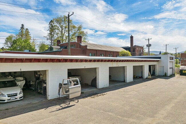
Autorepair
12
2024
0.52 AC
2024
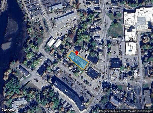
Downtown Laconia
966100
Other Market Areas
7,756 SF
DEMOGRAPHICS near 11 Wilson Ct
1 Mile
3 Mile
5 Mile
2024 Total Population
8,287
19,223
29,133
2029 Population
8,688
20,401
31,338
Pop Growth 2024-2029
+ 4.84%
+ 6.13%
+ 7.57%
Average Age
42
45
46
2024 Total Households
3,643
8,284
12,758
HH Growth 2024-2029
+ 4.78%
+ 6.12%
+ 7.77%
Median Household Inc
$67,209
$84,382
$92,210
Avg Household Size
2.20
2.20
2.20
2024 Avg HH Vehicles
2.00
2.00
2.00
Median Home Value
$286,177
$347,829
$380,476
Median Year Built
1954
1971
1977
Nearby Places
Map Layers
Map Styles
 Street
 Aerial
- Restaurants
- Banks
- Shops
- Fitness
- Groceries
Nearby Properties
Address
Land Use
TOTAL SIZE
Lot Size
Zoning
Address
Land Use
TOTAL SIZE
Lot Size
Zoning
Address
Land Use
TOTAL SIZE
Lot Size
Zoning
1,370 SF
92.23 AC
UC
Address
Land Use
TOTAL SIZE
Lot Size
Zoning
147,353 SF
18.97 AC
UC
Address
Land Use
TOTAL SIZE
Lot Size
Zoning
1,600 SF
24 AC
RS
Address
Land Use
TOTAL SIZE
Lot Size
Zoning
57.90 AC
C
Address
Land Use
TOTAL SIZE
Lot Size
Zoning
78,038 SF
35 AC
RA
Address
Land Use
TOTAL SIZE
Lot Size
Zoning
90,077 SF
25 AC
RA
Address
Land Use
TOTAL SIZE
Lot Size
Zoning
1,954 SF
Address
Land Use
TOTAL SIZE
Lot Size
Zoning
21.50 AC
C
Address
Land Use
TOTAL SIZE
Lot Size
Zoning
9.63 AC
C
Address
Land Use
TOTAL SIZE
Lot Size
Zoning
77,703 SF
1.50 AC
UC
Address
Land Use
TOTAL SIZE
Lot Size
Zoning
210,552 SF
28.55 AC
COM
Address
Land Use
TOTAL SIZE
Lot Size
Zoning
2,624 SF
10.50 AC
RA
Address
Land Use
TOTAL SIZE
Lot Size
Zoning
53,766 SF
1.30 AC
UC
Address
Land Use
TOTAL SIZE
Lot Size
Zoning
49,398 SF
29.36 AC
RS
Address
Land Use
TOTAL SIZE
Lot Size
Zoning
29,508 SF
6.38 AC
RA
Address
Land Use
TOTAL SIZE
Lot Size
Zoning
104,952 SF
5.10 AC
C
Address
Land Use
TOTAL SIZE
Lot Size
Zoning
4,943 SF
6.71 AC
UC
Address
Land Use
TOTAL SIZE
Lot Size
Zoning
7,150 SF
4.40 AC
UC
Address
Land Use
TOTAL SIZE
Lot Size
Zoning
276 SF
21.72 AC
RS
Address
Land Use
TOTAL SIZE
Lot Size
Zoning
30,930 SF
11.11 AC
UC
Address
Land Use
TOTAL SIZE
Lot Size
Zoning
188,960 SF
19.70 AC
IP
Address
Land Use
TOTAL SIZE
Lot Size
Zoning
43,955 SF
5.06 AC
RA
Address
Land Use
TOTAL SIZE
Lot Size
Zoning
148,787 SF
15.47 AC
IP
Address
Land Use
TOTAL SIZE
Lot Size
Zoning
15,086 SF
4.82 AC
CR
Address
Land Use
TOTAL SIZE
Lot Size
Zoning
37,344 SF
15.35 AC
RS
Address
Land Use
TOTAL SIZE
Lot Size
Zoning
46,863 SF
8.71 AC
UC
Address
Land Use
TOTAL SIZE
Lot Size
Zoning
10 AC
C
Address
Land Use
TOTAL SIZE
Lot Size
Zoning
528 SF
17 AC
UC
Address
Land Use
TOTAL SIZE
Lot Size
Zoning
35,647 SF
38 AC
RS
The World's #1 Commercial Real Estate Marketplace
Connect with us
© 2026 CoStar Group
The information above has been obtained from sources believed reliable. While we do not doubt its accuracy we have not verified it and make no guarantee, warranty or representation about it. It is your responsibility to independently confirm its accuracy and completeness. Any projections, opinions, assumptions, or estimates used are for example only and do not represent the current or future performance of the property. The value of this transaction to you depends on tax and other factors which should be evaluated by your tax, financial, and legal advisors. You and your advisors should conduct a careful, independent investigation of the property to determine to your satisfaction the suitability of the property for your needs.