Property Record
110 6Th Ave S, Birmingham, AL 35205
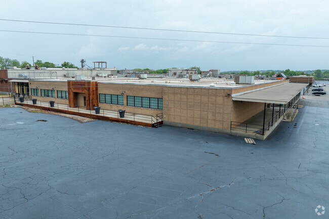


This Property Is For Sale
Property Detail
110 6Th Ave S
29-00-02-2-017-002.000
LOT 1-A GOLDEN FLAKE RESUR 109/88
Warehouse
JEFFERSON
M1
Alabama
B and X Area of moderate flood hazard, usually the area between the limits of the 100-year and 500-year floods.
1-a
2024
11 AC
2025
Westside
004902
Birmingham
225,899 SF
Birmingham, AL
NEARBY LISTINGS FOR SALE OR LEASE
DEMOGRAPHICS near 110 6Th Ave S
1 mile
3 mile
5 mile
2025 Total Population
9,668
88,747
179,657
2030 Population
10,057
90,111
180,532
Pop Growth 2025-2030
+ 4.02%
+ 1.54%
+ 0.49%
Average Age
38
38
39
2025 Total Households
4,748
40,361
78,151
HH Growth 2025-2030
+ 4.04%
+ 1.51%
+ 0.45%
Median Household Inc
$37,227
$46,159
$50,176
Avg Household Size
1.90
1.90
2.10
2025 Avg HH Vehicles
1.00
1.00
2.00
Median Home Value
$115,498
$240,338
$247,840
Median Year Built
1971
1966
1964
Nearby Places
Map Layers
Map Styles
 Street
 Aerial
Layers
 Traffic
 Biking
Places
Listings with unknown addresses are not visible on the map
- Restaurants
- Banks
- Shops
- Fitness
- Groceries
PUBLIC TRANSPORTATION
COMMUTER RAIL
Birmingham (Crescent - Amtrak)
Drive
Walk
Distance
Birmingham (Crescent - Amtrak)
4 min
1.8 mi
AIRPORT
Birmingham-Shuttlesworth International
Drive
Walk
Distance
Birmingham-Shuttlesworth International
12 min
6.9 mi
Freight Ports
Port of Mobile
Drive
Walk
Distance
Port of Mobile
279 min
255.1 mi
Nearby Properties
Address
Land Use
TOTAL SIZE
Lot Size
Zoning
Address
Land Use
TOTAL SIZE
Lot Size
Zoning
296,284 SF
12 AC
OI
Address
Land Use
TOTAL SIZE
Lot Size
Zoning
305,826 SF
4 AC
B4
Address
Land Use
TOTAL SIZE
Lot Size
Zoning
189,447 SF
4 AC
B4
Address
Land Use
TOTAL SIZE
Lot Size
Zoning
224,049 SF
4 AC
M1
Address
Land Use
TOTAL SIZE
Lot Size
Zoning
239,334 SF
4 AC
B6
Address
Land Use
TOTAL SIZE
Lot Size
Zoning
203,878 SF
13 AC
B6
Address
Land Use
TOTAL SIZE
Lot Size
Zoning
183,862 SF
10 AC
B4
Address
Land Use
TOTAL SIZE
Lot Size
Zoning
230,441 SF
10 AC
M1
Address
Land Use
TOTAL SIZE
Lot Size
Zoning
106,144 SF
1 AC
B4
Address
Land Use
TOTAL SIZE
Lot Size
Zoning
94,958 SF
4 AC
M1
Address
Land Use
TOTAL SIZE
Lot Size
Zoning
334,463 SF
2 AC
B4
Address
Land Use
TOTAL SIZE
Lot Size
Zoning
57,066 SF
1 AC
B4
Address
Land Use
TOTAL SIZE
Lot Size
Zoning
46,161 SF
1 AC
M1-B
Address
Land Use
TOTAL SIZE
Lot Size
Zoning
95,993 SF
3.67 AC
M1
Address
Land Use
TOTAL SIZE
Lot Size
Zoning
229,669 SF
2.75 AC
B4
Address
Land Use
TOTAL SIZE
Lot Size
Zoning
109,411 SF
3 AC
B4
Address
Land Use
TOTAL SIZE
Lot Size
Zoning
344,150 SF
42 AC
R5
Address
Land Use
TOTAL SIZE
Lot Size
Zoning
2 AC
M1-B
Address
Land Use
TOTAL SIZE
Lot Size
Zoning
1,666 SF
2 AC
M1
Address
Land Use
TOTAL SIZE
Lot Size
Zoning
30,453 SF
0.87 AC
B2
Address
Land Use
TOTAL SIZE
Lot Size
Zoning
2 AC
B4
Address
Land Use
TOTAL SIZE
Lot Size
Zoning
29,136 SF
2 AC
B4
Address
Land Use
TOTAL SIZE
Lot Size
Zoning
79,458 SF
1 AC
B4
Address
Land Use
TOTAL SIZE
Lot Size
Zoning
143,200 SF
23.49 AC
R3/O
Address
Land Use
TOTAL SIZE
Lot Size
Zoning
416,477 SF
80 AC
R5
Address
Land Use
TOTAL SIZE
Lot Size
Zoning
109,819 SF
2.91 AC
M2
Address
Land Use
TOTAL SIZE
Lot Size
Zoning
62,350 SF
1.29 AC
B-4
Address
Land Use
TOTAL SIZE
Lot Size
Zoning
156,986 SF
1.29 AC
M1
Address
Land Use
TOTAL SIZE
Lot Size
Zoning
96,102 SF
1.74 AC
B4
Address
Land Use
TOTAL SIZE
Lot Size
Zoning
2 AC
B4
The World's #1 Commercial Real Estate Marketplace
Connect with us
© 2026 CoStar Group
The information above has been obtained from sources believed reliable. While we do not doubt its accuracy we have not verified it and make no guarantee, warranty or representation about it. It is your responsibility to independently confirm its accuracy and completeness. Any projections, opinions, assumptions, or estimates used are for example only and do not represent the current or future performance of the property. The value of this transaction to you depends on tax and other factors which should be evaluated by your tax, financial, and legal advisors. You and your advisors should conduct a careful, independent investigation of the property to determine to your satisfaction the suitability of the property for your needs.