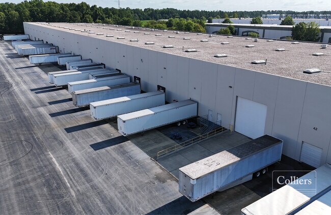
Property Record
110 Belk Ct, Blythewood, SC 29016


NEARBY LISTINGS FOR SALE OR LEASE
Property Detail
110 Belk Ct
17600-01-32
TRACT 2 #PR RB428-2573 RB886-540
Commercialnec
Richland
X
South Carolina
45079C0137L
10.48 AC
2025
Northeast Columbia
2024
Columbia
010105
Columbia, SC
178,080 SF
DEMOGRAPHICS near 110 Belk Ct
1 Mile
3 Mile
5 Mile
2024 Total Population
2,024
29,527
76,743
2029 Population
2,090
30,275
78,237
Pop Growth 2024-2029
+ 3.26%
+ 2.53%
+ 1.95%
Average Age
35
36
37
2024 Total Households
813
10,624
28,518
HH Growth 2024-2029
+ 3.44%
+ 2.72%
+ 1.95%
Median Household Inc
$63,541
$80,087
$72,478
Avg Household Size
2.50
2.70
2.60
2024 Avg HH Vehicles
2.00
2.00
2.00
Median Home Value
$226,046
$233,087
$217,714
Median Year Built
2010
2007
2003
Nearby Places
Map Layers
Map Styles
 Street
 Aerial
- Restaurants
- Banks
- Shops
- Fitness
- Groceries
PUBLIC TRANSPORTATION
AIRPORT
Columbia Metro
DRIVE
WALK
Distance
Columbia Metro
29 min
25.9 mi
Freight Ports
Georgia Ports - Savannah
DRIVE
WALK
Distance
Georgia Ports - Savannah
1 min
141.7 mi
SALE & LEASE HISTORY
LISTING DATE
SALE/LEASE

Mar 29, 2024
For Lease
Jan 08, 2018
For Lease
Nearby Properties
Address
Land Use
TOTAL SIZE
Lot Size
Zoning
Address
Land Use
TOTAL SIZE
Lot Size
Zoning
231,760 SF
23.84 AC
M-1
Address
Land Use
TOTAL SIZE
Lot Size
Zoning
83,808 SF
95.58 AC
PDD
Address
Land Use
TOTAL SIZE
Lot Size
Zoning
18,000 SF
52.20 AC
GC
Address
Land Use
TOTAL SIZE
Lot Size
Zoning
325,344 SF
71.41 AC
HI
Address
Land Use
TOTAL SIZE
Lot Size
Zoning
33.32 AC
M-1
Address
Land Use
TOTAL SIZE
Lot Size
Zoning
306,612 SF
20.94 AC
GC
Address
Land Use
TOTAL SIZE
Lot Size
Zoning
349,845 SF
23.62 AC
HI
Address
Land Use
TOTAL SIZE
Lot Size
Zoning
462,800 SF
104.82 AC
M-1
Address
Land Use
TOTAL SIZE
Lot Size
Zoning
253,136 SF
18.85 AC
PUD-1R
Address
Land Use
TOTAL SIZE
Lot Size
Zoning
269,200 SF
40.65 AC
M-1
Address
Land Use
TOTAL SIZE
Lot Size
Zoning
176,878 SF
15.48 AC
PDD
Address
Land Use
TOTAL SIZE
Lot Size
Zoning
51,803 SF
11.99 AC
M-1
Address
Land Use
TOTAL SIZE
Lot Size
Zoning
217,580 SF
32.47 AC
M-1
Address
Land Use
TOTAL SIZE
Lot Size
Zoning
65,665 SF
7.03 AC
GC
Address
Land Use
TOTAL SIZE
Lot Size
Zoning
184,000 SF
9.67 AC
M-1
Address
Land Use
TOTAL SIZE
Lot Size
Zoning
275,753 SF
26.21 AC
HI
Address
Land Use
TOTAL SIZE
Lot Size
Zoning
148,809 SF
17.52 AC
M-1
Address
Land Use
TOTAL SIZE
Lot Size
Zoning
129,017 SF
14.70 AC
PDD
Address
Land Use
TOTAL SIZE
Lot Size
Zoning
71,394 SF
12.05 AC
M-1
Address
Land Use
TOTAL SIZE
Lot Size
Zoning
75,893 SF
10 AC
PDD
Address
Land Use
TOTAL SIZE
Lot Size
Zoning
169,600 SF
10.80 AC
M-1
Address
Land Use
TOTAL SIZE
Lot Size
Zoning
55,747 SF
5.80 AC
M-1
Address
Land Use
TOTAL SIZE
Lot Size
Zoning
72,549 SF
2.49 AC
PDD
Address
Land Use
TOTAL SIZE
Lot Size
Zoning
37,971 SF
8.40 AC
PDD
Address
Land Use
TOTAL SIZE
Lot Size
Zoning
42,938 SF
7.30 AC
HI
Address
Land Use
TOTAL SIZE
Lot Size
Zoning
103,719 SF
4.05 AC
RM-HD
Address
Land Use
TOTAL SIZE
Lot Size
Zoning
2,740 SF
5 AC
D-1
Address
Land Use
TOTAL SIZE
Lot Size
Zoning
74,014 SF
22.02 AC
HI
Address
Land Use
TOTAL SIZE
Lot Size
Zoning
45,820 SF
4.58 AC
M-1
The World's #1 Commercial Real Estate Marketplace
Connect with us
© 2025 CoStar Group
The information above has been obtained from sources believed reliable. While we do not doubt its accuracy we have not verified it and make no guarantee, warranty or representation about it. It is your responsibility to independently confirm its accuracy and completeness. Any projections, opinions, assumptions, or estimates used are for example only and do not represent the current or future performance of the property. The value of this transaction to you depends on tax and other factors which should be evaluated by your tax, financial, and legal advisors. You and your advisors should conduct a careful, independent investigation of the property to determine to your satisfaction the suitability of the property for your needs.