Property Record
110 Crest Dr, Watsonville, CA 95076


Property Detail
110 Crest Dr
046-271-22-000
SANTA CRUZ
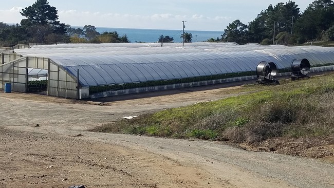
Horticulturegrowinghousesagricultural
California
CA
33,42
B and X Area of moderate flood hazard, usually the area between the limits of the 100-year and 500-year floods.
19.90 AC
2024
Watsonville
2025
Santa Cruz/Watsonville
122300
Santa Cruz-Watsonville, CA
236,022 SF
NEARBY LISTINGS FOR SALE OR LEASE
DEMOGRAPHICS near 110 Crest Dr
1 mile
3 mile
5 mile
2025 Total Population
826
7,818
64,867
2030 Population
858
7,824
63,588
Pop Growth 2025-2030
+ 3.87%
+ 0.08%
(1.97%)
Average Age
48
45
39
2025 Total Households
330
2,932
19,722
HH Growth 2025-2030
+ 3.64%
(0.27%)
(2.10%)
Median Household Inc
$164,535
$133,253
$95,735
Avg Household Size
2.50
2.60
3.10
2025 Avg HH Vehicles
3.00
2.00
2.00
Median Home Value
$1,100,578
$1,077,129
$909,977
Median Year Built
1975
1975
1974
Nearby Places
Map Layers
Map Styles
 Street
 Aerial
Layers
 Traffic
 Biking
Places
Listings with unknown addresses are not visible on the map
- Restaurants
- Banks
- Shops
- Fitness
- Groceries
PUBLIC TRANSPORTATION
AIRPORT
Monterey Regional
Drive
Walk
Distance
Monterey Regional
42 min
32.3 mi
Freight Ports
Port of Redwood City
Drive
Walk
Distance
Port of Redwood City
81 min
59.7 mi
SALE & LEASE HISTORY
LISTING DATE
SALE/LEASE

Dec 19, 2019
For Sale
Nearby Properties
Address
Land Use
TOTAL SIZE
Lot Size
Zoning
Address
Land Use
TOTAL SIZE
Lot Size
Zoning
146,574 SF
9.97 AC
Address
Land Use
TOTAL SIZE
Lot Size
Zoning
369 AC
CA-P
Address
Land Use
TOTAL SIZE
Lot Size
Zoning
16,252 SF
12.79 AC
CA
Address
Land Use
TOTAL SIZE
Lot Size
Zoning
3.84 AC
RM-4
Address
Land Use
TOTAL SIZE
Lot Size
Zoning
39,711 SF
3.88 AC
Address
Land Use
TOTAL SIZE
Lot Size
Zoning
2.71 AC
Address
Land Use
TOTAL SIZE
Lot Size
Zoning
85,044 SF
6.95 AC
Address
Land Use
TOTAL SIZE
Lot Size
Zoning
0.35 AC
VA
Address
Land Use
TOTAL SIZE
Lot Size
Zoning
36.42 AC
CA
Address
Land Use
TOTAL SIZE
Lot Size
Zoning
44,868 SF
4.08 AC
C-1
Address
Land Use
TOTAL SIZE
Lot Size
Zoning
92.47 AC
CA
Address
Land Use
TOTAL SIZE
Lot Size
Zoning
8,974 SF
17.20 AC
CA
Address
Land Use
TOTAL SIZE
Lot Size
Zoning
6,082 SF
1.05 AC
RA
Address
Land Use
TOTAL SIZE
Lot Size
Zoning
185.13 AC
CA
Address
Land Use
TOTAL SIZE
Lot Size
Zoning
7,077 SF
10.06 AC
CA
Address
Land Use
TOTAL SIZE
Lot Size
Zoning
211.97 AC
CA
Address
Land Use
TOTAL SIZE
Lot Size
Zoning
51,885 SF
4.95 AC
CA
Address
Land Use
TOTAL SIZE
Lot Size
Zoning
2,232 SF
50.80 AC
CA
Address
Land Use
TOTAL SIZE
Lot Size
Zoning
10,741 SF
1.82 AC
RA
Address
Land Use
TOTAL SIZE
Lot Size
Zoning
4.40 AC
Address
Land Use
TOTAL SIZE
Lot Size
Zoning
5.03 AC
Address
Land Use
TOTAL SIZE
Lot Size
Zoning
5,434 SF
1.97 AC
RR
Address
Land Use
TOTAL SIZE
Lot Size
Zoning
13,899 SF
1.04 AC
Address
Land Use
TOTAL SIZE
Lot Size
Zoning
82,930 SF
10.21 AC
CA
Address
Land Use
TOTAL SIZE
Lot Size
Zoning
219,138 SF
19.50 AC
CA
Address
Land Use
TOTAL SIZE
Lot Size
Zoning
25,449 SF
1.77 AC
RM-2.5-H
Address
Land Use
TOTAL SIZE
Lot Size
Zoning
1,704 SF
76.30 AC
CA
Address
Land Use
TOTAL SIZE
Lot Size
Zoning
12,115 SF
3.10 AC
SU
Address
Land Use
TOTAL SIZE
Lot Size
Zoning
188,692 SF
26.95 AC
CA
The World's #1 Commercial Real Estate Marketplace
Connect with us
© 2026 CoStar Group
The information above has been obtained from sources believed reliable. While we do not doubt its accuracy we have not verified it and make no guarantee, warranty or representation about it. It is your responsibility to independently confirm its accuracy and completeness. Any projections, opinions, assumptions, or estimates used are for example only and do not represent the current or future performance of the property. The value of this transaction to you depends on tax and other factors which should be evaluated by your tax, financial, and legal advisors. You and your advisors should conduct a careful, independent investigation of the property to determine to your satisfaction the suitability of the property for your needs.