Property Record
110 Dewitt Ln, Spring Lake, MI 49456
NEARBY LISTINGS FOR SALE OR LEASE
Property Detail
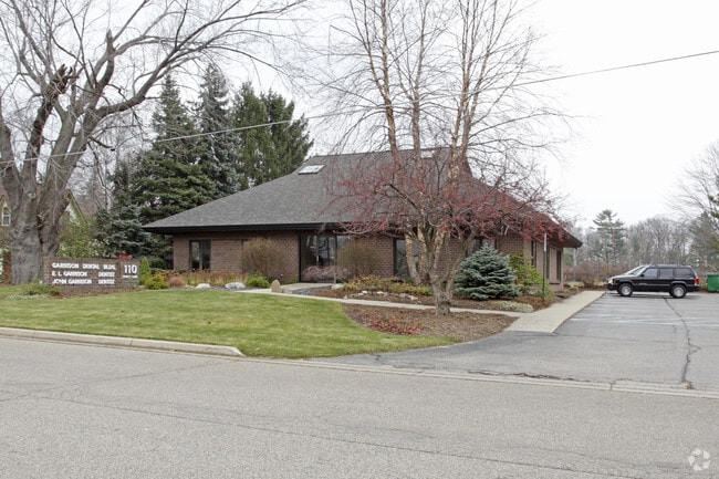
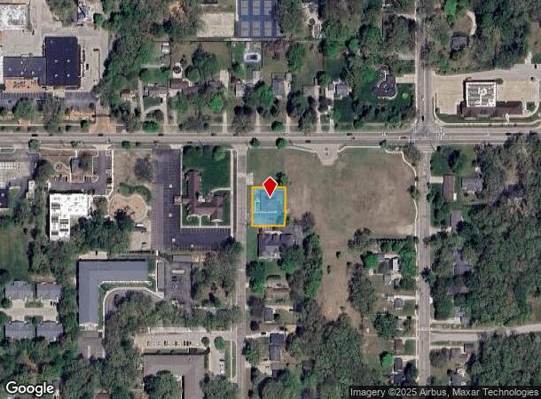
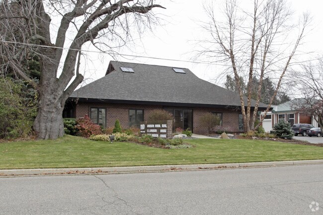
110 Dewitt Ln
70-03-14-376-028
PART OF SE 1/4 OF SW 1/4 COM S 0D 21M W 122 FT FROM INTERS OF S LI OF M-104 & E LI OF DEWITT LANE, TH S 0D 21M W 125 FT, E
Dentalbldg
Ottawa
X
Michigan
26139C0083F
0.30 AC
2025
Grand Haven/Ferrysburg
2025
West Michigan
021100
Grand Rapids-Wyoming-Kentwood, MI
2,630 SF
DEMOGRAPHICS near 110 Dewitt Ln
1 Mile
3 Mile
5 Mile
2024 Total Population
5,535
33,516
57,756
2029 Population
5,870
35,571
60,999
Pop Growth 2024-2029
+ 6.05%
+ 6.13%
+ 5.62%
Average Age
43
43
42
2024 Total Households
2,358
14,253
24,038
HH Growth 2024-2029
+ 6.19%
+ 6.24%
+ 5.75%
Median Household Inc
$72,838
$68,023
$72,418
Avg Household Size
2.30
2.30
2.40
2024 Avg HH Vehicles
2.00
2.00
2.00
Median Home Value
$290,016
$281,583
$283,765
Median Year Built
1977
1977
1983
Nearby Places
Map Layers
Map Styles
 Street
 Aerial
- Restaurants
- Banks
- Shops
- Fitness
- Groceries
PUBLIC TRANSPORTATION
AIRPORT
Gerald R Ford International
DRIVE
WALK
Distance
Gerald R Ford International
55 min
43.8 mi
Nearby Properties
Address
Land Use
TOTAL SIZE
Lot Size
Zoning
Address
Land Use
TOTAL SIZE
Lot Size
Zoning
381,476 SF
17.96 AC
I INDU
Address
Land Use
TOTAL SIZE
Lot Size
Zoning
188,314 SF
9.72 AC
Address
Land Use
TOTAL SIZE
Lot Size
Zoning
184,312 SF
11.47 AC
PUD
Address
Land Use
TOTAL SIZE
Lot Size
Zoning
131,302 SF
4.70 AC
Address
Land Use
TOTAL SIZE
Lot Size
Zoning
191,144 SF
16.60 AC
Address
Land Use
TOTAL SIZE
Lot Size
Zoning
121,189 SF
8.73 AC
PUD
Address
Land Use
TOTAL SIZE
Lot Size
Zoning
192,833 SF
14.44 AC
I INDU
Address
Land Use
TOTAL SIZE
Lot Size
Zoning
40,251 SF
159.38 AC
PR
Address
Land Use
TOTAL SIZE
Lot Size
Zoning
207,571 SF
22 AC
LI
Address
Land Use
TOTAL SIZE
Lot Size
Zoning
192,641 SF
25.16 AC
Address
Land Use
TOTAL SIZE
Lot Size
Zoning
37,874 SF
20.27 AC
PORT IN
Address
Land Use
TOTAL SIZE
Lot Size
Zoning
242,746 SF
36.05 AC
I INDU
Address
Land Use
TOTAL SIZE
Lot Size
Zoning
55,600 SF
LI
Address
Land Use
TOTAL SIZE
Lot Size
Zoning
90,701 SF
5.65 AC
Address
Land Use
TOTAL SIZE
Lot Size
Zoning
125,088 SF
7.24 AC
CBD
Address
Land Use
TOTAL SIZE
Lot Size
Zoning
2,724 SF
56.50 AC
MHP
Address
Land Use
TOTAL SIZE
Lot Size
Zoning
143,083 SF
12.25 AC
Address
Land Use
TOTAL SIZE
Lot Size
Zoning
148,413 SF
38.08 AC
Address
Land Use
TOTAL SIZE
Lot Size
Zoning
105,179 SF
20.81 AC
I INDU
Address
Land Use
TOTAL SIZE
Lot Size
Zoning
99,081 SF
11.66 AC
R-4
Address
Land Use
TOTAL SIZE
Lot Size
Zoning
27,006 SF
6.12 AC
MU
Address
Land Use
TOTAL SIZE
Lot Size
Zoning
127,211 SF
11.74 AC
I INDU
Address
Land Use
TOTAL SIZE
Lot Size
Zoning
50,969 SF
1.67 AC
Address
Land Use
TOTAL SIZE
Lot Size
Zoning
64,143 SF
11.43 AC
LI
Address
Land Use
TOTAL SIZE
Lot Size
Zoning
42,300 SF
3.12 AC
Address
Land Use
TOTAL SIZE
Lot Size
Zoning
61,612 SF
2.12 AC
PUD
Address
Land Use
TOTAL SIZE
Lot Size
Zoning
113,167 SF
6.72 AC
I INDU
Address
Land Use
TOTAL SIZE
Lot Size
Zoning
89,974 SF
7.51 AC
Address
Land Use
TOTAL SIZE
Lot Size
Zoning
104,776 SF
9.43 AC
Address
Land Use
TOTAL SIZE
Lot Size
Zoning
12,389 SF
17.59 AC
The World's #1 Commercial Real Estate Marketplace
Connect with us
© 2026 CoStar Group
The information above has been obtained from sources believed reliable. While we do not doubt its accuracy we have not verified it and make no guarantee, warranty or representation about it. It is your responsibility to independently confirm its accuracy and completeness. Any projections, opinions, assumptions, or estimates used are for example only and do not represent the current or future performance of the property. The value of this transaction to you depends on tax and other factors which should be evaluated by your tax, financial, and legal advisors. You and your advisors should conduct a careful, independent investigation of the property to determine to your satisfaction the suitability of the property for your needs.