Property Record
E 2Nd Ave, Pierson, FL 32180
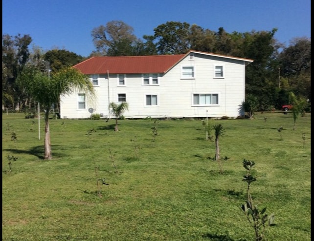
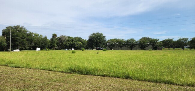
This Property Is For Sale
NEARBY LISTINGS FOR SALE OR LEASE
-
-
View all Pierson listings for sale on LoopNet.com
Property Detail
E 2Nd Ave
Deltona-Daytona Beach-Ormond Beach, FL
Pierson Meadows Mb
4834-11-00-0060
LOT 6 PIERSON MEADOWS MB 54 PG 165 PER OR 6702 PG 2366 PER OR 6778 PGS 4182-4183
Agriculturalland
Volusia
X
Florida
12127C0300H
6
2025
1 AC
2026
NW Volusia County
090101
Deltona/Daytona Beach
DEMOGRAPHICS near E 2Nd Ave
1 Mile
3 Mile
5 Mile
2024 Total Population
593
2,423
3,463
2029 Population
649
2,661
3,801
Pop Growth 2024-2029
+ 9.44%
+ 9.82%
+ 9.76%
Average Age
41
42
42
2024 Total Households
196
851
1,260
HH Growth 2024-2029
+ 9.69%
+ 9.99%
+ 9.92%
Median Household Inc
$65,073
$64,106
$64,320
Avg Household Size
2.80
2.70
2.60
2024 Avg HH Vehicles
2.00
2.00
2.00
Median Home Value
$266,666
$270,279
$274,065
Median Year Built
1980
1980
1980
Nearby Places
Map Layers
Map Styles
 Street
 Aerial
- Restaurants
- Banks
- Shops
- Fitness
- Groceries
PUBLIC TRANSPORTATION
AIRPORT
Daytona Beach International
DRIVE
WALK
Distance
Daytona Beach International
46 min
33.2 mi
Freight Ports
Port Canaveral
DRIVE
WALK
Distance
Port Canaveral
119 min
95.4 mi
Nearby Properties
Address
Land Use
TOTAL SIZE
Lot Size
Zoning
Address
Land Use
TOTAL SIZE
Lot Size
Zoning
227,542 SF
90.24 AC
Address
Land Use
TOTAL SIZE
Lot Size
Zoning
93,639 SF
23.48 AC
A1
Address
Land Use
TOTAL SIZE
Lot Size
Zoning
46,635 SF
6.17 AC
Address
Land Use
TOTAL SIZE
Lot Size
Zoning
18,440 SF
15.90 AC
A1
Address
Land Use
TOTAL SIZE
Lot Size
Zoning
2,268 SF
11.36 AC
A2
Address
Land Use
TOTAL SIZE
Lot Size
Zoning
27,005 SF
7.38 AC
14A1
Address
Land Use
TOTAL SIZE
Lot Size
Zoning
38,891 SF
20.30 AC
A1
Address
Land Use
TOTAL SIZE
Lot Size
Zoning
11,564 SF
4.24 AC
Address
Land Use
TOTAL SIZE
Lot Size
Zoning
11,076 SF
145 AC
A2
Address
Land Use
TOTAL SIZE
Lot Size
Zoning
5,121 SF
85.04 AC
RC
Address
Land Use
TOTAL SIZE
Lot Size
Zoning
10,672 SF
1.69 AC
Address
Land Use
TOTAL SIZE
Lot Size
Zoning
3,910 SF
33.31 AC
A1
Address
Land Use
TOTAL SIZE
Lot Size
Zoning
17,566 SF
2.47 AC
Address
Land Use
TOTAL SIZE
Lot Size
Zoning
4,565 SF
41.82 AC
A1
Address
Land Use
TOTAL SIZE
Lot Size
Zoning
6,327 SF
33 AC
Address
Land Use
TOTAL SIZE
Lot Size
Zoning
10,674 SF
2 AC
01R4
Address
Land Use
TOTAL SIZE
Lot Size
Zoning
28,834 SF
16.02 AC
MPUD
Address
Land Use
TOTAL SIZE
Lot Size
Zoning
5,496 SF
12.60 AC
A1
Address
Land Use
TOTAL SIZE
Lot Size
Zoning
4,620 SF
4.81 AC
Address
Land Use
TOTAL SIZE
Lot Size
Zoning
5,232 SF
349.31 AC
RC
Address
Land Use
TOTAL SIZE
Lot Size
Zoning
207 AC
Address
Land Use
TOTAL SIZE
Lot Size
Zoning
3,894 SF
20 AC
A1
Address
Land Use
TOTAL SIZE
Lot Size
Zoning
4,724 SF
11.20 AC
Address
Land Use
TOTAL SIZE
Lot Size
Zoning
9,748 SF
0.96 AC
Address
Land Use
TOTAL SIZE
Lot Size
Zoning
3,962 SF
32.09 AC
Address
Land Use
TOTAL SIZE
Lot Size
Zoning
25,120 SF
4 AC
14B2
Address
Land Use
TOTAL SIZE
Lot Size
Zoning
8,494 SF
1.24 AC
Address
Land Use
TOTAL SIZE
Lot Size
Zoning
5,725 SF
9.50 AC
A1
Address
Land Use
TOTAL SIZE
Lot Size
Zoning
4,500 SF
24.24 AC
A2
Address
Land Use
TOTAL SIZE
Lot Size
Zoning
7,838 SF
0.49 AC
The World's #1 Commercial Real Estate Marketplace
Connect with us
© 2026 CoStar Group
The information above has been obtained from sources believed reliable. While we do not doubt its accuracy we have not verified it and make no guarantee, warranty or representation about it. It is your responsibility to independently confirm its accuracy and completeness. Any projections, opinions, assumptions, or estimates used are for example only and do not represent the current or future performance of the property. The value of this transaction to you depends on tax and other factors which should be evaluated by your tax, financial, and legal advisors. You and your advisors should conduct a careful, independent investigation of the property to determine to your satisfaction the suitability of the property for your needs.