Property Record
110 Farley St, Hutto, TX 78634

NEARBY LISTINGS FOR SALE OR LEASE
Property Detail
110 Farley St
Austin-Round Rock-San Marcos, TX
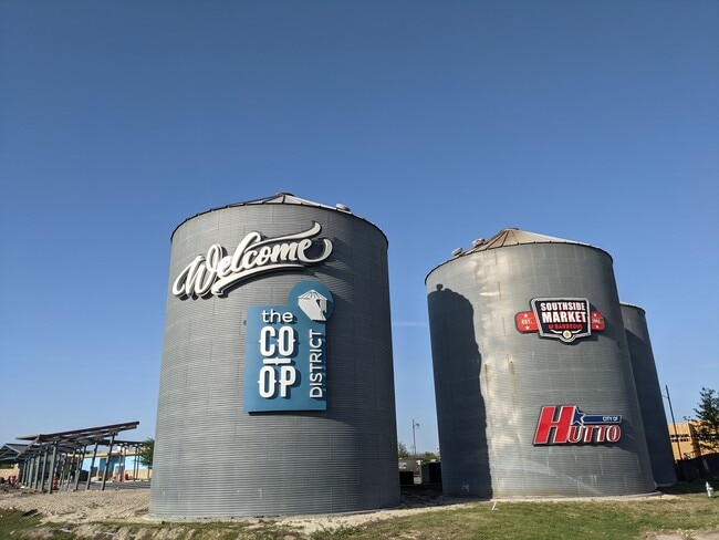
Co-Op Dist(Resub Lots 4A&B&E&5A Of 4A-6A
R590427
S13415 - CO-OP DIST(RESUB LOTS 4A&B&E&5A OF 4A-6A RESUB), LOT 4E-1 (PT), ACRES 0.0491
Commercialacreage
Williamson
X
Texas
48491C0520F
4e
2024
0.05 AC
2025
Georgetown
020813
Austin
DEMOGRAPHICS near 110 Farley St
1 Mile
3 Mile
5 Mile
2024 Total Population
10,347
42,618
97,666
2029 Population
13,179
54,136
120,794
Pop Growth 2024-2029
+ 27.37%
+ 27.03%
+ 23.68%
Average Age
34
34
36
2024 Total Households
3,190
13,863
31,541
HH Growth 2024-2029
+ 27.90%
+ 27.61%
+ 24.42%
Median Household Inc
$95,400
$101,762
$116,997
Avg Household Size
3.20
3.00
3.10
2024 Avg HH Vehicles
2.00
2.00
2.00
Median Home Value
$267,669
$304,398
$359,822
Median Year Built
2007
2009
2009
Nearby Places
Map Layers
Map Styles
 Street
 Aerial
- Restaurants
- Banks
- Shops
- Fitness
- Groceries
PUBLIC TRANSPORTATION
COMMUTER RAIL
Taylor Amtrak (Texas Eagle - Amtrak)
DRIVE
WALK
Distance
Taylor Amtrak (Texas Eagle - Amtrak)
14 min
9.4 mi
AIRPORT
Austin-Bergstrom International
DRIVE
WALK
Distance
Austin-Bergstrom International
41 min
32.3 mi
Freight Ports
Calhoun Port
DRIVE
WALK
Distance
Calhoun Port
202 min
175.2 mi
SALE & LEASE HISTORY
LISTING DATE
SALE/LEASE

Oct 16, 2017
For Lease
Nearby Properties
Address
Land Use
TOTAL SIZE
Lot Size
Zoning
Address
Land Use
TOTAL SIZE
Lot Size
Zoning
533,782 SF
79.41 AC
Address
Land Use
TOTAL SIZE
Lot Size
Zoning
425,891 SF
20.85 AC
Address
Land Use
TOTAL SIZE
Lot Size
Zoning
409,416 SF
22.65 AC
Address
Land Use
TOTAL SIZE
Lot Size
Zoning
243,097 SF
15.73 AC
Address
Land Use
TOTAL SIZE
Lot Size
Zoning
336,672 SF
15.09 AC
Address
Land Use
TOTAL SIZE
Lot Size
Zoning
302,465 SF
15.79 AC
Address
Land Use
TOTAL SIZE
Lot Size
Zoning
315,884 SF
15.05 AC
Address
Land Use
TOTAL SIZE
Lot Size
Zoning
253,225 SF
12.25 AC
Address
Land Use
TOTAL SIZE
Lot Size
Zoning
301,721 SF
16.54 AC
Address
Land Use
TOTAL SIZE
Lot Size
Zoning
304,814 SF
17.04 AC
Address
Land Use
TOTAL SIZE
Lot Size
Zoning
308,759 SF
13.93 AC
Address
Land Use
TOTAL SIZE
Lot Size
Zoning
290,840 SF
20.08 AC
Address
Land Use
TOTAL SIZE
Lot Size
Zoning
76.14 AC
Address
Land Use
TOTAL SIZE
Lot Size
Zoning
230,841 SF
17.51 AC
Address
Land Use
TOTAL SIZE
Lot Size
Zoning
183,310 SF
10.78 AC
Address
Land Use
TOTAL SIZE
Lot Size
Zoning
266,428 SF
58.60 AC
Address
Land Use
TOTAL SIZE
Lot Size
Zoning
338,229 SF
15.38 AC
Address
Land Use
TOTAL SIZE
Lot Size
Zoning
195,520 SF
14.89 AC
Address
Land Use
TOTAL SIZE
Lot Size
Zoning
243,097 SF
12.53 AC
Address
Land Use
TOTAL SIZE
Lot Size
Zoning
154,528 SF
7.23 AC
Address
Land Use
TOTAL SIZE
Lot Size
Zoning
220,850 SF
12.06 AC
Address
Land Use
TOTAL SIZE
Lot Size
Zoning
161,190 SF
8.82 AC
Address
Land Use
TOTAL SIZE
Lot Size
Zoning
297,577 SF
28.22 AC
Address
Land Use
TOTAL SIZE
Lot Size
Zoning
141,718 SF
24.12 AC
Address
Land Use
TOTAL SIZE
Lot Size
Zoning
535,408 SF
30.16 AC
Address
Land Use
TOTAL SIZE
Lot Size
Zoning
147,230 SF
8.05 AC
Address
Land Use
TOTAL SIZE
Lot Size
Zoning
109,908 SF
7.94 AC
Address
Land Use
TOTAL SIZE
Lot Size
Zoning
16.70 AC
Address
Land Use
TOTAL SIZE
Lot Size
Zoning
14.30 AC
Address
Land Use
TOTAL SIZE
Lot Size
Zoning
309,652 SF
29.26 AC
The World's #1 Commercial Real Estate Marketplace
Connect with us
© 2026 CoStar Group
The information above has been obtained from sources believed reliable. While we do not doubt its accuracy we have not verified it and make no guarantee, warranty or representation about it. It is your responsibility to independently confirm its accuracy and completeness. Any projections, opinions, assumptions, or estimates used are for example only and do not represent the current or future performance of the property. The value of this transaction to you depends on tax and other factors which should be evaluated by your tax, financial, and legal advisors. You and your advisors should conduct a careful, independent investigation of the property to determine to your satisfaction the suitability of the property for your needs.