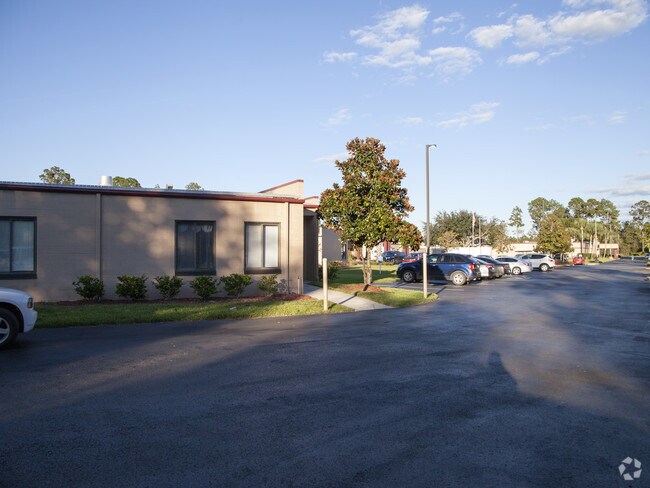
Property Record
110 Kay Larkin Dr, Palatka, FL 32177


NEARBY LISTINGS FOR SALE OR LEASE
-
-
View all Palatka listings for sale on LoopNet.com
Property Detail
110 Kay Larkin Dr
03-10-26-0000-0131-0010
PT OF SW1/4 OF SW1/4 OR514 P6, + OR639 P1307 (SUBJECT TO 10FT, CLAY ELECTRIC ESMT OR533 P70)
Retirementnursinghomecombined
Putnam
X
Florida
12107C0190C
8.99 AC
2025
Florida Central North Area
2025
Other Market Areas
950600
Palatka, FL
44,160 SF
DEMOGRAPHICS near 110 Kay Larkin Dr
1 Mile
3 Mile
5 Mile
2024 Total Population
2,625
16,599
21,338
2029 Population
2,672
17,028
21,928
Pop Growth 2024-2029
+ 1.79%
+ 2.58%
+ 2.77%
Average Age
40
41
41
2024 Total Households
1,006
6,465
8,401
HH Growth 2024-2029
+ 1.29%
+ 2.40%
+ 2.64%
Median Household Inc
$25,474
$30,748
$30,997
Avg Household Size
2.20
2.40
2.40
2024 Avg HH Vehicles
1.00
2.00
2.00
Median Home Value
$133,548
$129,174
$129,990
Median Year Built
1980
1975
1975
Nearby Places
Map Layers
Map Styles
 Street
 Aerial
- Restaurants
- Banks
- Shops
- Fitness
- Groceries
PUBLIC TRANSPORTATION
COMMUTER RAIL
Palatka Amtrak (Silver Meteor - Amtrak, Silver Star - Amtrak)
DRIVE
WALK
Distance
Palatka Amtrak (Silver Meteor - Amtrak, Silver Star - Amtrak)
9 min
3.4 mi
Freight Ports
Jacksonville Port
DRIVE
WALK
Distance
Jacksonville Port
89 min
57.9 mi
Nearby Properties
Address
Land Use
TOTAL SIZE
Lot Size
Zoning
Address
Land Use
TOTAL SIZE
Lot Size
Zoning
211,250 SF
586.70 AC
Address
Land Use
TOTAL SIZE
Lot Size
Zoning
1,242 SF
693.76 AC
Address
Land Use
TOTAL SIZE
Lot Size
Zoning
174,699 SF
41.50 AC
Address
Land Use
TOTAL SIZE
Lot Size
Zoning
152,364 SF
27.76 AC
Address
Land Use
TOTAL SIZE
Lot Size
Zoning
7,139 SF
87.49 AC
Address
Land Use
TOTAL SIZE
Lot Size
Zoning
59,233 SF
29.34 AC
Address
Land Use
TOTAL SIZE
Lot Size
Zoning
106,319 SF
28.86 AC
Address
Land Use
TOTAL SIZE
Lot Size
Zoning
97,240 SF
12.72 AC
Address
Land Use
TOTAL SIZE
Lot Size
Zoning
33,616 SF
38.79 AC
Address
Land Use
TOTAL SIZE
Lot Size
Zoning
43,844 SF
31.63 AC
Address
Land Use
TOTAL SIZE
Lot Size
Zoning
43,080 SF
11.70 AC
Address
Land Use
TOTAL SIZE
Lot Size
Zoning
75,330 SF
6.63 AC
Address
Land Use
TOTAL SIZE
Lot Size
Zoning
1,120 SF
12.44 AC
Address
Land Use
TOTAL SIZE
Lot Size
Zoning
38,392 SF
21.60 AC
Address
Land Use
TOTAL SIZE
Lot Size
Zoning
47,010 SF
9.43 AC
Address
Land Use
TOTAL SIZE
Lot Size
Zoning
39,660 SF
12.04 AC
Address
Land Use
TOTAL SIZE
Lot Size
Zoning
15.93 AC
Address
Land Use
TOTAL SIZE
Lot Size
Zoning
14,040 SF
14.25 AC
Address
Land Use
TOTAL SIZE
Lot Size
Zoning
10,503 SF
1.98 AC
Address
Land Use
TOTAL SIZE
Lot Size
Zoning
2,444 SF
29.51 AC
Address
Land Use
TOTAL SIZE
Lot Size
Zoning
3,002 SF
14.82 AC
Address
Land Use
TOTAL SIZE
Lot Size
Zoning
60,902 SF
13.07 AC
Address
Land Use
TOTAL SIZE
Lot Size
Zoning
64,863 SF
18.29 AC
Address
Land Use
TOTAL SIZE
Lot Size
Zoning
75,592 SF
7.87 AC
Address
Land Use
TOTAL SIZE
Lot Size
Zoning
18,895 SF
11.20 AC
Address
Land Use
TOTAL SIZE
Lot Size
Zoning
6,120 SF
6.32 AC
Address
Land Use
TOTAL SIZE
Lot Size
Zoning
67,425 SF
17.47 AC
Address
Land Use
TOTAL SIZE
Lot Size
Zoning
52,164 SF
10 AC
Address
Land Use
TOTAL SIZE
Lot Size
Zoning
25,124 SF
13.45 AC
The World's #1 Commercial Real Estate Marketplace
Connect with us
© 2026 CoStar Group
The information above has been obtained from sources believed reliable. While we do not doubt its accuracy we have not verified it and make no guarantee, warranty or representation about it. It is your responsibility to independently confirm its accuracy and completeness. Any projections, opinions, assumptions, or estimates used are for example only and do not represent the current or future performance of the property. The value of this transaction to you depends on tax and other factors which should be evaluated by your tax, financial, and legal advisors. You and your advisors should conduct a careful, independent investigation of the property to determine to your satisfaction the suitability of the property for your needs.