Property Record
110 Long Pond Rd, Plymouth, MA 02360
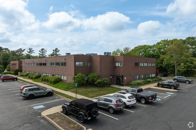
This Property Is For Sale
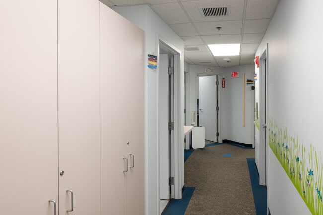
Current Lease Availabilities
NEARBY LISTINGS FOR SALE OR LEASE
Property Detail
110 Long Pond Rd
PLYM-000088-000055B-000002-000003
Long Pond Medical Off
Commercialcondominium
Plymouth
X
Massachusetts
25023C0302K
2-3
2025
Route 3 South
2025
Boston
530600
Boston-Cambridge-Newton, MA-NH
905 SF
DEMOGRAPHICS near 110 Long Pond Rd
1 Mile
3 Mile
5 Mile
2024 Total Population
1,269
19,741
44,262
2029 Population
1,269
19,866
44,740
Pop Growth 2024-2029
0.00%
+ 0.63%
+ 1.08%
Average Age
44
45
46
2024 Total Households
357
7,860
18,354
HH Growth 2024-2029
+ 0.84%
+ 0.71%
+ 1.12%
Median Household Inc
$91,999
$98,164
$98,103
Avg Household Size
2.30
2.30
2.30
2024 Avg HH Vehicles
2.00
2.00
2.00
Median Home Value
$510,870
$457,883
$470,690
Median Year Built
1977
1973
1978
Nearby Places
- Restaurants
- Banks
- Shops
- Fitness
- Groceries
PUBLIC TRANSPORTATION
COMMUTER RAIL
Kingston/Route 3 (Kingston/Plymouth Line - Massachusetts Bay Transportation Authority Commuter Rail (Purple Line))
DRIVE
WALK
Distance
Kingston/Route 3 (Kingston/Plymouth Line - Massachusetts Bay Transportation Authority Commuter Rail (Purple Line))
12 min
6.5 mi
Freight Ports
Port of New Bedford Harbor
DRIVE
WALK
Distance
Port of New Bedford Harbor
52 min
34.3 mi
Nearby Properties
Address
Land Use
TOTAL SIZE
Lot Size
Zoning
Address
Land Use
TOTAL SIZE
Lot Size
Zoning
24.64 AC
HC
Address
Land Use
TOTAL SIZE
Lot Size
Zoning
42.21 AC
R25
Address
Land Use
TOTAL SIZE
Lot Size
Zoning
56.81 AC
LI
Address
Land Use
TOTAL SIZE
Lot Size
Zoning
12.26 AC
R25
Address
Land Use
TOTAL SIZE
Lot Size
Zoning
18.38 AC
AC
Address
Land Use
TOTAL SIZE
Lot Size
Zoning
197,178 SF
47.10 AC
RR
Address
Land Use
TOTAL SIZE
Lot Size
Zoning
98,501 SF
4.74 AC
R20M
Address
Land Use
TOTAL SIZE
Lot Size
Zoning
134,760 SF
13.18 AC
HC
Address
Land Use
TOTAL SIZE
Lot Size
Zoning
233,971 SF
14.93 AC
R20M
Address
Land Use
TOTAL SIZE
Lot Size
Zoning
62,502 SF
0.92 AC
R20S
Address
Land Use
TOTAL SIZE
Lot Size
Zoning
12.71 AC
LI
Address
Land Use
TOTAL SIZE
Lot Size
Zoning
4.58 AC
R20M
Address
Land Use
TOTAL SIZE
Lot Size
Zoning
95.79 AC
LI
Address
Land Use
TOTAL SIZE
Lot Size
Zoning
17.26 AC
HC
Address
Land Use
TOTAL SIZE
Lot Size
Zoning
5.50 AC
HC
Address
Land Use
TOTAL SIZE
Lot Size
Zoning
120,654 SF
14.14 AC
R25
Address
Land Use
TOTAL SIZE
Lot Size
Zoning
8,936 SF
248.34 AC
OSMU
Address
Land Use
TOTAL SIZE
Lot Size
Zoning
166,865 SF
22.21 AC
HC
Address
Land Use
TOTAL SIZE
Lot Size
Zoning
3.13 AC
R20M
Address
Land Use
TOTAL SIZE
Lot Size
Zoning
96,598 SF
8.47 AC
R20M
Address
Land Use
TOTAL SIZE
Lot Size
Zoning
89,568 SF
3.52 AC
R20S
Address
Land Use
TOTAL SIZE
Lot Size
Zoning
95,228 SF
7.65 AC
HC
Address
Land Use
TOTAL SIZE
Lot Size
Zoning
118,602 SF
10.49 AC
AC
Address
Land Use
TOTAL SIZE
Lot Size
Zoning
9.02 AC
MC
Address
Land Use
TOTAL SIZE
Lot Size
Zoning
79,560 SF
3.03 AC
R20M
Address
Land Use
TOTAL SIZE
Lot Size
Zoning
138,475 SF
15.10 AC
HC
Address
Land Use
TOTAL SIZE
Lot Size
Zoning
17,348 SF
1.25 AC
WF
Address
Land Use
TOTAL SIZE
Lot Size
Zoning
127,680 SF
3.64 AC
HC
Address
Land Use
TOTAL SIZE
Lot Size
Zoning
75,091 SF
1.74 AC
HC
Address
Land Use
TOTAL SIZE
Lot Size
Zoning
53,538 SF
6.47 AC
HC
The World's #1 Commercial Real Estate Marketplace
Connect with us
© 2025 CoStar Group
The information above has been obtained from sources believed reliable. While we do not doubt its accuracy we have not verified it and make no guarantee, warranty or representation about it. It is your responsibility to independently confirm its accuracy and completeness. Any projections, opinions, assumptions, or estimates used are for example only and do not represent the current or future performance of the property. The value of this transaction to you depends on tax and other factors which should be evaluated by your tax, financial, and legal advisors. You and your advisors should conduct a careful, independent investigation of the property to determine to your satisfaction the suitability of the property for your needs.