Property Record
110 N 5Th Ave, Wauchula, FL 33873
NEARBY LISTINGS FOR SALE OR LEASE
Property Detail
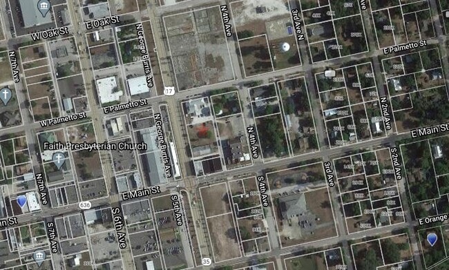
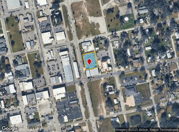
110 N 5Th Ave
Wauchula, FL
Original Survey Of Wauchula
0334-25-0200-00018-0013
S 5 FT OF LOT 13 & LOTS 14 15 16 17 & N 22 FT OF LOT 18 BLK 18 WAUCHULA ORS LOCATED IN SEC 4 34 25 234P164 383P456 549P142(P/A) AFF-549P146 549P147 615P1451 681P451 202125000257-AFF /0258 202525002415
Miscellaneous
Hardee
X
Florida
12049C0191D
13
0
0.64 AC
2025
Florida Central South Area
970301
Other Market Areas
5,074 SF
DEMOGRAPHICS near 110 N 5Th Ave
1 Mile
3 Mile
5 Mile
2024 Total Population
5,163
10,553
14,867
2029 Population
5,256
10,814
15,126
Pop Growth 2024-2029
+ 1.80%
+ 2.47%
+ 1.74%
Average Age
35
37
37
2024 Total Households
1,679
3,529
5,014
HH Growth 2024-2029
+ 1.91%
+ 2.64%
+ 1.87%
Median Household Inc
$29,476
$34,210
$41,483
Avg Household Size
3.00
2.90
2.90
2024 Avg HH Vehicles
2.00
2.00
2.00
Median Home Value
$93,578
$145,733
$139,675
Median Year Built
1977
1978
1979
Nearby Places
Map Layers
Map Styles
 Street
 Aerial
- Restaurants
- Banks
- Shops
- Fitness
- Groceries
Nearby Properties
Address
Land Use
TOTAL SIZE
Lot Size
Zoning
Address
Land Use
TOTAL SIZE
Lot Size
Zoning
60.50 AC
F-R
Address
Land Use
TOTAL SIZE
Lot Size
Zoning
25 AC
F-R
Address
Land Use
TOTAL SIZE
Lot Size
Zoning
22.21 AC
P-SP
Address
Land Use
TOTAL SIZE
Lot Size
Zoning
47,399 SF
55.51 AC
C-2
Address
Land Use
TOTAL SIZE
Lot Size
Zoning
50,071 SF
9.78 AC
C-2
Address
Land Use
TOTAL SIZE
Lot Size
Zoning
59,117 SF
70 AC
A-1
Address
Land Use
TOTAL SIZE
Lot Size
Zoning
107,610 SF
14.32 AC
C-1
Address
Land Use
TOTAL SIZE
Lot Size
Zoning
45,018 SF
17.48 AC
P-SP
Address
Land Use
TOTAL SIZE
Lot Size
Zoning
40,161 SF
4.48 AC
C-1
Address
Land Use
TOTAL SIZE
Lot Size
Zoning
104,690 SF
9.96 AC
F-R
Address
Land Use
TOTAL SIZE
Lot Size
Zoning
89,500 SF
6.80 AC
C-2
Address
Land Use
TOTAL SIZE
Lot Size
Zoning
54,007 SF
9 AC
P-SP
Address
Land Use
TOTAL SIZE
Lot Size
Zoning
13.28 AC
F-R
Address
Land Use
TOTAL SIZE
Lot Size
Zoning
47,374 SF
1.79 AC
P-SP
Address
Land Use
TOTAL SIZE
Lot Size
Zoning
28.95 AC
P-SP
Address
Land Use
TOTAL SIZE
Lot Size
Zoning
432 SF
9.75 AC
P-SP
Address
Land Use
TOTAL SIZE
Lot Size
Zoning
60,546 SF
14.57 AC
R-3
Address
Land Use
TOTAL SIZE
Lot Size
Zoning
35,140 SF
2.02 AC
P-SP
Address
Land Use
TOTAL SIZE
Lot Size
Zoning
65,778 SF
7.46 AC
F-R
Address
Land Use
TOTAL SIZE
Lot Size
Zoning
53,214 SF
12.50 AC
R-1A
Address
Land Use
TOTAL SIZE
Lot Size
Zoning
425.01 AC
A-1
Address
Land Use
TOTAL SIZE
Lot Size
Zoning
68,254 SF
11 AC
R-3
Address
Land Use
TOTAL SIZE
Lot Size
Zoning
26,155 SF
8.86 AC
A-1
Address
Land Use
TOTAL SIZE
Lot Size
Zoning
80,371 SF
7.52 AC
C-2
Address
Land Use
TOTAL SIZE
Lot Size
Zoning
38,275 SF
18.72 AC
C-2
Address
Land Use
TOTAL SIZE
Lot Size
Zoning
35,537 SF
30 AC
F-R
Address
Land Use
TOTAL SIZE
Lot Size
Zoning
27,168 SF
3.62 AC
C-1
Address
Land Use
TOTAL SIZE
Lot Size
Zoning
29,145 SF
0.80 AC
HC-1
Address
Land Use
TOTAL SIZE
Lot Size
Zoning
97,776 SF
6.29 AC
I
Address
Land Use
TOTAL SIZE
Lot Size
Zoning
36,053 SF
15.50 AC
C-2
The World's #1 Commercial Real Estate Marketplace
Connect with us
© 2025 CoStar Group
The information above has been obtained from sources believed reliable. While we do not doubt its accuracy we have not verified it and make no guarantee, warranty or representation about it. It is your responsibility to independently confirm its accuracy and completeness. Any projections, opinions, assumptions, or estimates used are for example only and do not represent the current or future performance of the property. The value of this transaction to you depends on tax and other factors which should be evaluated by your tax, financial, and legal advisors. You and your advisors should conduct a careful, independent investigation of the property to determine to your satisfaction the suitability of the property for your needs.