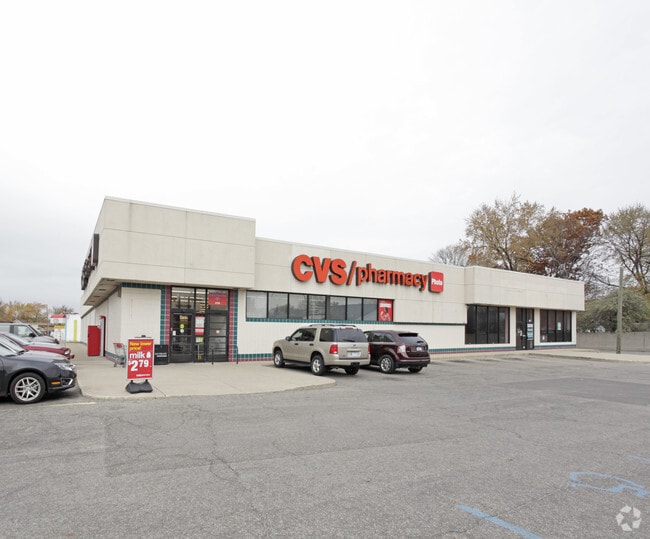
Property Record
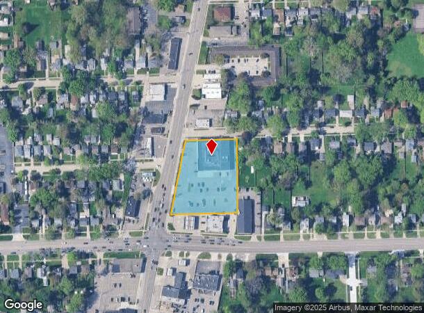
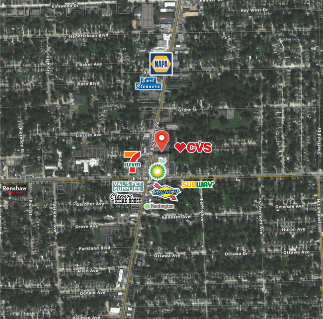
110 N Rochester Rd, Clawson, MI 48017
NEARBY LISTINGS FOR SALE OR LEASE
Property Detail
110 N Rochester Rd
Detroit-Warren-Dearborn, MI
Royal Oak Gardens
20-34-456-053
T2N, R11E, SEC 34 ROYAL OAK GARDENS LOTS 4 TO 8 INCL EXC THAT PART TAKEN FOR ROCHESTER RD 8-16-89 FR 052
Storebuilding
Oakland
X
Michigan
26125C0542G
4-8
2024
1.70 AC
2024
Royal Oak
180200
Detroit
16,900 SF
DEMOGRAPHICS near 110 N Rochester Rd
1 Mile
3 Mile
5 Mile
2024 Total Population
10,925
102,977
307,752
2029 Population
10,763
102,078
304,634
Pop Growth 2024-2029
(1.48%)
(0.87%)
(1.01%)
Average Age
42
41
41
2024 Total Households
5,305
47,869
132,475
HH Growth 2024-2029
(1.47%)
(0.91%)
(0.98%)
Median Household Inc
$83,483
$82,252
$85,725
Avg Household Size
2.00
2.10
2.30
2024 Avg HH Vehicles
2.00
2.00
2.00
Median Home Value
$230,838
$257,938
$266,756
Median Year Built
1955
1964
1964
Nearby Places
Map Layers
Map Styles
 Street
 Aerial
- Restaurants
- Banks
- Shops
- Fitness
- Groceries
PUBLIC TRANSPORTATION
COMMUTER RAIL
DRIVE
WALK
Distance
9 min
3.5 mi
DRIVE
WALK
Distance
9 min
3.5 mi
AIRPORT
Windsor International
DRIVE
WALK
Distance
Windsor International
44 min
25.7 mi
Detroit Metro Wayne County
DRIVE
WALK
Distance
Detroit Metro Wayne County
48 min
35.3 mi
SALE & LEASE HISTORY
LISTING DATE
SALE/LEASE

Mar 07, 2017
For Lease
Nearby Properties
Address
Land Use
TOTAL SIZE
Lot Size
Zoning
Address
Land Use
TOTAL SIZE
Lot Size
Zoning
272,233 SF
90.90 AC
Address
Land Use
TOTAL SIZE
Lot Size
Zoning
136,137 SF
12.28 AC
RM2
Address
Land Use
TOTAL SIZE
Lot Size
Zoning
300,925 SF
10.13 AC
Address
Land Use
TOTAL SIZE
Lot Size
Zoning
Address
Land Use
TOTAL SIZE
Lot Size
Zoning
512,475 SF
20.02 AC
Address
Land Use
TOTAL SIZE
Lot Size
Zoning
21.76 AC
Address
Land Use
TOTAL SIZE
Lot Size
Zoning
476,388 SF
23 AC
Address
Land Use
TOTAL SIZE
Lot Size
Zoning
208,296 SF
8.16 AC
OSC
Address
Land Use
TOTAL SIZE
Lot Size
Zoning
157,500 SF
20.79 AC
OM
Address
Land Use
TOTAL SIZE
Lot Size
Zoning
272,233 SF
9.09 AC
OSC
Address
Land Use
TOTAL SIZE
Lot Size
Zoning
15.32 AC
GEN BUS
Address
Land Use
TOTAL SIZE
Lot Size
Zoning
399,212 SF
26.18 AC
RM1
Address
Land Use
TOTAL SIZE
Lot Size
Zoning
136,672 SF
32 AC
Address
Land Use
TOTAL SIZE
Lot Size
Zoning
12.16 AC
PUD
Address
Land Use
TOTAL SIZE
Lot Size
Zoning
251,735 SF
10.57 AC
RM3
Address
Land Use
TOTAL SIZE
Lot Size
Zoning
250,868 SF
6 AC
OSC
Address
Land Use
TOTAL SIZE
Lot Size
Zoning
362,816 SF
29 AC
Address
Land Use
TOTAL SIZE
Lot Size
Zoning
300,925 SF
10.13 AC
OSC
Address
Land Use
TOTAL SIZE
Lot Size
Zoning
300,924 SF
10.13 AC
Address
Land Use
TOTAL SIZE
Lot Size
Zoning
94,228 SF
17.66 AC
Address
Land Use
TOTAL SIZE
Lot Size
Zoning
16,022 SF
4.07 AC
OSC
Address
Land Use
TOTAL SIZE
Lot Size
Zoning
150,240 SF
10.70 AC
OSC
Address
Land Use
TOTAL SIZE
Lot Size
Zoning
228,421 SF
17.18 AC
RMMUL
Address
Land Use
TOTAL SIZE
Lot Size
Zoning
206,913 SF
16.99 AC
O1
Address
Land Use
TOTAL SIZE
Lot Size
Zoning
349,226 SF
21.62 AC
RMMUL
Address
Land Use
TOTAL SIZE
Lot Size
Zoning
4.21 AC
Address
Land Use
TOTAL SIZE
Lot Size
Zoning
276,235 SF
14.49 AC
OM
Address
Land Use
TOTAL SIZE
Lot Size
Zoning
279,360 SF
14.34 AC
RM1
Address
Land Use
TOTAL SIZE
Lot Size
Zoning
8,914 SF
5 AC
Address
Land Use
TOTAL SIZE
Lot Size
Zoning
76,260 SF
8.09 AC
The World's #1 Commercial Real Estate Marketplace
Connect with us
© 2025 CoStar Group
The information above has been obtained from sources believed reliable. While we do not doubt its accuracy we have not verified it and make no guarantee, warranty or representation about it. It is your responsibility to independently confirm its accuracy and completeness. Any projections, opinions, assumptions, or estimates used are for example only and do not represent the current or future performance of the property. The value of this transaction to you depends on tax and other factors which should be evaluated by your tax, financial, and legal advisors. You and your advisors should conduct a careful, independent investigation of the property to determine to your satisfaction the suitability of the property for your needs.