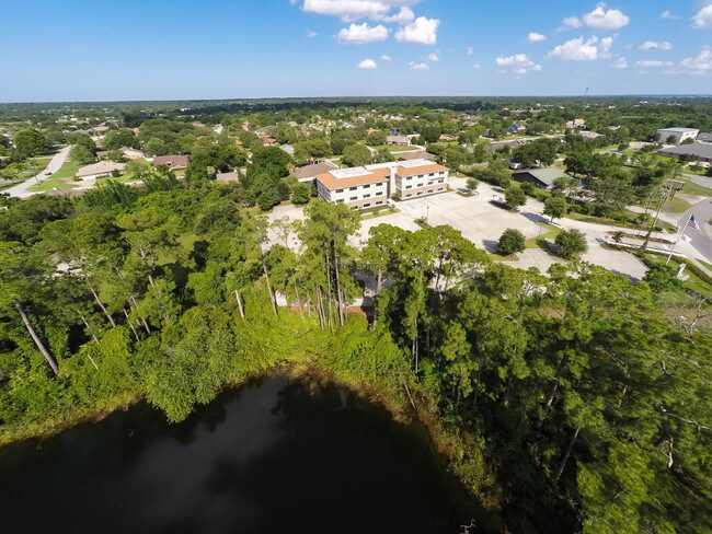
Property Record
110 Pond Ct, Debary, FL 32713


Current Lease Availabilities
Property Detail
110 Pond Ct
8026-00-00-0020
26-18-30 IRREG PARCEL IN NE 1/4 OF SE 1/4 E OF ENTERPRISE RD & MEAS 830.12 FT ON N/L & 358.16 FT ON E/L EXC W 300.12 FT MEAS ON N/L OF N 350 FT MEAS ON E/L OF ENTERPRISE RD PER OR 4576 PGS 2450-2451 PER OR 5638 PG 2252 PER OR 5638 PG 2246 PER OR 5638
Commercialnec
Volusia
01B4
Florida
A Areas with a 1% annual chance of flooding and a 26% chance of flooding over the life of a 30-year mortgage.
2
2025
4.20 AC
2026
Deltona
090905
Deltona/Daytona Beach
22,629 SF
Deltona-Daytona Beach-Ormond Beach, FL
NEARBY LISTINGS FOR SALE OR LEASE
DEMOGRAPHICS near 110 Pond Ct
1 mile
3 mile
5 mile
2025 Total Population
6,132
58,059
106,004
2030 Population
6,487
61,495
112,599
Pop Growth 2025-2030
+ 5.79%
+ 5.92%
+ 6.22%
Average Age
42
42
42
2025 Total Households
2,326
22,483
40,549
HH Growth 2025-2030
+ 5.80%
+ 5.85%
+ 6.13%
Median Household Inc
$100,047
$69,247
$72,243
Avg Household Size
2.60
2.50
2.50
2025 Avg HH Vehicles
2.00
2.00
2.00
Median Home Value
$364,601
$314,696
$318,604
Median Year Built
1993
1988
1988
Nearby Places
Map Layers
Map Styles
 Street
 Aerial
Layers
 Traffic
 Biking
Places
Listings with unknown addresses are not visible on the map
- Restaurants
- Banks
- Shops
- Fitness
- Groceries
PUBLIC TRANSPORTATION
COMMUTER RAIL
Debary (SunRail - Florida Department of Transportation)
Drive
Walk
Distance
Debary (SunRail - Florida Department of Transportation)
9 min
4.7 mi
AIRPORT
Orlando Sanford International
Drive
Walk
Distance
Orlando Sanford International
29 min
16.0 mi
Daytona Beach International
Drive
Walk
Distance
Daytona Beach International
35 min
27.1 mi
Freight Ports
Port Canaveral
Drive
Walk
Distance
Port Canaveral
95 min
78.2 mi
Nearby Properties
Address
Land Use
TOTAL SIZE
Lot Size
Zoning
Address
Land Use
TOTAL SIZE
Lot Size
Zoning
485,392 SF
69.83 AC
ROW
Address
Land Use
TOTAL SIZE
Lot Size
Zoning
409,021 SF
38.53 AC
ROW
Address
Land Use
TOTAL SIZE
Lot Size
Zoning
369,949 SF
13.70 AC
Address
Land Use
TOTAL SIZE
Lot Size
Zoning
390,347 SF
4.10 AC
Address
Land Use
TOTAL SIZE
Lot Size
Zoning
258,869 SF
38.34 AC
P
Address
Land Use
TOTAL SIZE
Lot Size
Zoning
212,959 SF
65.31 AC
MPUDE
Address
Land Use
TOTAL SIZE
Lot Size
Zoning
232,605 SF
15.03 AC
12B4
Address
Land Use
TOTAL SIZE
Lot Size
Zoning
9,460 SF
208.56 AC
Address
Land Use
TOTAL SIZE
Lot Size
Zoning
136,761 SF
17.77 AC
Address
Land Use
TOTAL SIZE
Lot Size
Zoning
50,005 SF
5.60 AC
Address
Land Use
TOTAL SIZE
Lot Size
Zoning
11,016 SF
13 AC
01MH1
Address
Land Use
TOTAL SIZE
Lot Size
Zoning
170,850 SF
17.82 AC
Address
Land Use
TOTAL SIZE
Lot Size
Zoning
213,506 SF
21 AC
12R2
Address
Land Use
TOTAL SIZE
Lot Size
Zoning
193,964 SF
23.50 AC
Address
Land Use
TOTAL SIZE
Lot Size
Zoning
135,845 SF
18.34 AC
Address
Land Use
TOTAL SIZE
Lot Size
Zoning
11,509 SF
10 AC
01MH1
Address
Land Use
TOTAL SIZE
Lot Size
Zoning
4,684 SF
1.14 AC
12MH1
Address
Land Use
TOTAL SIZE
Lot Size
Zoning
123,193 SF
20 AC
01A3
Address
Land Use
TOTAL SIZE
Lot Size
Zoning
117,406 SF
17.58 AC
Address
Land Use
TOTAL SIZE
Lot Size
Zoning
169,634 SF
12.97 AC
01B
Address
Land Use
TOTAL SIZE
Lot Size
Zoning
121,380 SF
2.33 AC
Address
Land Use
TOTAL SIZE
Lot Size
Zoning
147,759 SF
19.64 AC
Address
Land Use
TOTAL SIZE
Lot Size
Zoning
113,782 SF
18.52 AC
P
Address
Land Use
TOTAL SIZE
Lot Size
Zoning
44,975 SF
7.98 AC
Address
Land Use
TOTAL SIZE
Lot Size
Zoning
214,666 SF
9 AC
Address
Land Use
TOTAL SIZE
Lot Size
Zoning
64,836 SF
11.06 AC
BPUD
Address
Land Use
TOTAL SIZE
Lot Size
Zoning
174,640 SF
13.46 AC
Address
Land Use
TOTAL SIZE
Lot Size
Zoning
139,919 SF
7.20 AC
MPUD
Address
Land Use
TOTAL SIZE
Lot Size
Zoning
115,271 SF
17.08 AC
R4
Address
Land Use
TOTAL SIZE
Lot Size
Zoning
127,891 SF
10.58 AC
The World's #1 Commercial Real Estate Marketplace
Connect with us
© 2026 CoStar Group
The information above has been obtained from sources believed reliable. While we do not doubt its accuracy we have not verified it and make no guarantee, warranty or representation about it. It is your responsibility to independently confirm its accuracy and completeness. Any projections, opinions, assumptions, or estimates used are for example only and do not represent the current or future performance of the property. The value of this transaction to you depends on tax and other factors which should be evaluated by your tax, financial, and legal advisors. You and your advisors should conduct a careful, independent investigation of the property to determine to your satisfaction the suitability of the property for your needs.