Property Record
110 Presto Ln, Jackson, MS 39206
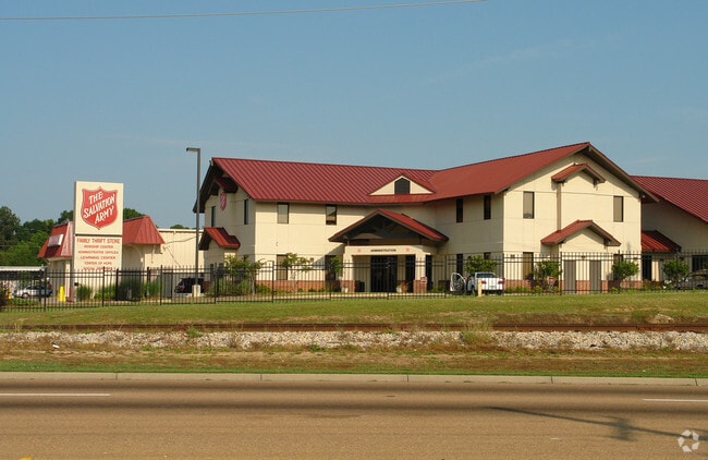

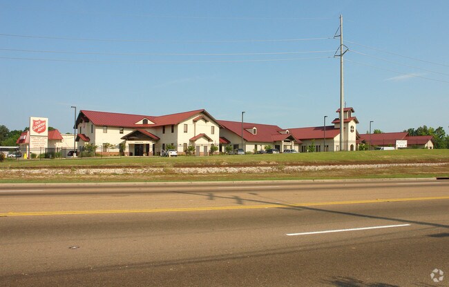
Property Detail
110 Presto Ln
Jackson, MS
BEG AT INTERSECTION N LINE PRESTO LANE & W LINE ICRR RUN NE/LY ALONG W LINE ICRR 520.6 FT W/LY 777.5 FT S/LY 463 FT TO N LINE PRESTO LANE E/LY 540.3 FT TO PT OF BEG BEING PT LOT 2 OF HANGING MOSS SY IN NE 1/4 SEC 11 T 6N R1E
0723-0007-007
Hinds
Charitableorganization
Mississippi
B and X Area of moderate flood hazard, usually the area between the limits of the 100-year and 500-year floods.
2
0
6.99 AC
2025
North Jackson
010201
Jackson
54,291 SF
NEARBY LISTINGS FOR SALE OR LEASE
DEMOGRAPHICS near 110 Presto Ln
1 mile
3 mile
5 mile
2025 Total Population
6,241
48,539
97,939
2030 Population
5,951
46,572
96,433
Pop Growth 2025-2030
(4.65%)
(4.05%)
(1.54%)
Average Age
36
39
39
2025 Total Households
2,717
20,740
43,078
HH Growth 2025-2030
(4.78%)
(4.23%)
(1.62%)
Median Household Inc
$41,059
$57,352
$52,248
Avg Household Size
2.20
2.20
2.20
2025 Avg HH Vehicles
1.00
2.00
2.00
Median Home Value
$111,981
$184,502
$188,073
Median Year Built
1973
1971
1975
Nearby Places
Map Layers
Map Styles
 Street
 Aerial
Transit
 Traffic
 Biking
Places
Listings with unknown addresses are not visible on the map
- Restaurants
- Banks
- Shops
- Fitness
- Groceries
PUBLIC TRANSPORTATION
COMMUTER RAIL
Jackson (City of New Orleans - Amtrak)
Drive
Walk
Distance
Jackson (City of New Orleans - Amtrak)
10 min
6.5 mi
AIRPORT
Jackson-Medgar Wiley Evers International
Drive
Walk
Distance
Jackson-Medgar Wiley Evers International
24 min
13.8 mi
Freight Ports
Port of Greater Baton Rouge
Drive
Walk
Distance
Port of Greater Baton Rouge
206 min
182.1 mi
Nearby Properties
Address
Land Use
TOTAL SIZE
Lot Size
Zoning
Address
Land Use
TOTAL SIZE
Lot Size
Zoning
7,561 SF
153.82 AC
Address
Land Use
TOTAL SIZE
Lot Size
Zoning
416,776 SF
18.77 AC
Address
Land Use
TOTAL SIZE
Lot Size
Zoning
33,960 SF
19,602 AC
Address
Land Use
TOTAL SIZE
Lot Size
Zoning
59,840 SF
2.72 AC
Address
Land Use
TOTAL SIZE
Lot Size
Zoning
10,904 SF
8.50 AC
Address
Land Use
TOTAL SIZE
Lot Size
Zoning
55,160 SF
3 AC
Address
Land Use
TOTAL SIZE
Lot Size
Zoning
64,949 SF
3 AC
Address
Land Use
TOTAL SIZE
Lot Size
Zoning
105,600 SF
13 AC
Address
Land Use
TOTAL SIZE
Lot Size
Zoning
186,992 SF
27.27 AC
Address
Land Use
TOTAL SIZE
Lot Size
Zoning
49,949 SF
10 AC
Address
Land Use
TOTAL SIZE
Lot Size
Zoning
57,234 SF
Address
Land Use
TOTAL SIZE
Lot Size
Zoning
102,249 SF
14.38 AC
Address
Land Use
TOTAL SIZE
Lot Size
Zoning
10,620 SF
2.81 AC
Address
Land Use
TOTAL SIZE
Lot Size
Zoning
230,401 SF
643,381.54 AC
Address
Land Use
TOTAL SIZE
Lot Size
Zoning
108,198 SF
15.40 AC
Address
Land Use
TOTAL SIZE
Lot Size
Zoning
310,650 SF
17 AC
Address
Land Use
TOTAL SIZE
Lot Size
Zoning
23,589 SF
110,808.08 AC
Address
Land Use
TOTAL SIZE
Lot Size
Zoning
48,847 SF
20.70 AC
Address
Land Use
TOTAL SIZE
Lot Size
Zoning
93.67 AC
Address
Land Use
TOTAL SIZE
Lot Size
Zoning
9,003 SF
1 AC
Address
Land Use
TOTAL SIZE
Lot Size
Zoning
26,875 SF
3 AC
Address
Land Use
TOTAL SIZE
Lot Size
Zoning
81,911 SF
15.53 AC
Address
Land Use
TOTAL SIZE
Lot Size
Zoning
148,195 SF
11.66 AC
Address
Land Use
TOTAL SIZE
Lot Size
Zoning
139,497 SF
12 AC
Address
Land Use
TOTAL SIZE
Lot Size
Zoning
83,318 SF
4.35 AC
Address
Land Use
TOTAL SIZE
Lot Size
Zoning
223,203 SF
625,957.30 AC
Address
Land Use
TOTAL SIZE
Lot Size
Zoning
30,703 SF
1 AC
Address
Land Use
TOTAL SIZE
Lot Size
Zoning
349,916 SF
29.10 AC
Address
Land Use
TOTAL SIZE
Lot Size
Zoning
15.57 AC
The World's #1 Commercial Real Estate Marketplace
Connect with us
© 2026 CoStar Group
The information above has been obtained from sources believed reliable. While we do not doubt its accuracy we have not verified it and make no guarantee, warranty or representation about it. It is your responsibility to independently confirm its accuracy and completeness. Any projections, opinions, assumptions, or estimates used are for example only and do not represent the current or future performance of the property. The value of this transaction to you depends on tax and other factors which should be evaluated by your tax, financial, and legal advisors. You and your advisors should conduct a careful, independent investigation of the property to determine to your satisfaction the suitability of the property for your needs.