Property Record
110 Route 311, Carmel, NY 10512
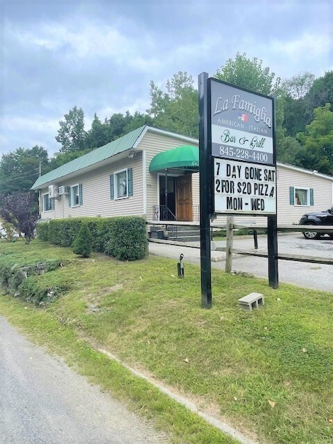


Property Detail
110 Route 311
372200-022-000-0002-014-000-0000
Putnam
Restaurantbuilding
New York
C
14.00
B and X Area of moderate flood hazard, usually the area between the limits of the 100-year and 500-year floods.
0.46 AC
2024
Carmel
2025
Westchester/So Connecticut
010300
New York-Jersey City-White Plains, NY-NJ
2,550 SF
NEARBY LISTINGS FOR SALE OR LEASE
DEMOGRAPHICS near 110 Route 311
1 mile
3 mile
5 mile
2025 Total Population
4,338
15,608
34,444
2030 Population
4,335
15,613
34,458
Pop Growth 2025-2030
(0.07%)
+ 0.03%
+ 0.04%
Average Age
43
44
44
2025 Total Households
1,608
5,872
12,592
HH Growth 2025-2030
(0.12%)
(0.02%)
+ 0.06%
Median Household Inc
$133,750
$114,792
$119,570
Avg Household Size
2.60
2.60
2.60
2025 Avg HH Vehicles
2.00
2.00
2.00
Median Home Value
$363,061
$390,749
$434,123
Median Year Built
1954
1967
1972
Nearby Places
Map Layers
Map Styles
 Street
 Aerial
Layers
 Traffic
 Biking
Places
Listings with unknown addresses are not visible on the map
- Restaurants
- Banks
- Shops
- Fitness
- Groceries
PUBLIC TRANSPORTATION
COMMUTER RAIL
Patterson Station (Harlem Line - Metro-North Commuter Railroad Company (Metro-North))
Drive
Walk
Distance
Patterson Station (Harlem Line - Metro-North Commuter Railroad Company (Metro-North))
9 min
5.0 mi
Southeast Station (Harlem Line - Metro-North Commuter Railroad Company (Metro-North))
Drive
Walk
Distance
Southeast Station (Harlem Line - Metro-North Commuter Railroad Company (Metro-North))
12 min
5.5 mi
AIRPORT
New York Stewart International
Drive
Walk
Distance
New York Stewart International
42 min
30.7 mi
Westchester County
Drive
Walk
Distance
Westchester County
41 min
32.1 mi
Freight Ports
Port of New Haven
Drive
Walk
Distance
Port of New Haven
74 min
51.8 mi
SALE & LEASE HISTORY
LISTING DATE
SALE/LEASE

Aug 25, 2021
For Sale
Apr 01, 2022
For Sale
Nearby Properties
Address
Land Use
TOTAL SIZE
Lot Size
Zoning
Address
Land Use
TOTAL SIZE
Lot Size
Zoning
618,786 SF
164.46 AC
OP3
Address
Land Use
TOTAL SIZE
Lot Size
Zoning
223,335 SF
27.56 AC
OP2
Address
Land Use
TOTAL SIZE
Lot Size
Zoning
303,100 SF
64.48 AC
OP3
Address
Land Use
TOTAL SIZE
Lot Size
Zoning
Address
Land Use
TOTAL SIZE
Lot Size
Zoning
144,300 SF
25.97 AC
C
Address
Land Use
TOTAL SIZE
Lot Size
Zoning
Address
Land Use
TOTAL SIZE
Lot Size
Zoning
Address
Land Use
TOTAL SIZE
Lot Size
Zoning
107,745 SF
25.70 AC
R40
Address
Land Use
TOTAL SIZE
Lot Size
Zoning
116,349 SF
14.49 AC
R4
Address
Land Use
TOTAL SIZE
Lot Size
Zoning
Address
Land Use
TOTAL SIZE
Lot Size
Zoning
36,014 SF
65.24 AC
R10
Address
Land Use
TOTAL SIZE
Lot Size
Zoning
40,613 SF
49.91 AC
I
Address
Land Use
TOTAL SIZE
Lot Size
Zoning
72,040 SF
9.87 AC
I
Address
Land Use
TOTAL SIZE
Lot Size
Zoning
41,082 SF
21 AC
R4
Address
Land Use
TOTAL SIZE
Lot Size
Zoning
49,144 SF
28.87 AC
R40
Address
Land Use
TOTAL SIZE
Lot Size
Zoning
3,420 SF
5.33 AC
IOC
Address
Land Use
TOTAL SIZE
Lot Size
Zoning
32,270 SF
2.12 AC
IOC
Address
Land Use
TOTAL SIZE
Lot Size
Zoning
7,299 SF
7.53 AC
C
Address
Land Use
TOTAL SIZE
Lot Size
Zoning
91,776 SF
34.10 AC
C
Address
Land Use
TOTAL SIZE
Lot Size
Zoning
102,897 SF
37.30 AC
C
Address
Land Use
TOTAL SIZE
Lot Size
Zoning
581.90 AC
R4
Address
Land Use
TOTAL SIZE
Lot Size
Zoning
Address
Land Use
TOTAL SIZE
Lot Size
Zoning
Address
Land Use
TOTAL SIZE
Lot Size
Zoning
37,095 SF
2.90 AC
IOC
Address
Land Use
TOTAL SIZE
Lot Size
Zoning
56,475 SF
7.53 AC
R80
Address
Land Use
TOTAL SIZE
Lot Size
Zoning
Address
Land Use
TOTAL SIZE
Lot Size
Zoning
23,200 SF
4.72 AC
C
Address
Land Use
TOTAL SIZE
Lot Size
Zoning
22.03 AC
IOC
Address
Land Use
TOTAL SIZE
Lot Size
Zoning
18,286 SF
152.66 AC
R4
Address
Land Use
TOTAL SIZE
Lot Size
Zoning
36,358 SF
4.09 AC
C
The World's #1 Commercial Real Estate Marketplace
Connect with us
© 2026 CoStar Group
The information above has been obtained from sources believed reliable. While we do not doubt its accuracy we have not verified it and make no guarantee, warranty or representation about it. It is your responsibility to independently confirm its accuracy and completeness. Any projections, opinions, assumptions, or estimates used are for example only and do not represent the current or future performance of the property. The value of this transaction to you depends on tax and other factors which should be evaluated by your tax, financial, and legal advisors. You and your advisors should conduct a careful, independent investigation of the property to determine to your satisfaction the suitability of the property for your needs.