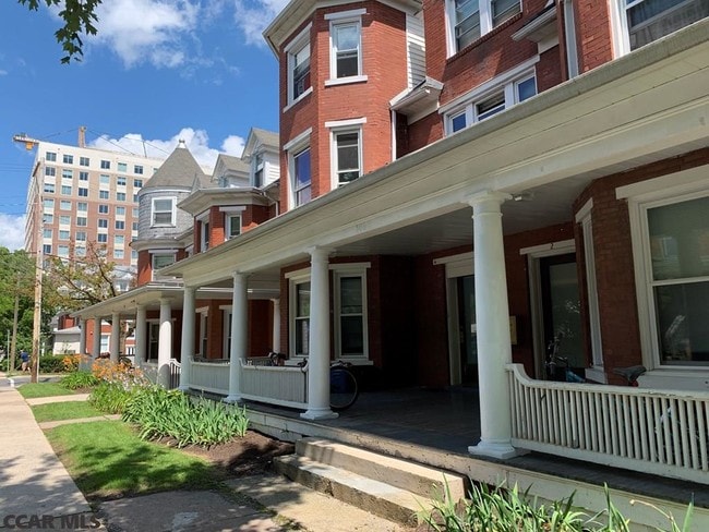
Property Record
110 S Barnard St, State College, PA 16801

NEARBY LISTINGS FOR SALE OR LEASE
Property Detail
110 S Barnard St
36-011-111A-0000
500 W COLLEGE AVE
Apartment
Centre
X
Pennsylvania
42027C0636F
0.07 AC
2025
Holmes-Foster
2025
Other Market Areas
012400
State College, PA
DEMOGRAPHICS near 110 S Barnard St
1 Mile
3 Mile
5 Mile
2024 Total Population
28,146
74,869
89,084
2029 Population
28,424
74,834
89,033
Pop Growth 2024-2029
+ 0.99%
(0.05%)
(0.06%)
Average Age
29
33
34
2024 Total Households
9,341
26,811
32,542
HH Growth 2024-2029
+ 1.32%
(0.13%)
(0.13%)
Median Household Inc
$35,097
$53,676
$63,419
Avg Household Size
2.20
2.20
2.20
2024 Avg HH Vehicles
1.00
1.00
2.00
Median Home Value
$407,957
$364,885
$363,803
Median Year Built
1974
1982
1983
Nearby Places
Map Layers
Map Styles
 Street
 Aerial
- Restaurants
- Banks
- Shops
- Fitness
- Groceries
PUBLIC TRANSPORTATION
AIRPORT
State College Regional
DRIVE
WALK
Distance
State College Regional
15 min
6.3 mi
Freight Ports
Port of Baltimore
DRIVE
WALK
Distance
Port of Baltimore
226 min
167.8 mi
SALE & LEASE HISTORY
LISTING DATE
SALE/LEASE

May 09, 2020
For Sale
Jul 25, 2019
For Sale
Aug 28, 2025
For Sale
Nearby Properties
Address
Land Use
TOTAL SIZE
Lot Size
Zoning
Address
Land Use
TOTAL SIZE
Lot Size
Zoning
1,607.06 AC
Address
Land Use
TOTAL SIZE
Lot Size
Zoning
27.86 AC
Address
Land Use
TOTAL SIZE
Lot Size
Zoning
59.65 AC
Address
Land Use
TOTAL SIZE
Lot Size
Zoning
60.26 AC
Address
Land Use
TOTAL SIZE
Lot Size
Zoning
Address
Land Use
TOTAL SIZE
Lot Size
Zoning
Address
Land Use
TOTAL SIZE
Lot Size
Zoning
Address
Land Use
TOTAL SIZE
Lot Size
Zoning
Address
Land Use
TOTAL SIZE
Lot Size
Zoning
Address
Land Use
TOTAL SIZE
Lot Size
Zoning
Address
Land Use
TOTAL SIZE
Lot Size
Zoning
56.73 AC
Address
Land Use
TOTAL SIZE
Lot Size
Zoning
Address
Land Use
TOTAL SIZE
Lot Size
Zoning
The World's #1 Commercial Real Estate Marketplace
Connect with us
© 2026 CoStar Group
The information above has been obtained from sources believed reliable. While we do not doubt its accuracy we have not verified it and make no guarantee, warranty or representation about it. It is your responsibility to independently confirm its accuracy and completeness. Any projections, opinions, assumptions, or estimates used are for example only and do not represent the current or future performance of the property. The value of this transaction to you depends on tax and other factors which should be evaluated by your tax, financial, and legal advisors. You and your advisors should conduct a careful, independent investigation of the property to determine to your satisfaction the suitability of the property for your needs.