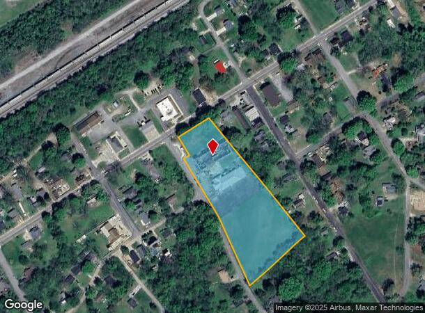
Property Record
110 S Long St, Salisbury, NC 28144

NEARBY LISTINGS FOR SALE OR LEASE
Property Detail
110 S Long St
Publicschool
Rowan
X
North Carolina
3710577000J
4.15 AC
2025
Rowan County
2025
Charlotte
050500
Charlotte-Concord-Gastonia, NC-SC
8,616 SF
026-079
DEMOGRAPHICS near 110 S Long St
1 Mile
3 Mile
5 Mile
2024 Total Population
3,858
22,775
47,302
2029 Population
4,069
24,167
49,957
Pop Growth 2024-2029
+ 5.47%
+ 6.11%
+ 5.61%
Average Age
39
41
41
2024 Total Households
1,550
9,051
19,066
HH Growth 2024-2029
+ 5.42%
+ 6.22%
+ 5.71%
Median Household Inc
$51,137
$51,167
$52,376
Avg Household Size
2.40
2.30
2.30
2024 Avg HH Vehicles
2.00
2.00
2.00
Median Home Value
$160,062
$192,845
$202,255
Median Year Built
1966
1967
1975
Nearby Places
Map Layers
Map Styles
 Street
 Aerial
- Restaurants
- Banks
- Shops
- Fitness
- Groceries
PUBLIC TRANSPORTATION
COMMUTER RAIL
Salisbury Station (Piedmont - North Carolina by Train (NC Train))
DRIVE
WALK
Distance
Salisbury Station (Piedmont - North Carolina by Train (NC Train))
7 min
2.5 mi
AIRPORT
Concord-Padgett Regional
DRIVE
WALK
Distance
Concord-Padgett Regional
45 min
32.3 mi
Nearby Properties
Address
Land Use
TOTAL SIZE
Lot Size
Zoning
Address
Land Use
TOTAL SIZE
Lot Size
Zoning
221,875 SF
7.31 AC
Address
Land Use
TOTAL SIZE
Lot Size
Zoning
708,972 SF
79.50 AC
Address
Land Use
TOTAL SIZE
Lot Size
Zoning
61,191 SF
33.96 AC
Address
Land Use
TOTAL SIZE
Lot Size
Zoning
395,051 SF
263.20 AC
Address
Land Use
TOTAL SIZE
Lot Size
Zoning
48,865 SF
55.30 AC
HB:HIGHWAY
Address
Land Use
TOTAL SIZE
Lot Size
Zoning
212,046 SF
32.25 AC
Address
Land Use
TOTAL SIZE
Lot Size
Zoning
451,980 SF
60.67 AC
Address
Land Use
TOTAL SIZE
Lot Size
Zoning
27,932 SF
108.40 AC
Address
Land Use
TOTAL SIZE
Lot Size
Zoning
206,758 SF
24.40 AC
Address
Land Use
TOTAL SIZE
Lot Size
Zoning
59,092 SF
1.73 AC
Address
Land Use
TOTAL SIZE
Lot Size
Zoning
31,327 SF
1.86 AC
Address
Land Use
TOTAL SIZE
Lot Size
Zoning
71,353 SF
37.10 AC
Address
Land Use
TOTAL SIZE
Lot Size
Zoning
92,101 SF
28.16 AC
R8:SINGLE
Address
Land Use
TOTAL SIZE
Lot Size
Zoning
29,875 SF
34.69 AC
I:MANUFACT
Address
Land Use
TOTAL SIZE
Lot Size
Zoning
37,692 SF
2.80 AC
Address
Land Use
TOTAL SIZE
Lot Size
Zoning
18,200 SF
2.94 AC
Address
Land Use
TOTAL SIZE
Lot Size
Zoning
53,296 SF
1.92 AC
Address
Land Use
TOTAL SIZE
Lot Size
Zoning
57,072 SF
2.53 AC
HB:HIGHWAY
Address
Land Use
TOTAL SIZE
Lot Size
Zoning
32,331 SF
3.75 AC
Address
Land Use
TOTAL SIZE
Lot Size
Zoning
48,843 SF
1.84 AC
Address
Land Use
TOTAL SIZE
Lot Size
Zoning
37,568 SF
45.28 AC
Address
Land Use
TOTAL SIZE
Lot Size
Zoning
33,550 SF
0.61 AC
Address
Land Use
TOTAL SIZE
Lot Size
Zoning
70,424 SF
7.18 AC
Address
Land Use
TOTAL SIZE
Lot Size
Zoning
86,632 SF
22.44 AC
Address
Land Use
TOTAL SIZE
Lot Size
Zoning
19,404 SF
1.25 AC
Address
Land Use
TOTAL SIZE
Lot Size
Zoning
43,869 SF
3.33 AC
Address
Land Use
TOTAL SIZE
Lot Size
Zoning
34,958 SF
7.21 AC
Address
Land Use
TOTAL SIZE
Lot Size
Zoning
50,688 SF
0.43 AC
Address
Land Use
TOTAL SIZE
Lot Size
Zoning
22,800 SF
5.66 AC
HB:HIGHWAY
Address
Land Use
TOTAL SIZE
Lot Size
Zoning
32,248 SF
1.52 AC
The World's #1 Commercial Real Estate Marketplace
Connect with us
© 2026 CoStar Group
The information above has been obtained from sources believed reliable. While we do not doubt its accuracy we have not verified it and make no guarantee, warranty or representation about it. It is your responsibility to independently confirm its accuracy and completeness. Any projections, opinions, assumptions, or estimates used are for example only and do not represent the current or future performance of the property. The value of this transaction to you depends on tax and other factors which should be evaluated by your tax, financial, and legal advisors. You and your advisors should conduct a careful, independent investigation of the property to determine to your satisfaction the suitability of the property for your needs.